Skip to content

Spatial Dimensions is a UK measured building survey and geospatial company delivering utility verification surveys — PAS 128 QL-A, the highest quality level of underground utility survey — from permanent offices in London, Sevenoaks and Nottingham, working on site anywhere in the UK.
A utility verification survey, also known as a PAS 128 Type A or QL-A survey, physically exposes an underground utility to confirm its exact position, depth and condition. Careful, localised excavation — typically vacuum excavation or trial holes, sometimes called potholing — uncovers the buried service so a surveyor can see it, measure it and record it. It is the most accurate and reliable utility data available.
In short: a utility verification survey from Spatial Dimensions safely exposes a buried service at agreed points, confirms its position and depth by direct measurement under HSE guidance HSG47, and adds the verified results to your utility survey drawing or model — so piling, excavation and design proceed on confirmed facts rather than detection tolerances. Verification is priced per trial hole, from £350 per point.
or call 01732 458799

What is a utility verification survey?
A utility verification survey is the physical confirmation of a buried service. BSI PAS 128:2022, the UK specification for underground utility surveys, defines four quality levels — D, C, B and A — and QL-A is the highest: positive visual identification of a service and its depth, typically via localised vacuum excavation or trial holes, under the HSE’s safety guidance HSG47, Avoiding Danger from Underground Services.
The difference from every other level is directness. A detection survey infers where a service runs from readings taken at the surface; a verification survey exposes the service itself. By directly inspecting the utility, Spatial Dimensions removes the remaining uncertainty at the points that matter most — which is why verification is essential on high-risk construction and excavation projects that need precise utility information.
When do you need QL-A verification rather than a QL-B detection survey?
You need verification wherever detection tolerances are not good enough. A QL-B detection survey using both electromagnetic location and ground penetrating radar records depth to within ±15%; a single technology widens that to ±40%. Detection is also never complete — up to about 95% of buried utilities can be located; 100% is not feasible, whoever you appoint.
For most of a site, QL-B is the right level. But where piling, foundations, deep drainage or tight design clearances cannot tolerate that uncertainty, HSG47 recommends trial holes: safely exposing a service positively identifies it and its depth, verifies its status, and can make it easier to apply a tracing signal to follow the rest of the run. That advice is the basis of QL-A, and Spatial Dimensions will tell you plainly which points justify verification and which do not.
How does verification fit into a PAS 128 survey?
Verification is the final stage of the PAS 128 sequence.
- QL-D — desktop utility search. Statutory utility records collated onto one drawing — the prerequisite for every other level. Interim report in 3–5 working days; full report within 10.
- QL-B — detection. Electromagnetic location (EML) and ground penetrating radar (GPR) scanning plotted on a topographical survey base; visual inspection of surface features (QL-C) usually runs in the same visit.
- QL-A — verification. Trial holes or vacuum excavation at chosen points, targeted using the detection results.
One honest note: verification is per-location, not blanket. Each trial hole raises that point to QL-A; the rest of the site stays at its detection quality level. That is why Spatial Dimensions detects first and verifies second — detection shows where verification will earn its keep.
What happens on site during a verification survey?
Spatial Dimensions issues a site-specific risk assessment and method statement (RAMS) before mobilising — on average 5.3 working days from instruction. On site we carefully excavate the agreed points to safely expose and document the buried services, confirm each one’s position and depth by direct measurement, and add the verified results to the utility survey record.
Work follows HSG47 and HSE guidance L144, with hazards such as live cables and pressurised pipes assessed in the RAMS. On minor public roads Spatial Dimensions provides basic signing, lighting and guarding to New Roads and Street Works Act Chapter 8; strategic roads need third-party traffic management, arranged at cost.
What are the benefits of a utility verification survey?
- Precise utility locations — the exact position of underground utilities, minimising guesswork and improving safety.
- Reduced risk of utility strikes — verified data helps avoid costly damage to buried services, protecting workers, infrastructure and budgets.
- Better project planning — clear information prevents disruption and supports efficient resource allocation.
- Validated utility records — physically exposing utilities confirms and updates existing utility maps.
- Support for regulatory compliance — verified data helps projects meet safety and legal duties around underground services.
- Fewer unexpected delays — accurate early location reduces interruptions from unforeseen conflicts.
- Informed next steps — results show whether further investigation or risk mitigation is needed.
Why choose Spatial Dimensions for your utility verification surveys?
Choosing Spatial Dimensions means partnering with a team committed to delivering the most accurate and reliable utility data possible. Our utility verification surveys physically expose underground utilities to confirm their exact location, depth and condition — hands-on certainty exactly where your project cannot afford doubt.
At Spatial Dimensions, we use proven, safe excavation techniques to expose and document buried services, and we record all findings carefully so you can make confident, informed decisions. Established in 2012, we are certified to ISO 9001:2015, accredited Constructionline Gold and Acclaim (SSIP), and carry £10 million each of professional indemnity, public and employers liability cover. We are a corporate member of The Survey Association — our Managing Director, Claire Fenwick, is the TSA’s current President — and all processing and drafting is done in-house: the person who drafts your survey is never the person who signs it off.
By choosing Spatial Dimensions, you reduce unexpected utility strikes, minimise project delays and protect your workforce and assets — whether you are a contractor, developer, consultant or infrastructure manager.
What will I receive?
The verified positions and depths are added to your utility survey record.
Swipe the table sideways to see all the columns.
| Deliverable | Format | What it is |
|---|---|---|
| Updated utility survey drawing | .DWG / PDF | Verified positions and depths at each trial-hole location, on a topographical survey base |
| 3D BIM-compatible model | .RVT | Chambers, pipes and ducts modelled with verified data, where 3D delivery is specified |
| Report of findings | Detailed record of what was exposed and confirmed at each verification point |
Spatial Dimensions retains the intellectual property; on full payment you receive a permanent licence to use the data, and every project is securely archived.
Who commissions utility verification surveys?
Contractors verifying services before piling or excavation, civil and structural engineers fixing below-ground design, and the consultants, project managers and architects de-risking those programmes. See our resources for contractors, consultants and architects.
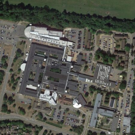
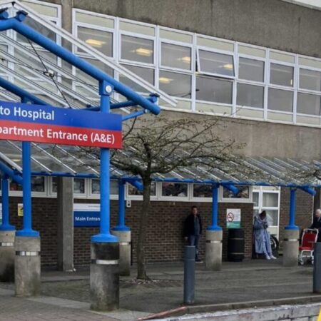
Spatial Dimensions’ underground utility survey projects include Basildon University Hospital, Kent and Canterbury Hospital, QEQM Hospital, Southend University Hospital, William Harvey Hospital, Hinchingbrooke Hospital and Bracknell Healthspace; Unity Campus and Broadwalk House; Dulwich Prep School, St Michael’s School (Ty Mawr) and Canterbury College; and RAF bases.
How much does a utility verification survey cost?
Utility verification from Spatial Dimensions is priced per trial hole, from £350 per point. Most verification jobs fall between £850 and £2,500 in total, depending on the number of points and the access arrangements.
Price depends on the number of verification points, their location and access, any traffic management, and whether the desktop search and detection survey are already in place. Spatial Dimensions quotes a fixed price against a written specification, so you know exactly what is included before we mobilise.
For a fixed price, send us the site address and the number of points you need verified. We will come back with a written quote within 24 hours. All prices exclude VAT.
Our Guide to Specifying an Underground Utilities Survey is free to download from our guides page.
or call 01732 458799
Frequently asked questions
What is PAS 128 QL-A?
QL-A is the highest of the four quality levels in BSI PAS 128:2022: positive visual identification of a service and its depth — typically via localised vacuum excavation or trial holes under HSG47 — rather than inference from surface detection readings.
What is vacuum excavation?
Vacuum excavation is a method of digging that uses suction to remove the ground and expose buried services safely. Alongside trial holes, it is the typical way a service is uncovered for QL-A verification.
When do I need a verification survey?
When specific points cannot tolerate detection tolerances. A QL-B survey records depth to within ±15% at best; before piling, deep excavation or connecting into an existing service, that margin can be too wide. Verification confirms the true position and depth at exactly those points.
Does a verification survey cover the whole site?
No. Verification is per-location: each trial hole confirms one point; the rest of the site remains at its detection quality level. That is why Spatial Dimensions detects first, then verifies at the chosen points where certainty is worth the excavation.
How disruptive is a verification survey?
Less than you might expect. The work is localised — small, careful excavations at agreed points rather than open trenches — planned under a site-specific RAMS, with traffic management arranged where points sit on the highway.
What does HSG47 say about trial holes?
HSG47, the HSE’s Avoiding Danger from Underground Services, recommends trial holes to positively identify a buried service and its depth: safe exposure verifies the service’s status and can make it easier to apply a tracing signal. PAS 128 QL-A is the formal survey expression of that advice.
Do I still need a desktop utility search first?
Yes. A QL-D desktop search is the prerequisite for every PAS 128 survey level, and statutory records must be in hand before the survey completes — otherwise Spatial Dimensions and its professional indemnity insurers cannot accept responsibility for the survey information. Obtain them yourself or commission us.
Request a utility verification survey quote
Send us the site address, the number of points you need verified and whether a detection survey is already in place; Spatial Dimensions will reply with a written, fixed-price quote within 24 hours.
Phone: 01732 458799
Offices: London · Sevenoaks · Nottingham · working nationwide
Related services
- Underground utility surveys — the parent service
- PAS 128 surveys — the specification and quality levels
- GPR surveys — QL-B detection
- Electromagnetic location surveys — QL-B detection
- Desktop utility searches — the QL-D prerequisite
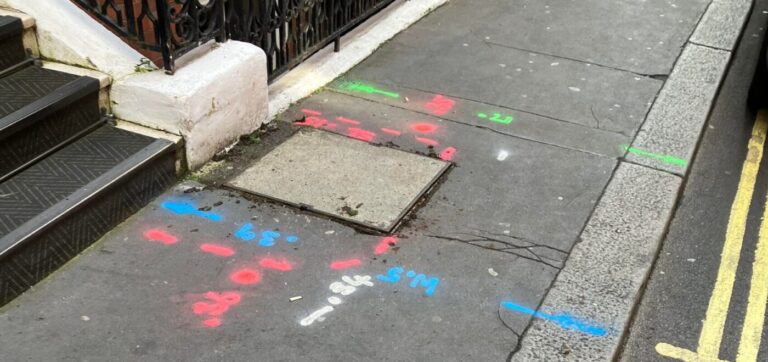
- Site mark outs — marking detected services on site
- Topographical surveys — the survey base PAS 128 requires