Skip to content
Spatial Dimensions is a UK measured building survey and geospatial company producing area referencing reports — independently measured floor areas, calculated to RICS and IPMS standards — from permanent offices in London, Sevenoaks and Nottingham, working on site anywhere in the UK.
Founded in 2012, we measure every building ourselves with survey-grade laser scanners, calculate the areas in-house, and check every report under an ISO 9001:2015 quality workflow. Each report is underwritten and assignable, backed by £10 million of professional indemnity insurance.
In short: an area referencing report from Spatial Dimensions tells you, floor by floor and in total, how big a building actually is — as GIA, GEA, NIA, NSA or ITZA, measured to RICS and IPMS standards — in a clear PDF report with supporting plans that a landlord, tenant, valuer, buyer or lender can rely on. Reports start at £250.
or call 01732 458799

What is an area referencing report?
An area referencing report is an accurate, independent calculation of the areas within a building — for the whole building or floor by floor — measured on site and reported against a defined standard. It replaces estimated, scaled-off or inherited floor areas with figures a transaction can stand on.
Floor areas move money. Rent, service charges, business rates, valuations and sale prices are all calculated per square metre or square foot, so a small error in the area repeats through every figure that follows it. Most clients come to Spatial Dimensions for an area report at a specific moment: a lease being granted, renewed or reviewed, an acquisition, a valuation, or a disposal. Because the basis of measurement changes the number, every report states which standard and basis each figure was measured to.
What do GIA, GEA, NIA, NSA and ITZA mean?
These are the five measurement bases Spatial Dimensions calculates. The same building produces a different figure on each — which is exactly why the basis must be stated.
- GIA — gross internal area. The whole area of a building measured to the internal face of the external walls, floor by floor. Commonly used for industrial and warehouse property and for building cost work.
- GEA — gross external area. The whole area of a building measured to the outside face of the external walls, floor by floor. Commonly used in planning applications.
- NIA — net internal area. The usable area within a building measured to the internal face of the perimeter walls — broadly, the space an occupier can actually use, excluding areas such as stairwells, lifts and plant rooms. Commonly used for letting and valuing offices and shops.
- NSA — net sales area. A retail measure: the area within a shop that is usable for retail sales.
- ITZA — in terms of Zone A. A retail valuation convention rather than a simple area. The shop floor is divided into zones of set depth from the shop front, each zone behind is valued at half the rate of the one in front, and the result is expressed as an equivalent Zone A area — so shops of different shapes can be compared like for like.
If you are not sure which basis your transaction needs, tell us what the report is for and Spatial Dimensions will tell you plainly which is appropriate. We can report more than one basis from a single site visit.
What standards are floor areas measured to?
Spatial Dimensions calculates areas to the RICS and IPMS measurement standards.
The traditional UK bases — GIA, GEA and NIA — come from the RICS Code of Measuring Practice, 6th edition, which most UK lease and valuation work still asks for. IPMS, the International Property Measurement Standards, is a newer framework designed so floor areas are measured consistently across markets, and RICS has incorporated IPMS into its Property Measurement professional statements.
In practice many instructions still specify the traditional bases, some require IPMS, and some need both. Spatial Dimensions works to whichever your instruction requires and states the standard on the face of the report.
What does “underwritten and assignable” mean?
It means the report is one you — and others after you — can rely on, rather than an informal set of measurements.
Underwritten means Spatial Dimensions stands behind the figures professionally. The report is backed by £10 million of professional indemnity insurance, alongside £10 million each of public liability and employers liability cover. We have had zero professional indemnity claims since founding in 2012.
Assignable means the benefit of the report can be transferred to another party — typically a buyer, an incoming tenant or a lender — so they can rely on the same figures without commissioning a fresh survey. That matters in transactions, where the person who commissions the report is rarely the only one who needs to trust it. Reliance and assignment operate under the terms of the report; if you know it will need to be assigned, tell us at quotation stage.
How does Spatial Dimensions measure floor areas?
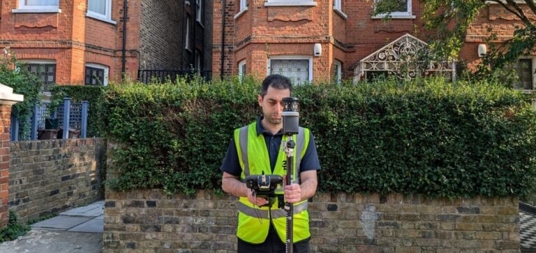
We measure the building on site with survey-grade laser scanners — Leica BLK, RTC360 and P-series instruments — rather than a hand-held tape. Laser scanning captures millions of verifiable measurements of every space, so each area is calculated from a complete record of the floor rather than a chain of individual dimensions. Because the scan is a permanent record, if a figure is ever queried during a transaction we can demonstrate exactly what was measured and where.
The scan data is processed, drafted and calculated in-house by Spatial Dimensions’ own technicians — we never outsource production. Every report then passes a multi-stage check under our ISO 9001:2015 certified quality system: the person who drafts a job is never the person who signs it off.

What will I receive?
Swipe the table sideways to see all the columns.
| Deliverable | Format | What it is |
|---|---|---|
| Area referencing report | The measured areas, floor by floor and in total, on each agreed basis, with the standard stated | |
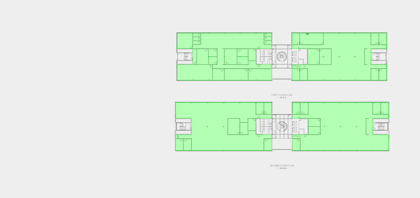
| Supporting plans | Comprehensive, clear plans supporting the reported figures | |
| CAD linework | .DWG | High-quality 2D or 3D linework with 3D points, for your design team or records |
The report can stand alone or sit alongside the drawings from a full measured building survey. On full payment you receive a permanent licence to use the data, and every project is securely archived so later visits integrate with the original dataset.
Who commissions area referencing reports?
Area referencing reports are commissioned by the people for whom the size of a building carries financial or legal weight — solicitors and property lawyers, estate agents, property consultants and valuers, landlords and asset managers, and planners. Typical instructions include lease grants and renewals, rent reviews, acquisitions and disposals, and valuations.
Spatial Dimensions carries out legal-sector and property-transaction work for clients including The Berkeley Group, British Land, Cadogan, Castleforge Partners, The Portman Estate and the National Trust.
How do area reports relate to measured building surveys and lease plans?
They are three deliverables that often serve the same transaction, and Spatial Dimensions produces all three.
- A measured building survey records the building dimensionally — floor plans, elevations and sections for design work.
- An area referencing report states how big the building is, on a defined basis, for lease, valuation and transaction use.
- A land registry plan shows the extent of the space being let or transferred — the demise — in the format HM Land Registry requires for registration.
If you need more than one, say so at quotation stage — the same site visit and scan data can support all three, which is quicker and cheaper than commissioning them separately.
How long does an area referencing report take?
Spatial Dimensions mobilises to site in an average of 5.3 working days from instruction, anywhere in the UK. Time on site is short for most buildings — laser scanning is fast — and reporting time depends on the size of the building and the number of bases required. Your quote states the site date and the delivery date. If a transaction deadline is driving the work, tell us at enquiry stage and we will plan to it.
How much does an area referencing report cost?
An area referencing report from Spatial Dimensions starts at £250. Most area referencing reports fall between £500 and £2,500, depending on the size of the building and the measurement bases required.
The price depends on the size of the building and number of floors, the measurement bases required, how accessible the building is, and whether the report is combined with a measured building survey or lease plans.
Spatial Dimensions quotes a fixed price against a written specification — the bases, standard, deliverables and delivery date are all stated before you commit.
For a fixed price, send us the building address, the approximate floor area and which bases you need. We will come back with a written quote within 24 hours. All prices exclude VAT.
or call 01732 458799
Frequently asked questions
GIA (gross internal area) is everything inside the external walls, including circulation, stairs, lifts and plant. NIA (net internal area) strips those out, leaving broadly the space an occupier can actually use. NIA is always the smaller figure, and the two are not interchangeable — a lease priced on the wrong one misprices the rent.
Use IPMS when your instruction, client or lender requires it — typically international portfolios and instructions issued under the RICS Property Measurement professional statements. Much UK work still runs on the traditional bases. If you are unsure, tell us what the report is for; Spatial Dimensions can report IPMS and the traditional bases together from one visit.
Yes. Spatial Dimensions reports are assignable, so the benefit can be transferred to a purchaser, incoming tenant or funder, letting them rely on the same figures without a re-survey. Assignment operates under the terms of the report — tell us at quotation stage if you know it will be needed.
Yes. Spatial Dimensions regularly works in occupied offices, shops, hospitals, schools and residential buildings. Laser scanning is quick and non-intrusive, we work around access windows and out of hours where needed, and field staff carry CSCS cards and DBS checks.
Not necessarily. If all the transaction needs is the areas, the report stands alone. If you also need floor plans, elevations or a 3D model, the same scan data supports both — commissioning them together is cheaper than commissioning them twice.
The property address, the building type, the approximate floor area and number of floors, which bases you need (or what the report is for, and we will advise), and your deadline. That is usually enough for a fixed written quote.
Request an area referencing report quote
Send us the property address and what the report is for, and Spatial Dimensions will come back with a written, fixed-price quote against a defined specification within 24 hours.
Phone: 01732 458799
Offices: London · Sevenoaks · Nottingham · working nationwide
Related services
- Measured building surveys — floor plans, elevations and sections from the same visit
- Land Registry plans — the demise, in HM Land Registry format
- CAD drawings — the drafting behind the supporting plans
- Laser scanning surveys — how the building is measured
- 360° photographic records — a dated visual record of the same space