Skip to content
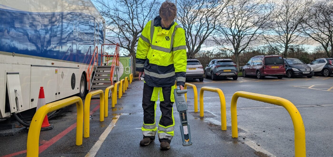
Spatial Dimensions is a UK measured building survey and geospatial company, founded in 2012, carrying out electromagnetic location (EML) surveys from permanent offices in London, Sevenoaks and Nottingham on sites nationwide. EML is one half of the detection toolkit on our underground utility surveys; the other half is ground penetrating radar (GPR).
Surveys run to BSI PAS 128:2022 and are backed by £10 million professional indemnity insurance.
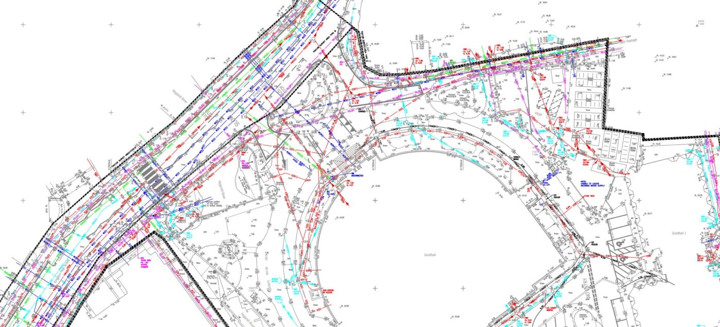
In short: an EML survey from Spatial Dimensions locates buried live cables, metallic pipes and traceable ducts by detecting the electromagnetic fields around them, marks every finding on the ground, and maps it onto a topographical base as a 2D CAD drawing or 3D model. Paired with GPR under PAS 128:2022, recorded depths are accurate to within ±15%. Surveys start at £800 per day on site.
or call 01732 458799

What is an electromagnetic location (EML) survey?
An electromagnetic location (EML) survey finds buried services by picking up the electromagnetic fields that surround them. Live electricity cables and metallic pipes carry or conduct these fields, so a Spatial Dimensions surveyor can detect each service from the surface and follow its route without any digging. It is fast and completely non-destructive — the first pass on almost every utility survey we carry out.
Where a pipe or duct is non-metallic and carries no field of its own, EML can still trace it if there is a way in: we insert a flexi-trace rod or transmitter probe through an access point and follow it from above ground. Plastic services with no access point are invisible to EML, which is why we always pair it with GPR.
What can an EML survey detect?
On a Spatial Dimensions utility survey, EML is the technology that finds:
- Live power cables — low-voltage (240V and above) and high-voltage, including supply feeds to street lighting and other powered structures
- Telecoms cables and metal-sheathed fibre optics
- Metallic water, gas and fuel pipes of 63 mm diameter and over
- Metallic heating pipes
- Underground ducting and accessible drainage — traced by flexi-trace or probe wherever an entry point gives access
What can’t an EML survey find?
EML only detects services that carry an electromagnetic field or can be given one via an access point. Plainly, that rules out:
- Plastic or clay pipes with no metallic component and no access for a trace rod — locating these is GPR’s job
- Unsheathed fibre-optic cable, unless there is duct access for a flexi-trace; small-diameter fibre laid directly in the ground is likely undetectable by any method
- Drainage with no access point for a transmitter probe — excluded from the survey scope
- Pumped or sealed drainage pipes, which can be hard to detect depending on material and size; silted, blocked or surcharged drains also limit results
- Cut-off, abandoned or disused utilities — excluded from the survey scope
- Services within 25 cm of surface obstructions — walls, skips, planters, parked vehicles — may go undetected, and steel reinforcing grids impair radio-frequency penetration
No non-invasive technique guarantees complete detection: a good utility survey locates up to about 95% of buried services, and Spatial Dimensions says so on every quote rather than promising 100%.
How accurate is an EML survey?
Under PAS 128:2022, depths recorded with a single detection technology carry a tolerance of ±40%. Combining EML and GPR tightens that to ±15%, which is why Spatial Dimensions deploys both together on every PAS 128 detection (QL-B) survey rather than offering EML alone.
Plan position matters as much as depth. Detected services are mapped onto a topographical survey base captured with calibrated robotic total stations and data-corrected GPS — without one, PAS 128 quality-level requirements cannot be met on an OS map base alone.
A desktop utility search (QL-D) collates the statutory records first — these must be in hand before the survey completes for our PI insurers to accept responsibility — and where positive identification is needed, utility verification (QL-A) confirms services by vacuum excavation or trial holes under HSG47.
How does EML trace drainage and ducts?
By putting the signal inside the pipe: where a manhole or chamber gives access, we feed a flexi-trace rod or transmitter probe into the duct or drain and trace its route from the surface. Spatial Dimensions drainage teams carry electronic tracing equipment alongside their CCTV kit — see our CCTV drainage surveys.
The practical rules we work to:
- Covers are lifted with a hand-operated hydraulic lifter, 30 minutes maximum per cover; one that will not lift safely is recorded as Unable to Lift (UTL)
- Chambers are assumed NC1 low-risk confined spaces (Water UK classification); with no chamber entry, ground-level measurements are indicative only
- Jetting is not standard; clearing silted or blocked drains costs extra, agreed in advance
What happens on site during an EML survey?
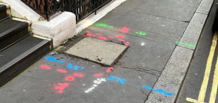
A site-specific risk assessment and method statement (RAMS) is issued before we mobilise — on average 5.3 working days from instruction. Everything we detect is marked on the ground: temporary biodegradable spray paint as standard, long-lasting paint on request before work starts, and tape, chalk or marker flags on sensitive surfaces. Marks are not removed after the survey.
Safety follows HSG47, Avoiding Danger from Underground Services. Most EML and GPR equipment is not intrinsically safe (not certified for potentially explosive atmospheres), so where gas could be present we plan gas detection and safe systems of work before starting.
What will I receive?
Swipe the table sideways to see all the columns.
| Deliverable | Format | What it is |
|---|---|---|
| Utility survey drawing | 2D CAD (.DWG) / PDF | Detected services on a topographical base, with depths and quality levels |
| 3D utility model | Revit (.RVT) / AutoCAD | BIM-compatible model with chambers, pipes and ducts modelled |
| Desktop search job pack | Digital | Statutory records collated onto one OS background by our in-house CAD team |
Two honest notes: a single line on the drawing can represent multiple cables or ducts, and sub-surface position and depth can never be guaranteed — verify independently before design or excavation. All drafting is done in-house and checked under our ISO 9001:2015 quality system.
Who commissions EML surveys?
Contractors and groundworkers commission EML surveys before breaking ground; architects and engineers use them to design foundations, drainage and below-ground services around what is already there; planners and consultants use them to de-risk sites early. See our resources for contractors, architects, planners and consultants.
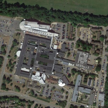
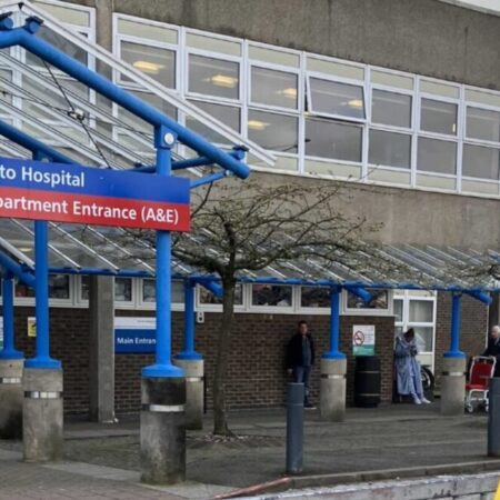
Spatial Dimensions has delivered utility detection surveys at hospitals including Basildon University Hospital, Kent & Canterbury, QEQM, Southend, William Harvey, Hinchingbrooke and Bracknell Healthspace; at Unity Campus and Broadwalk House; at schools and colleges including Dulwich Prep School, St Michael’s School (Ty Mawr) and Canterbury College; and on RAF bases.
How much does an EML survey cost?
An EML survey from Spatial Dimensions starts at £800 per day on site. Most EML detection surveys fall between £1,200 and £3,500 in total, depending on site area, congestion and the quality level required.
The price depends on site area and congestion, the PAS 128 quality level, whether a suitable topographical survey exists, the number and condition of chambers (NC1 assumed; higher classifications cost extra), traffic management, and out-of-hours working. Spatial Dimensions quotes a fixed price against a written specification.
For a fixed price, send us the site address and the approximate area. We will come back with a written quote within 24 hours. All prices exclude VAT.
or call 01732 458799
Frequently asked questions
How does an EML survey work?
Buried conductive services — live cables and metallic pipes — carry electromagnetic fields. An EML receiver detects those fields from the surface, so a Spatial Dimensions surveyor can follow each service and record its position and depth without excavation.
Can EML find dead or abandoned cables?
EML traces active electromagnetic fields, so live cables are its strongest target. An EML survey never designates any cable as live or dead — that designation is excluded from the survey scope, as are cut-off, abandoned and disused utilities. Treat every buried cable as live; where positive identification matters, specify QL-A verification with trial holes under HSG47.
Can an EML survey find plastic pipes?
Only where there is a way in: a plastic duct or drain with an accessible entry point can be traced by flexi-trace rod or transmitter probe. With no access point, a plastic pipe carries no detectable field, so locating it is a job for GPR.
What is the difference between EML and GPR?
EML detects the electromagnetic fields around conductive or traceable services, making it excellent for live cables and metallic pipes. GPR sends radar energy into the ground and reads the reflections, which lets it find non-metallic pipes, buried slabs, voids and reinforcement that EML cannot. Each finds things the other misses.
Why do you need both EML and GPR?
Two reasons. Coverage: EML misses non-metallic services without trace access, and GPR struggles where reinforcing grids block penetration. Accuracy: under PAS 128:2022, depths from one technology carry a ±40% tolerance; combining both tightens it to ±15%.
Will you mark what you find on the ground?
Yes — with biodegradable spray paint as standard, long-lasting paint on request, or tape, chalk and marker flags on sensitive surfaces. Marks stay in place after the survey, and everything marked is also recorded on the drawing. See site mark outs.
Request an EML survey quote
Send us the site address, the approximate area and what the survey is for; Spatial Dimensions will reply with a written, fixed-price quote within 24 hours.
Phone: 01732 458799
Offices: London · Sevenoaks · Nottingham · working nationwide
Related services
- Underground utility surveys — the parent service
- GPR surveys — non-metallic services, voids and reinforcement
- PAS 128 utility surveys — the specification and quality levels
- Utility verification surveys — QL-A trial holes and vacuum excavation
- CCTV drainage surveys — internal inspection and tracing
- Site mark outs — marking detected services on the ground
Both guides this page draws on are free to download from our guides page.