Skip to content
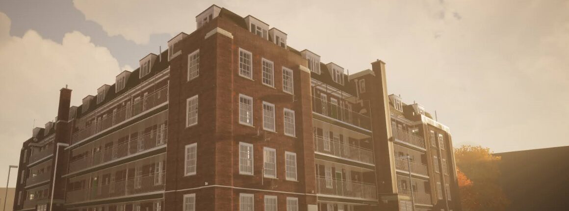
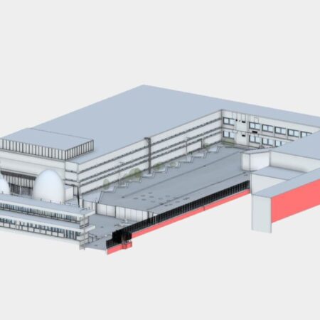
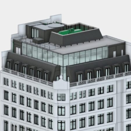
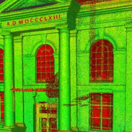
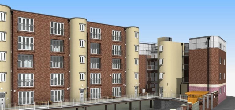
Spatial Dimensions is a UK measured building survey and geospatial company at the forefront of the Building Information Modelling (BIM) process in the built environment. We have been producing 3D models from laser scan data for nearly 15 years, bringing measured survey data and point clouds to life as dimensionally accurate, visually impressive 3D and rights of light models.
Typically, our 3D models are produced after we have undertaken a measured survey of the building or structure, using laser scanners alongside our 360° panoramic imaging. We can also model from point clouds or other survey data provided by third parties. Every model is built in-house in the UK by our own Revit technicians and checked under an ISO 9001:2015 workflow — the person who models a job is never the person who signs it off.
In short: a 3D model from Spatial Dimensions is an accurate as-built Revit or IFC model of an existing building, produced from laser scan data at a written level of detail (LOD 2, 3 or 4), referenced to Ordnance Survey grid and datum, and delivered in your exact Revit version. Models start at £500.
or call 01732 458799

What is a BIM model?
BIM is an acronym for Building Information Modelling — a way for everyone on a project to understand a building through a shared digital model, rather than separate sets of drawings. An as-built BIM model from Spatial Dimensions is the existing-conditions end of that process, often called scan to BIM: we laser scan the building, register the scans into a point cloud, then model every element in Revit from that measured data.
Spatial Dimensions models with parametric Revit families, not traced geometry, so walls, doors, windows and structure behave as real Revit elements your design team can develop directly — for architectural design, clash detection and MEP routing at RIBA Stage 4, rights of light analysis and facilities management.

Which level of detail (LOD) do I need?
The right level of detail depends on what the model is for — and choosing correctly means you do not pay for information you will never use. Spatial Dimensions defines three levels in writing on every quotation.
- LOD 2 (comparable to a 1:100 survey) — structural walls, floors, ceilings, columns and beams, with windows and doors shown as basic openings using the external reveals. For planning, project visualisation and rights of light.
- LOD 3 (comparable to 1:50) — more detailed structural elements; windows and doors show their true style, including which panes open; non-structural walls and boxing; fixed furniture such as cupboards and countertops. For architectural design, construction documentation and higher-detail planning applications.
- LOD 4 (comparable to 1:20) — the most detailed level: all structural elements, fixtures, fittings and materials, down to skirtings, dado rails, cornices and architraves. For highly detailed architectural work and heritage conservation.
If you are unsure, tell us what the model is for and we will tell you plainly which level it needs. The full definitions are in the Spatial Dimensions 3D Level of Detail guide, free to download from our guides page.

How is each building element modelled?
Spatial Dimensions models to published element rules, so you know in advance how the model will handle the awkward parts of a real building.
- Walls — thicknesses come from measured data, referenced to floor levels. Where a thickness cannot be measured — a party wall, say — the wall is marked under our Assumed / Unable to Survey / Cut Through convention rather than guessed. For external facades, tell us before modelling starts whether you want continuous ground-to-roof walls or walls segmented per floor.
- Beams and columns — often hidden behind fireproofing or boxing. A fully boxed-in member is modelled as a standardised beam or column named as boxing; where we can measure part of the beam elsewhere, it is placed within the boxing with “Assumed” in the family name. LOD 2 models the mass; LOD 3 the profile and dimensions; LOD 4 adds minor features.
- Doors and windows — basic openings at LOD 2; true styles at LOD 3 and above, built parametrically where possible, with openers modelled so fixed and opening panes are distinguished; higher detail at LOD 4.
- Stairs — modelled monolithically where possible, with handrails at the correct height and a general profile, supporting fall-risk identification. Accurate posts and balustrades on request before the survey.
- Lofts and roof structure — trusses as truss families, rafters as beam systems. LOD 3 includes hip and valley rafters, ridge boards and purlins; LOD 4 adds hangers, individual rafters and struts. Loft joists are massed from the ceiling below at LOD 2 and 3, and modelled individually at LOD 4 where floorboards and insulation allow.
Are building services (MEP) included in the model?
Yes — at LOD 3, a defined schedule of mechanical, electrical and plumbing (MEP) elements is included as standard.
On residential models, the standard internal inclusions are boilers, water tanks, toilets, hand basins, sinks, fuse boxes, gas meters and service covers. Externally: pipes over 50 mm, gas meters, lights, vents, air handling units and major plant.
On commercial models, the same applies, and plant rooms and lift plant rooms are modelled to the fullest extent of the large plant using mass modelling.
Radiators, sockets, switches, internal lighting, small pipework, ducting, cable trays and fixings can all be added — tell us before or during quotation so Spatial Dimensions can price and programme them properly.
How accurate is a 3D model from Spatial Dimensions?
Accuracy is stated in writing on every quotation, measured against the RICS accuracy bands, and our models and point clouds are produced in line with the RICS guidance notes on Measured Surveys of Land, Buildings and Utilities.
Swipe the table sideways to see all the columns.
| Scale | RICS band | Plan accuracy (X,Y) | Height — hard detail | Height — soft detail | Smallest detail shown | |
|---|---|---|---|---|---|---|
| LOD 1 | 1:100 | E | ±50 mm | ±10 mm | ±50 mm | N/A |
| LOD 2 | 1:100 | D | ±20 mm | ±10 mm | ±25 mm | 50 mm |
| LOD 3 | 1:50 | D | ±20 mm | ±10 mm | ±25 mm | 20 mm |
| LOD 4 | 1:20 | C | ±10 mm | ±5 mm | ±15 mm | 10 mm |
Height accuracy is quoted separately for hard detail (crisp, well-defined features such as floor slabs and beams) and soft detail (irregular features with no defined edge).
Georeferencing. Models are delivered to Ordnance Survey grid and datum unless you specify a local grid. Reference levels are set floor by floor — mezzanines included where required — from the slab level at the stair core, and residential buildings often use an averaged finished floor level.
On buildings that are not straight. Real buildings settle, lean and drift, and Revit needs walls to stack. Our default is to model straight and perpendicular wherever viable, to keep the model workable for your design team. Where a wall genuinely leans beyond the stated tolerance, Spatial Dimensions flags it promptly with two options — model the wall from where its base meets the ground, or apply a computed best fit approximating the lean — and you decide which. We do not quietly straighten a leaning building.
What file formats and deliverables will I receive?
Swipe the table sideways to see all the columns.
| Deliverable | Format | Notes |
|---|---|---|
| Native Revit model | .RVT | Parametric Revit families; our family naming convention or yours |
| IFC model | .IFC | For ArchiCAD and other BIM platforms |
| 2D drawings from the model | .DWG / .PDF | Plans, elevations and sections — available for an additional fee, not standard (see caveat below) |
| Point cloud | .RCS, .RCP, .E57, .PTS, .PTG and more | Decimation available to reduce file size; black-and-white or colour (colour increases file size and site time) |
| Topography in Revit | within the model | Standard 3D topo at LOD 3 with typical 1:200 features — kerbs, street furniture, trees, service covers — or a 2D DWG linked in |
| Underground utilities in Revit | within the model | A 2D utility drawing linked in, or chambers, pipes and ducts modelled in 3D |
A caveat on 2D exports. Revit’s 2D exports show no level or height information unless an enhanced 2D deliverable is specified — tell us at quotation if your drawings need to stand alone.
A warning on Revit versions. Revit is not backwards compatible — a model built in a newer version cannot be opened in an older one — and upgrading an old model can harm its integrity through errors, data loss or corruption, so we advise against it. Spatial Dimensions can deliver in any Revit version: we fix your exact version at quotation and build the model in it from the start.
Can you produce rights of light (ROL) models?
Yes. Spatial Dimensions has a proven track record of producing accurate, reliable rights of light (ROL) models, used for rights of light, daylight and sunlight analysis. LOD 2 is typically the right level for this work — the structural envelope, openings and levels, without detail you would pay for and not use.
Who commissions 3D models from Spatial Dimensions?
Around 40% of our work comes from architects and space planners. The rest comes largely from property consultants, project managers, engineers, main contractors and planning consultants.
- Architects — as-built Revit models to develop designs directly
- Planners — rights of light, daylight and sunlight models
- Contractors — as-built models for coordination and verification
- Consultants — models supporting every RIBA stage, concept to in-use
- Estate agents — accurate models of buildings and land
- Engineers — structural and MEP coordination
Spatial Dimensions has produced measured building and 3D modelling work on the Old Cavendish Buildings at the University of Cambridge, the Bannerman Centre at Brunel University, St Thomas’ Hospital, King’s College Hospital, 4 Millbank, Broadwalk House, Festival House, Wellington Barracks and the Royal Military Academy Sandhurst, and on building safety projects including Greenwich Millennium Village. We mobilise to site in an average of 5.3 working days from instruction, anywhere in the UK.
How much does a 3D model cost?
A 3D model from Spatial Dimensions starts at £500. Most 3D models fall between £800 and £10,000, depending on the size of the building and the level of detail.
The price of a 3D model depends on five things: the size and complexity of the building, the level of detail, whether extra MEP elements are included beyond the standard schedule, the formats you need (a colour point cloud adds site time and file size), and whether Spatial Dimensions scans the building or models from a point cloud you already hold.
Spatial Dimensions quotes a fixed price against a written specification — the LOD, the inclusions, the file formats and the Revit version are all stated before you commit. Send us the address, the approximate floor area and what the model is for, and we will come back with a written quote within 24 hours. All prices exclude VAT.
or call 01732 458799.
Frequently asked questions
Do you deliver in Revit or IFC — and can I use the model in ArchiCAD?
Both. Spatial Dimensions delivers native Revit (.RVT) models built from parametric families, and .IFC files for ArchiCAD and other BIM platforms. Tell us your software at quotation.
Which level of detail do I need?
Match the level to the task: LOD 2 for planning, visualisation and rights of light; LOD 3 for architectural design and construction documentation; LOD 4 for heritage and highly detailed work. More detail costs more and produces heavier files, so Spatial Dimensions will tell you honestly if a lower level does the job.
Can you build a model from my existing point cloud?
Yes. Spatial Dimensions also models from point clouds and survey data provided by third parties. Send us the cloud and we will tell you plainly whether its coverage and registration are good enough for the level of detail you need.
How do you model beams and columns you cannot see?
We say so in the model rather than guessing. A fully boxed-in member is modelled as a standardised beam or column named as boxing; where part of the beam can be measured elsewhere, it carries “Assumed” in the family name.
Will the model be perfectly square and straight?
By default, yes — Spatial Dimensions models straight and perpendicular wherever viable so the model stays workable in Revit. Where a wall leans beyond the stated tolerance, we flag it and you choose: anchor it to its ground-plane footprint, or apply a computed best fit. Nothing is straightened without your knowledge.
What Revit version will my model be in?
Whichever version you use — we fix it at quotation and build in it from the start. Revit is not backwards compatible, and upgrading a model between versions can harm its integrity, so we get the version right at the beginning.
Do I get 2D drawings with the model?
Not as standard — 2D plans, elevations and sections from the model are available for an additional fee in DWG or PDF. Revit’s 2D exports carry no level or height information unless an enhanced 2D deliverable is specified, so tell us at quotation if the drawings need to stand alone. See also our CAD drawings service.
Request a 3D model quote
Send us the building address, the approximate floor area, what the model is for and your Revit version; Spatial Dimensions will reply with a written, fixed-price quote within 24 hours.
Phone: 01732 458799
Offices: London · Sevenoaks · Nottingham · working nationwide
Related services
- Measured building surveys — the survey the model is usually built from
- Laser scanning surveys — how the data is captured
- Point cloud surveys — the measured record itself
- CAD drawings — 2D plans, elevations and sections
- Topographical surveys — site context, modelled in Revit at LOD 3
- Spatial Twin — a browser-based model for the wider team