Skip to content
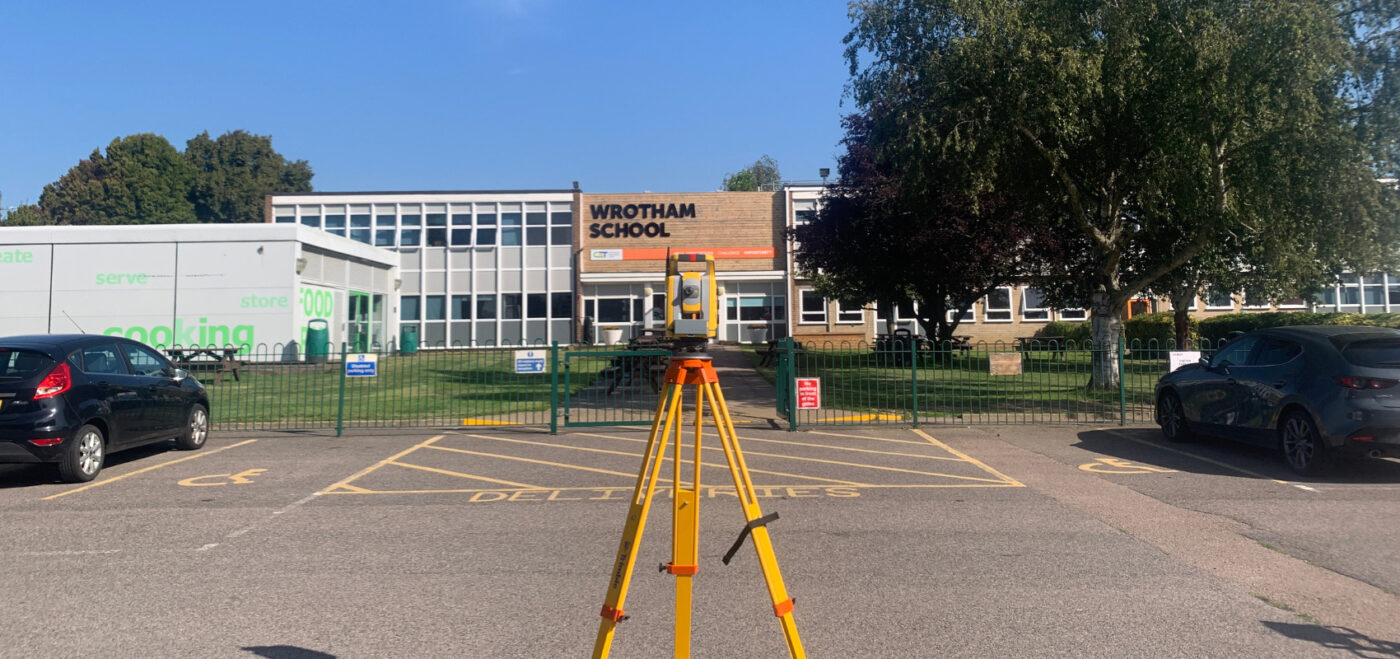
Spatial Dimensions has surveyed education estates since 2012 — primary schools, secondary schools, sixth forms, further education colleges and university campuses. Recent work includes the University of Cambridge (Old Cavendish Buildings), Brunel University, the University of Westminster, the University of Kent, Benenden School, Dulwich Prep School, Wrotham School, Canterbury College and West London College.
We work from offices in London, Sevenoaks and Nottingham and survey education sites nationwide.
In short: Spatial Dimensions provides measured building surveys, topographical surveys, laser scanning, underground utility surveys and 3D Revit models for education estates. Every site surveyor is DBS checked and holds a valid CSCS card, we work out of hours and in school holidays as standard, and we mobilise in an average of 5.3 working days from instruction. Topographical surveys start at £595 and measured building surveys at £850, with a written quote inside 24 hours.
or call 01732 458799
—
Why do schools and universities need measured surveys?
Because the estate is old, the drawings are usually wrong, and the money only gets released against evidence. The National Audit Office put the school building maintenance backlog in England at £13.8 billion in its January 2025 report, and noted that poor government data means the true figure is likely to be higher. Condition surveys, RAAC investigations, decarbonisation schemes, expansions and safeguarding upgrades all begin with an accurate record of what is actually there. Spatial Dimensions has done RAAC-related survey work — at Hinchingbrooke Hospital, where roughly 75% of the estate is built from RAAC panels, we were instructed directly by the NHS and produced the Revit model behind the redevelopment.
Spatial Dimensions produces that record. Where a school holds nothing but a hand-drawn plan from the 1970s, our survey becomes the estate’s working drawing set — and, increasingly, its 3D model.
Which education buildings does Spatial Dimensions survey?
All of them, and the ground between them. Named work on record:
Swipe the table sideways to see all the columns.
| Site | Project type | Working with |
|---|---|---|
| University of Cambridge (Old Cavendish Buildings) | Retrofit of an existing building | BDP, University of Cambridge |
| Brunel University (Bannerman Centre) | Development scheme | Perkins&Will, Brunel University |
| University of Westminster | Retrofit of an existing building | Box Architects, University of Westminster |
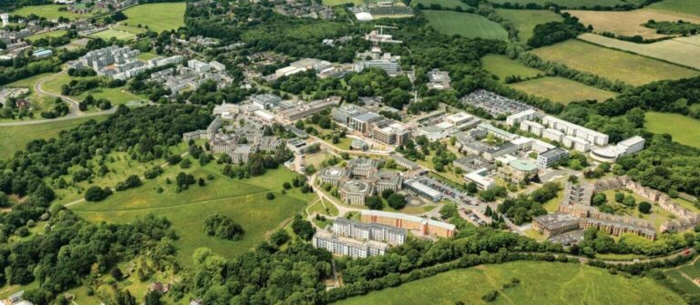
| University of Kent | Phased boiler and plant room replacement across a 300-acre campus housing over 6,000 students | Wilson Building Consultancy, University of Kent |
| West London College | New buildings on an existing site | ADP Architecture, West London College |
| Canterbury College (Spring Lane) | New buildings on an existing site | Betteridge & Milsom, East Kent College Group, Lee Evans Partnership |
| Dover College | Development scheme | Lee Evans Partnership LLP, Dover College |
| Lewisham College | Supporting a planning application | JLL, Lewisham College |
| Benenden School | Retrofit of an existing historic building | KSS, Benenden School |
| Dulwich Prep School | New buildings on an existing site | Lee Evans Partnership LLP, Dulwich Prep School |
| Wrotham School | Development scheme | BAM Construction, Wrotham School |
| Keyworth School | Retrofit of an existing building | ECD Architects, Keyworth School |
| St Michael’s Preparatory School | New buildings on an existing site | Trivandi, St Michael’s Preparatory School |
| St Michael’s School (Ty Mawr) | New buildings on an existing site | Envoplan, St Michael’s School |
| Hampton Court House School | Retrofit of an existing building | LXA, Hampton Court House School |
| Bounds Green Primary School | Building safety profile | Keegans, Bounds Green Primary School |
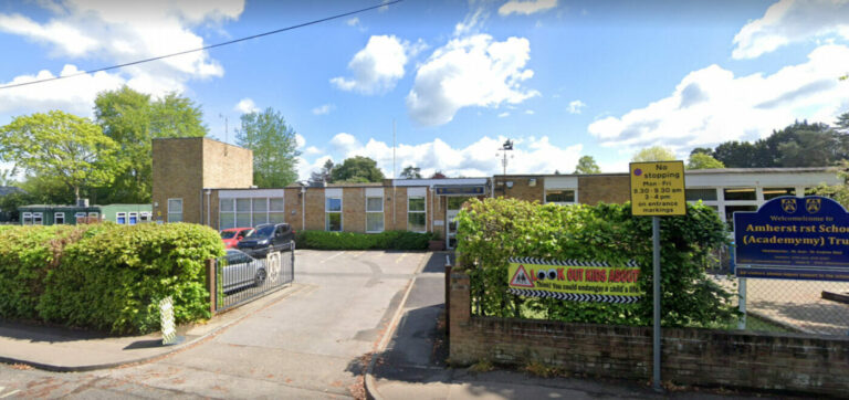
| Amherst School, Sevenoaks | Planning application for a new 101.8 m² classroom, surveyed while the school was closed to pupils | Carmen Austin Architecture |
| Sheppey College | Extension of the campus, part of a £20 million revival project with UK Government funding | East Kent Colleges Group, facilitated by Swale Borough Council |
What does an education estate usually need surveying?
It depends on the stage of the project. This is the combination Spatial Dimensions is most often asked for on education sites:
Swipe the table sideways to see all the columns.
| Survey | What it gives you | Typical use on a school or campus | From |
|---|---|---|---|
| Measured building survey | Floor plans, elevations, sections, reflected ceiling plans | Refurbishment, remodelling, condition and safety records | £850 |
| Topographical survey | Site levels, boundaries, playing fields, hard and soft landscaping | New blocks, MUGAs, car parks, drainage and access changes | £595 |
| Laser scanning survey | High-density point cloud, to the LOD tolerances below | Plant rooms, sports halls, listed campus buildings, anything a return visit would disrupt | £850 |
| Underground utility survey | Traced position of buried services to PAS 128 | Any excavation on a live campus — playing fields, service diversions | £850 |
| 3D models | Revit or IFC model at an agreed level of detail | BIM-led schemes and long-term estate management | £500 |
| 360° photographic records | Navigable panoramic record of the site | Point-in-time condition records; used on St Michael’s Preparatory School and Ty Mawr | £500 |
All prices are starting points. Every job is quoted as a fixed price against a written specification.
MEASURED SURVEYS FOR THE EDUCATION SECTOR
How can our education brochure help you?
- Hear directly from clients through testimonials
- Explore real case studies from completed education projects
- See the trusted clients we’ve worked with across the sector
- Review our accreditations that give you confidence in compliance and quality
- Understand our process and how we deliver accurate, reliable survey data
When it comes to surveying in the education sector, precision and trust are everything. From planning through to delivery, our expertise helps clients save time, reduce risk, and ensure projects are built on a solid foundation of data. Learn more by downloading our guide below.

READ THE GUIDE ONLINE
Drag a page across, or use the arrows and your left and right keys
Swipe to turn the pages
How do you survey a school without disrupting teaching?
By working when the pupils are not there. Spatial Dimensions offers out-of-hours working as standard, and on education sites that usually means half terms, INSET days, holidays, evenings and weekends. The access window is agreed in the quote rather than negotiated once we are on site.
At Lewisham College we worked around the college being open to students, to dates the college set before our visit. At Amherst School we mobilised while the school was closed to pupils during COVID. Where daytime working is unavoidable, our surveyors work room by room around the timetable, escorted, with equipment that sets up in seconds and makes no noise. Laser scanning helps here for the same reason it helps in hospitals: one visit captures the building, and later questions are answered from the point cloud rather than by coming back.
Are your surveyors DBS checked?
Yes. Every Spatial Dimensions surveyor attending an education site is DBS checked and holds a valid CSCS card, and is briefed on the specific site before attending. Our staff also hold BPSS clearance, obtained in advance rather than per job.
The company holds:
- ISO 9001:2015 certification
- Constructionline Gold
- Once For All Health and Safety accreditation
- The Survey Association (TSA) corporate membership
- CICES membership
- £10M professional indemnity, £10M public liability and £10M employer’s liability insurance
Spatial Dimensions is led by Managing Director Claire Fenwick FCICES, who is President of The Survey Association.
How accurate is the survey data?
Spatial Dimensions works to defined levels of detail rather than a vague promise of accuracy:
Swipe the table sideways to see all the columns.
| Level of detail | Scale | Tolerance | What it is for |
|---|---|---|---|
| LOD 2 | 1:100 | ±20 mm | Feasibility, space planning, rights of light |
| LOD 3 | 1:50 | ±10 mm | Detailed design and most refurbishment work |
| LOD 4 | 1:20 | ±5 mm | Heritage campus buildings, fit-out, tight-tolerance plant |
Site data is captured with Leica equipment including the RTC360, and georeferenced to Ordnance Survey National Grid and Ordnance Datum unless a local grid is requested. Our free guide 2D Level of Detail for Measured Building Surveys sets the tolerances out in full and is free to download from our guides page.
What do education clients receive?
Deliverables are agreed before we mobilise. On education projects Spatial Dimensions most often issues 2D CAD plans (.DWG and .PDF), 3D Revit models (.RVT or .IFC), registered point clouds (.E57 or .RCP), 360° photographic records, CCTV drainage reports and desktop utility searches. Project-specific RAMS are supplied where the school or the principal contractor requires them before access.
How long does a school survey take?
Spatial Dimensions returns a written quote within 24 hours of receiving the site address and scope, and mobilises in an average of 5.3 working days from instruction. On education sites the constraint is usually the calendar rather than the survey — if the work has to happen in a specific half term, tell us the dates early and we will book it in. We will also tell you plainly if the window you have is not long enough.
How much does a school or university survey cost?
Topographical surveys start at £595, measured building surveys at £850, underground utility surveys at £850 and 3D models at £500. On an education site the price is driven by floor area, the level of detail you need, how many separate buildings are in scope, and whether the work has to be compressed into a holiday period.
Spatial Dimensions quotes a fixed price against a written specification, so the figure in the quote is the figure on the invoice. Out-of-hours access is priced into that figure at quotation stage rather than added afterwards. We also operate a price match guarantee.
Frequently asked questions
Yes. Every Spatial Dimensions surveyor attending an education site is DBS checked and holds a valid CSCS card. BPSS clearance is held in advance across the survey team, so vetting does not delay mobilisation.
Yes. Out-of-hours and holiday working is standard for Spatial Dimensions on education sites. We agree the access window in the quote, so half terms and INSET days can be booked in advance.
Spatial Dimensions has surveyed for the University of Cambridge, Brunel University, the University of Westminster and the University of Kent, alongside colleges including Canterbury College, Dover College, Lewisham College and West London College.
Yes. A topographical survey covers levels, boundaries, playing fields, hard and soft landscaping and drainage covers, and Spatial Dimensions can add an underground utility survey to trace buried services before any excavation.
Yes. Spatial Dimensions delivers 3D Revit and IFC models at an agreed level of detail, starting at £500. Universities increasingly commission these as a long-term estate record rather than for a single scheme.
Yes. Benenden School was a retrofit of an existing historic building, surveyed by Spatial Dimensions with KSS. Historic fabric is normally captured at LOD 4 (±5 mm) using non-contact laser scanning.
Spatial Dimensions mobilises in an average of 5.3 working days from instruction. Where the work must land in a specific holiday, book early and we will hold the dates.
Measured building surveys start at £850 and topographical surveys at £595. Spatial Dimensions quotes a fixed price against a written specification within 24 hours.
Resources for your profession
Request an education survey quote
Send us the site address and what the survey is for, and Spatial Dimensions will come back with a written, fixed-price quote against a defined specification within 24 hours.
Phone: 01732 458799
Offices: London · Sevenoaks · Nottingham · working nationwide