Skip to content
Spatial Dimensions is a UK measured building survey and geospatial company providing setting out surveys on construction sites nationwide, from permanent offices in London, Sevenoaks and Nottingham. We have been putting designs on the ground since 2012 and reach most sites within an average of 5.3 working days.
Setting out is a measured survey in reverse: Spatial Dimensions transfers your digital design onto the physical site, so the trades build exactly where the drawings say they should.
In short: a setting out survey from Spatial Dimensions marks your design gridlines, levels and building elements — concrete foundations, brick courses, structural steelwork, rebar positions, structural slabs and interior stud work — on the site itself, controlled in both position and height from a verified survey control network, with as-built record drawings to show what was set out. Prices start at £700 per day on site.
or call 01732 458799

What is a setting out survey?
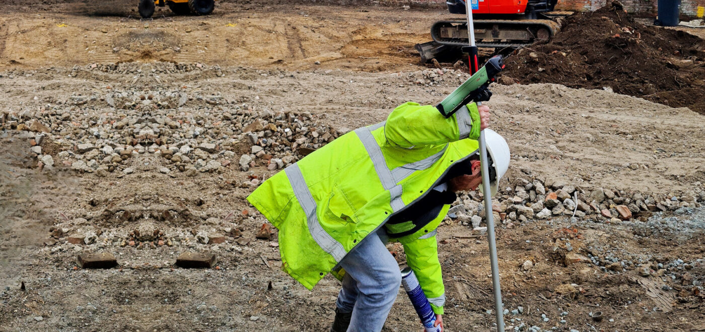
A setting out survey transfers a construction design from the drawings or model to the ground, marking where each element must be built and the level it must be built to. It is the point where the digital design and the physical site meet.
Two kinds of control are involved, and Spatial Dimensions provides both.
- Horizontal control is position on plan — where each gridline, foundation or wall sits on the site, east to west and north to south.
- Vertical control is height — the level each element is built to, tied to a known datum so floors, slabs and steel connections land at the designed height.
Setting out normally happens once the design is finalised and a topographical survey has been completed. Spatial Dimensions surveyors then work to the design gridlines and levels, marking positions as each stage of the build needs them.
What can Spatial Dimensions set out?
Spatial Dimensions sets out design gridlines and levels, plus the building elements built from them.
- Concrete foundations — positions and levels before excavation and pour
- Brick courses — line and level for masonry
- Structural steelwork — grid positions the fabricated steel must land on
- Rebar positioning — reinforcement laid out to the structural design
- Structural slabs — line and level for each pour
- Interior stud work — partition positions once the frame is up
One engineering workflow validates horizontal and vertical control across all of these, so every trade builds from the same framework.
Why does setting out accuracy matter?
Because a setting out error does not stay on paper — it gets built into the building. Concrete is poured on the marked line; steelwork is fabricated off site to the design grid and will not fit a grid that was set out wrong. Finding that out at erection means remedial works, programme delay and an argument about who pays.
The Spatial Dimensions Survey Buyers Guide makes the wider point: most survey problems trace back to site control — datums, grids, benchmarks and redundancy. Setting out is where weak control costs the most, because the mistake is corrected in concrete and steel rather than in CAD.
How does Spatial Dimensions control setting out accuracy?
Every Spatial Dimensions setting out job works from a closed-loop control network with redundant observations — meaning every position is measured more than once, from more than one station, so an error shows up as a misclosure instead of ending up in the building. The network is anchored either to Ordnance Survey benchmarks (OSGB36 in plan, Ordnance Datum in height) or to your site design grid, whichever the project requires.
On site we use calibrated robotic total stations and multi-frequency, data-corrected GNSS (survey-grade GPS). Positions are checked after they are set out — post-check verification is standard — and under our ISO 9001:2015 quality system the work is signed off by someone other than the person who did it.
Spatial Dimensions does not quote one headline accuracy figure for setting out, because different elements need different tolerances. The tolerance for each element is agreed in the written specification before we start, so you know exactly what is being promised — and our work is backed by £10 million professional indemnity insurance.

What will I receive from a setting out survey?
Swipe the table sideways to see all the columns.
| Deliverable | What it is |
|---|---|
| Set-out marks on site | Gridlines, level datums and element positions marked on site, ready to build from |
| As-built record drawings | A drawn record of what was set out and where — evidence if questions arise later |
| Archived project data | Projects are securely archived, so later visits integrate with the original dataset |

How does a setting out survey fit with our other surveys?
Setting out works best as one link in a continuous chain of survey control, and Spatial Dimensions provides every link.
- Before design: a topographical survey establishes the primary survey control network for all phases of development. When Spatial Dimensions carries out the topo, setting out uses that same network from day one.
- Before you dig: an underground utility survey maps buried services so foundations and drainage are set out clear of them.
- During the build: monitoring surveys track movement, tilt and deformation during enabling and building works, with 24/7 real-time options.
- After each stage: construction verification surveys laser scan what was built and cross-reference it against the design, reporting variances. Set out, build, verify.
Who commissions setting out surveys?
Mostly main contractors, groundworkers, steel erection contractors, site engineers and site managers who need reliable positions on site without carrying the control work in-house. Spatial Dimensions deploys setting out through engineering and contracting frameworks for firms including Willmott Dixon, Kier, BAM, Vinci Construction, Farrans, Bowmer & Kirkland, Mears Group and Bauvill, and works alongside engineering consultancies including Arup, Fairhurst and CampbellReith.
Setting out is usually needed to programme, ahead of a pour or a steel delivery. Spatial Dimensions often puts multiple technicians on one project to hold a deadline; if a date is programme-critical, tell us at enquiry.
If you are a contractor, our resources for contractors page collects the services and guides most relevant to site teams.
How much does a setting out survey cost?
Setting out surveys from Spatial Dimensions start at £700 per day on site. Most setting out visits fall between £850 and £1,000, depending on the number of points and site access.
The price of a setting out survey depends on three main factors: the number of site visits (foundations, steel and slabs are often set out on separate visits as the build progresses), the number of points set out on each visit, and site access.
Spatial Dimensions quotes a fixed price against a written specification, so the tolerance, the elements covered and the number of visits are agreed before work starts. We will come back with a written quote within 24 hours. All prices exclude VAT.
“A high-quality survey doesn’t cost more — it prevents more.”
Claire Fenwick, Managing Director of Spatial Dimensions and President of The Survey Association, in our Survey Buyers Guide — free to download from our guides page.
or call 01732 458799
Frequently asked questions
What is setting out in construction?
Setting out is marking the positions and levels of a proposed structure on the ground, transferring the design from drawings or a model to the physical site so the construction team builds in exactly the right place, at exactly the right height.
What accuracy do you set out to?
Spatial Dimensions agrees the tolerance for each element in the written specification, rather than quoting one blanket figure — different elements need different tolerances. Every job runs from a closed-loop control network, and positions are verified after they are set out.
What do you need from me before you can set out?
The design drawings or model, the gridlines and levels to be set out, and site access arrangements. The Spatial Dimensions project management team confirms what is needed at quotation and agrees the scope in writing before we mobilise.
Do you provide as-built records of what was set out?
Yes. As-built record drawings are part of the Spatial Dimensions setting out service — a drawn record of the positions and levels provided on site.
Can you set out on a live construction site?
Yes — that is where most setting out happens. Spatial Dimensions site staff carry CSCS cards, complete site inductions, and work to a site-specific risk assessment and method statement (RAMS) issued before we mobilise.
How quickly can Spatial Dimensions get to site?
In an average of 5.3 working days from instruction, nationwide from offices in London, Sevenoaks and Nottingham. For programme-critical dates such as pours or steel deliveries, tell us the deadline at enquiry.
Can our site team not set out from the drawings themselves?
Many site teams handle simple setting out themselves. What a survey-grade service adds is the control network behind the marks: calibrated instruments, redundant observations, independent checking and £10 million professional indemnity cover. For gridlines, steel and anything later trades build on top of, that backing is usually worth having.
Request a setting out survey quote
Send us the site address, the design drawings or model, what needs setting out and when it is needed on site; Spatial Dimensions will reply with a written, fixed-price quote within 24 hours.
Phone: 01732 458799
Offices: London · Sevenoaks · Nottingham · working nationwide
Related services
- Topographical surveys — the primary control network your setting out builds from
- Construction verification surveys — laser-scanned as-built checks against the design
- Monitoring surveys — movement, tilt and deformation tracking during works
- Underground utility surveys — know what is below ground before you dig
- Resources for contractors — the services and guides most relevant to site teams