Skip to content
Spatial Dimensions records historic buildings without touching them. Non-contact laser scanning captures fabric at ±5 mm, including stone-by-stone masonry profiles, decorative mouldings and structural defects as built — the level of detail conservation work and listed building consent applications need.
We have surveyed listed and historic structures since 2012, including BBC Maida Vale Studios, Freemasons’ Hall, Innholders’ Hall, Castlefield Viaduct for the National Trust, and 133 listed buildings across The Portman Estate. We work from offices in London, Sevenoaks and Nottingham, nationwide.
In short: Heritage surveys need a higher level of detail than ordinary measured surveys and a capture method that does not touch the fabric. Spatial Dimensions delivers LOD 4 records at ±5 mm from laser scanning and photogrammetry, as 2D CAD, 3D Revit models, point clouds and 360° photographic archives. Surveys start at £850, quoted fixed price within 24 hours.
or call 01732 458799
Why do listed buildings need measured surveys?
Because you cannot design a conservation scheme, justify a listed building consent application or plan a repair without knowing exactly what is there — and historic buildings are the ones least likely to have accurate drawings. England alone has over 370,000 listed buildings, and around a quarter of the country’s housing stock is more than a hundred years old (Historic England).
There is a second reason, which is getting more pressing. Retrofitting historic assets to reduce operational carbon means intervening in fabric that was never designed for it. That work is only safe to design from a survey that records the building as it actually is, deformation and all.
How do you survey a historic building without damaging it?
Without touching it. Spatial Dimensions uses non-contact terrestrial laser scanning and photogrammetry: the scanner sits on a tripod, records the building from a distance, and never makes physical contact with the fabric. Where elevations or roofs cannot be reached safely from the ground, drone photogrammetry captures them from the air.
Nothing is fixed to the building. No targets are drilled, no ladders are leaned, no fabric is loaded. On listed structures that is not a preference, it is usually a condition of access.
What level of detail does a heritage survey need?
LOD 4 in most cases. This is what separates a heritage survey from an ordinary measured building survey:
Swipe the table sideways to see all the columns.
| Level of detail | Scale | Tolerance | What is captured |
|---|---|---|---|
| LOD 2 | 1:100 | ±20 mm | Primary building lines, parapets, openings, roof outlines |
| LOD 3 | 1:50 | ±10 mm | Window and door framing, air bricks, vents, basic cornicing, pipes over 50 mm |
| LOD 4 | 1:20 | ±5 mm | Structural defects, stone-by-stone masonry profiles, railings, decorative mouldings under 50 mm, staircase spindles |
In 3D, Spatial Dimensions’ LOD 4 heritage standard models every structural element plus accurate material mapping, cornices, architraves, dado rails and skirting profiles at 1:20 precision.
A note on straightness: historic buildings lean, settle and drift. Our default modelling protocol applies perpendicular alignment where it is workable, so the model remains usable for design — but where a wall falls outside tolerance because of genuine lean, we flag the discrepancy to you rather than quietly straightening it. On a heritage building, the deviation is often the point.
Which heritage buildings has Spatial Dimensions surveyed?
Swipe the table sideways to see all the columns.
| Building | Listing / scale | Working with |
|---|---|---|
| BBC Maida Vale Studios | Grade II listed | MVS Partnership LLP, with Portman LX, Stiff + Trevillion Architects, Arup and TTP Consulting |
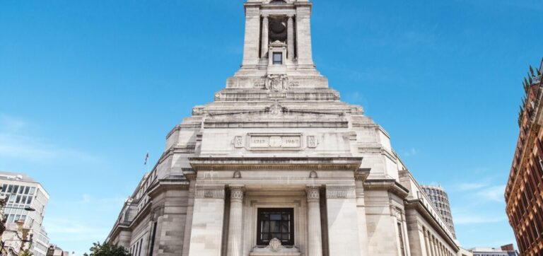
| Freemasons’ Hall, United Grand Lodge of England | Grade II listed Art Deco, 45,000 m² | United Grand Lodge of England |
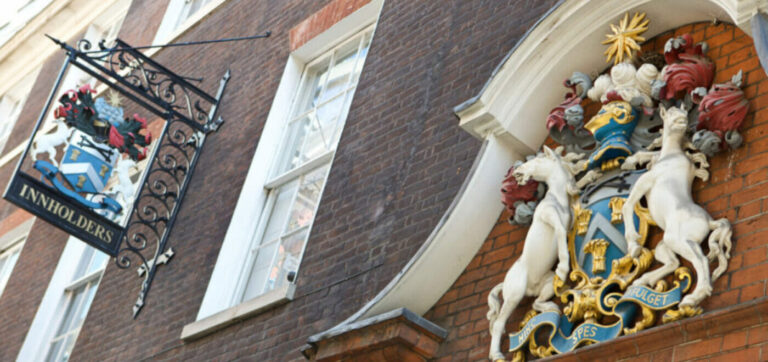
| Innholders’ Hall, Worshipful Company of Innholders | Grade II* listed and a Scheduled Ancient Monument | Murray Birrell |
| Castlefield Viaduct, Manchester | Listed structure | The National Trust |
| The Portman Estate, Marylebone | 133 heritage buildings across 110 acres | The Portman Estate |
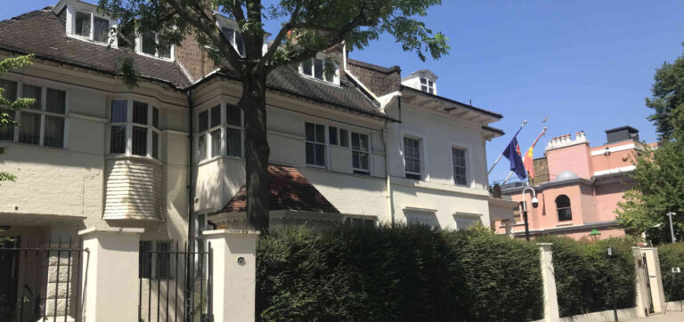
| Embassy of Vietnam, Victoria Road | Listed building in a conservation area | Corstorphine & Wright and LXA |
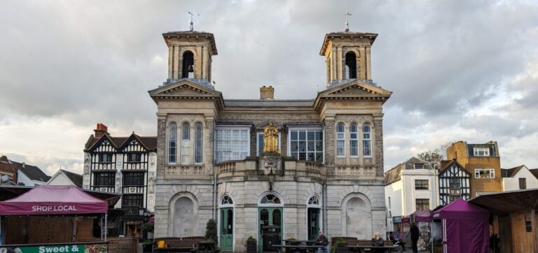
| Kingston’s Ancient Market Place | Market dating to the early 1200s | Regeneration published by Kingston Council |
| Dumbleton Hall Hotel | Grade II listed, 3,500 m², origins to 1534 | — |
| Rye Lane Chapel, Peckham | Historic chapel, LOD 4 Revit model | — |
| Battersea Power Station | Grade II listed, one of the world’s largest brick buildings | Bowman Riley Architects |
| 4 Millbank | Heritage recording alongside drone, laser scanning and measured building survey | JLL, Murray Birrell, Sandberg |
| Benenden School | Retrofit of an existing historic building | KSS |
Three of those are worth pulling out.
Freemasons’ Hall is 45,000 m² of Grade II listed Art Deco, built between 1927 and 1933 on an unusual polygonal site. Holding accuracy across a multi-levelled building of that shape needed an extensive closed traverse. The survey now serves both the facilities management team reconfiguring internal layouts and the lettings team, who hire the venue for London Fashion Week, award ceremonies and film work including James Bond.
The Portman Estate covers 110 acres of Marylebone and was founded in 1532. Spatial Dimensions measured 133 heritage buildings on it — elevation drawings of the listed facades, floor plans and internal elevations of the communal areas — to support listed building consent for a fibre optic infrastructure upgrade. Co-ordinating access across that many occupied buildings was as much of the job as the surveying.
Castlefield Viaduct was surveyed for the National Trust, whose plan is to turn the listed structure into a free-to-access park. Accuracy mattered to the architect and the structural engineer equally, so we delivered CAD plans, elevations and sections alongside coloured point clouds and mesh models.
Which surveys does a heritage project need?
Swipe the table sideways to see all the columns.
| Survey | What it gives you | Typical heritage use | From |
|---|---|---|---|
| Laser scanning survey | High-density non-contact point cloud, to the LOD tolerances below | The base capture for almost all heritage work | £850 |
| Measured building survey | Floor plans, elevations, sections at LOD 4 | Conservation design, listed building consent, repair schedules | £850 |
| 3D models | Revit or IFC model at LOD 4 | Conservation management plans and facility management | £500 |
| Drone surveys | Aerial photogrammetry of roofs and high elevations | Spires, towers, roofs and anything scaffolding would otherwise be needed for | £550 |
| 360° photographic records | Navigable panoramic archive linked to base mapping | Point-in-time record for heritage tracking and insurance reinstatement | £500 |
| Topographical survey | Site levels, boundaries, curtilage | Setting, landscape, drainage and access within a listed curtilage | £595 |
All prices are starting points. Every job is quoted as a fixed price against a written specification.
Can you record a building for archive rather than for a project?
Yes. Spatial Dimensions produces 360° photographic records — high-resolution panoramic capture linked to base mapping — as a point-in-time validation of a property. They are used for heritage tracking and for insurance reinstatement assessment, and they sit alongside the point cloud as a permanent digital record of the building as it stood on a given date.
For a building at risk, that record is worth having before anything happens to it, not after.
Can you work in an open or occupied historic building?
Yes. Cathedrals, museums, livery halls, historic hotels and working chapels cannot close for a survey. Spatial Dimensions offers out-of-hours working as standard, and on heritage buildings that usually means early mornings, evenings or closed days, with the access window agreed in the quote.
Laser scanning helps here for the same reason it helps everywhere else: one visit captures the building, and later questions are answered from the point cloud rather than by asking for access again.
At Kingston’s Ancient Market Place, where 28 permanent stalls trade from 10am to 5pm seven days a week, our underground utility team worked at night while the measured building and topographical surveys ran during the day. At Dumbleton Hall Hotel we surveyed a 3,500 m² Grade II listed building in five days over an August bank holiday, at full occupancy, without disrupting guests.
What credentials does Spatial Dimensions hold?
- ISO 9001:2015 certification, with multi-stage checking on every deliverable
- Constructionline Gold and Once For All Health and Safety
- The Survey Association (TSA) corporate membership and CICES membership
- £10M professional indemnity, £10M public liability and £10M employer’s liability insurance
- CSCS cards for all field personnel; DBS checks and BPSS clearance held in advance for all site staff
Spatial Dimensions is led by Managing Director Claire Fenwick, FCICES, who is President of The Survey Association.
How much does a heritage survey cost?
Measured building surveys and laser scanning start at £850, 3D models start at £500 and drone surveys start at £550. On a heritage building the price is driven mainly by level of detail — LOD 4 costs more than LOD 3 because it records more, and on historic fabric that difference is real work — along with building size, access difficulty and how much of the elevation has to be captured from the air.
Spatial Dimensions quotes a fixed price against a written specification, so the figure in the quote is the figure on the invoice. Out-of-hours access is priced into that figure at quotation stage rather than added afterwards. If LOD 4 is not necessary for what you are doing, we will say so rather than sell it to you.
Frequently asked questions
Will the survey touch or damage the building?
No. Spatial Dimensions uses non-contact laser scanning and photogrammetry. Nothing is fixed to the fabric, no targets are drilled and no ladders are leaned against the building.
What accuracy do you record historic fabric to?
LOD 4, at ±5 mm and 1:20 scale. That captures structural defects, stone-by-stone masonry profiles, railings, decorative mouldings under 50 mm and staircase spindles.
Which heritage buildings have you surveyed?
Spatial Dimensions has surveyed BBC Maida Vale Studios, Freemasons’ Hall for the United Grand Lodge of England, Innholders’ Hall, Castlefield Viaduct for the National Trust, 133 buildings across The Portman Estate, Kingston’s Ancient Market Place, Rye Lane Chapel and the Embassy of Vietnam.
Do you work on Grade I and Grade II listed buildings?
Yes. Recent Spatial Dimensions work includes Grade II listed BBC Maida Vale Studios, the Grade II listed Freemasons’ Hall, Grade II listed Battersea Power Station, and Innholders’ Hall, which is Grade II* listed and a Scheduled Ancient Monument.
Can you survey a spire or roof without scaffolding?
In most cases, yes. Drone photogrammetry captures roofs, towers and high elevations from the air, starting at £550, and is registered to the laser scan of the building below.
Can the survey support a listed building consent application?
Yes. An accurate existing-condition record at LOD 3 or LOD 4 is what a conservation officer needs to see, and Spatial Dimensions delivers it as 2D CAD drawings, PDFs and, where required, a 3D model. Our survey of the Embassy of Vietnam, a listed building in a Kensington & Chelsea conservation area, fed directly into the planning application.
Do you straighten walls in the model?
Only where it is workable and appropriate. Spatial Dimensions applies perpendicular alignment by default so models stay usable, but where a wall falls outside tolerance because of genuine lean or settlement we flag it rather than correct it silently.
Can you create a permanent archive record of a building?
Yes. Spatial Dimensions produces 360° photographic records linked to base mapping as a point-in-time record, used for heritage tracking and insurance reinstatement assessment, alongside the point cloud.
How much does a heritage building survey cost?
Measured building surveys and laser scanning start at £850. Spatial Dimensions quotes a fixed price against a written specification within 24 hours.
Request a heritage survey quote
Send us the building address and what the survey is for, and Spatial Dimensions will come back with a written, fixed-price quote against a defined specification within 24 hours. If you are not sure what level of detail you need, tell us what you are designing and we will advise.
Phone: 01732 458799
Offices: London · Sevenoaks · Nottingham · working nationwide