 Skip to content
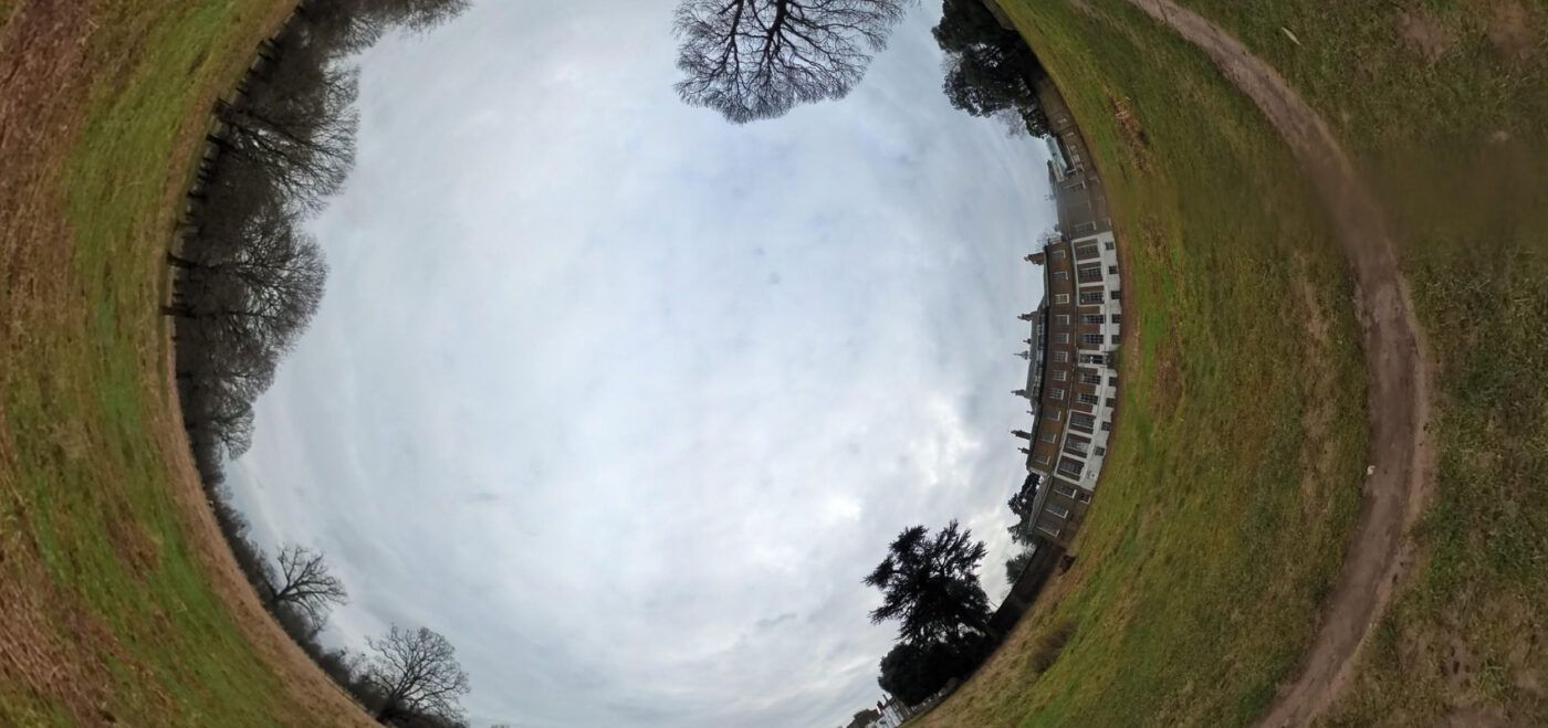
Spatial Dimensions is a UK measured building survey and geospatial company providing 360° photographic records — virtual online photographic tours of buildings — from permanent offices in London, Sevenoaks and Nottingham, working nationwide. Founded in 2012, we mobilise to site in an average of 5.3 working days from instruction.
A 360° photographic record gives you the whole building in one link: high-resolution panoramic images captured throughout the property and connected to a base plan, so you can move from room to room on screen. We usually capture it during the same visit as a laser scanning survey or measured building survey, which keeps the cost down.
In short: a 360° photographic record from Spatial Dimensions is a high-resolution virtual panoramic tour of your building, linked to base maps, hosted securely online and viewed in any web browser, including on mobile. It is a dated, point-in-time record of the property — used for heritage tracking, insurance reinstatement assessments, before-and-after records, marketing and design reference. Prices start at £500.
or call 01732 458799
What is a 360° photographic record?
A 360° photographic record is a virtual online photographic tour of a building. At each capture position the camera records high-resolution imagery in every direction — floor to ceiling, wall to wall — and the positions are linked to a base map or floor plan, so you navigate the building on screen the way you would walk it. Spatial Dimensions delivers 360° records through our own Spatial Twin platform, hosted by us and opened in a browser rather than a third-party viewer.
Because every tour is captured on a known date, it is a point-in-time record: evidence of exactly what the building looked like that day. For heritage tracking and insurance reinstatement assessments, the date matters as much as the pictures.
One honest point up front: a 360° record is visual, not measurable. If you need dimensions, you need a point cloud or a measured survey — more below.
What is a 360° photographic record used for?
Spatial Dimensions captures 360° photographic records for five main purposes.
- Heritage recording — a dated, room-by-room record of historic fabric, so the condition of a listed building can be tracked over time and evidenced to planners.
- Insurance reinstatement assessments — if the building were badly damaged, an insurer must work out what rebuilding it would cost. A dated record of the layout, finishes and fittings supports that assessment and any later claim.
- Before-and-after records — capture the building before strip-out or refurbishment and again after; a tour brings before-and-after photos to life.
- Marketing — showcase properties online with a walk-through tour rather than a set of disconnected photos.
- Design reference and fewer site visits — architects, consultants and contractors check details remotely instead of travelling back, which means fewer disruptions for occupants and a lower carbon footprint.

How is a 360° photographic record captured?
Most 360° records are captured during the same visit as a measured building survey or laser scanning survey. Spatial Dimensions surveyors carry 360° panoramic imaging equipment alongside our Leica laser scanners, so adding a photographic record to a survey you have already commissioned adds little site time and no extra mobilisation.
Capture itself is quick — a typical building is photographed in a fraction of the time the measured survey takes. We also capture 360° records as a standalone service, mobilising in an average of 5.3 working days from instruction, with site-specific risk assessments and method statements issued before we arrive.
How is a 360° record different from a point cloud or a Spatial Twin?
A 360° record shows you the building; a point cloud and a Spatial Twin let you measure and query it. They are complementary and often delivered from one site visit.
Swipe the table sideways to see all the columns.
| 360° photographic record | Point cloud | Spatial Twin | |
|---|---|---|---|
| What it is | Linked panoramic photographs of the building | Millions of measured 3D points from laser scanning | A lightweight web-hosted model of the building |
| What you can do | Walk through visually, compare dates, share a link | Measure, model and produce CAD or BIM from it | Query the building in a browser — no CAD licence needed |
| What you need to view it | Any web browser, including mobile | Point cloud or CAD software | Any web browser, mobile or desktop |
| Can you take measurements? | No — it is visual only | Yes | Yes |
Spatial Dimensions will tell you plainly which you need. If the job is a dated visual record, a 360° tour is the right, cheaper tool. If anyone will measure from the data, specify a laser scanning survey or a Spatial Twin alongside it.
How do I access and share a 360° tour?
Your tour is hosted securely by Spatial Dimensions for one year from delivery and accessed through a web browser — no software to install, and it works on mobile as well as desktop. Share it by sending the link to your project team, client or insurer. If you need the tour kept online beyond the first year, tell us and we will quote for it.
Consultants and contractors can revisit any room from their desk instead of arranging another site visit, which saves programme time, spares occupants another disruption and cuts travel. Every project is securely archived, so later visits can be integrated with the original dataset.
Who commissions 360° photographic records?
Four groups come to Spatial Dimensions for 360° records: planners, for heritage tracking; estate agents, for online property showcases and before-and-after records; architects and consultants, as a design reference alongside survey data; and building owners, for insurance reinstatement records.
Named projects with 360° photography deliverables include St Michael’s Preparatory School and St Michael’s School (Ty Mawr), where the tours were delivered alongside wider survey packages.

How much does a 360° photographic record cost?
A 360° photographic record from Spatial Dimensions starts at £500. Most 360° records fall between £750 and £2,500, depending on the size of the property and the number of capture positions.
The price depends on the size of the property, the number of capture positions, access arrangements, and — the biggest factor — whether we capture it during a survey visit we are already making, since that mobilisation is already paid for.
Spatial Dimensions quotes fixed prices against a written specification, so you know exactly what will be captured and hosted before we start. One year of secure hosting is included in the price. We will come back with a written quote within 24 hours. All prices exclude VAT.
Our Survey Buyers Guide, which explains how to compare survey quotes, is free to download from our guides page.
or call 01732 458799.
Frequently asked questions
What is a 360° photographic record?
A virtual online tour of a building: high-resolution panoramic photographs linked to a base plan, viewed in a web browser, standing as a dated record of the property at the moment of capture.
Can I take measurements from a 360° tour?
No. A 360° record is photographic — it shows the building but does not measure it. For dimensions you need a laser scanning survey, a measured building survey or a Spatial Twin, and Spatial Dimensions will tell you plainly at enquiry stage if a photo tour alone will not do.
How do I access my 360° tour?
Through any web browser, including on mobile — no software or licence required. Spatial Dimensions hosts the files securely; share access by sharing the link.
How long will my tour stay hosted online?
One year from delivery, included in the price. If you need it kept online for longer, tell Spatial Dimensions and we will quote for continued hosting.
Is a 360° record useful for insurance?
Yes. It gives your insurer a dated, room-by-room record of the building’s layout, finishes and fittings, which supports a reinstatement assessment — working out what it would cost to rebuild the property if it were damaged — and any later claim.
Can you capture 360° photography during our measured building survey?
Yes — and it is the most cost-effective route, since Spatial Dimensions captures the panoramic imagery in the same visit as the laser scanning, with no separate mobilisation. Ask at quotation stage.
How soon can you be on site?
Spatial Dimensions mobilises to site in an average of 5.3 working days from instruction, anywhere in the UK, with site-specific risk assessments and method statements issued before we arrive.
Request a 360° photographic record quote
Send us the site address, the approximate floor area and whether you also need a measured survey or laser scan; Spatial Dimensions will reply with a written, fixed-price quote within 24 hours.
Phone: 01732 458799
Offices: London · Sevenoaks · Nottingham · working nationwide
Related services
Laser scanning surveys · Measured building surveys · Spatial Twin · Drone surveys · Point cloud surveys · 3D models