Drone surveys are conducted with an unmanned aerial vehicle (UAV) more commonly known as a drone. It is an aircraft without a human pilot aboard.
Drone flights can operate with various degrees of autonomy: either under remote control by a human operator or autonomously by onboard computers.
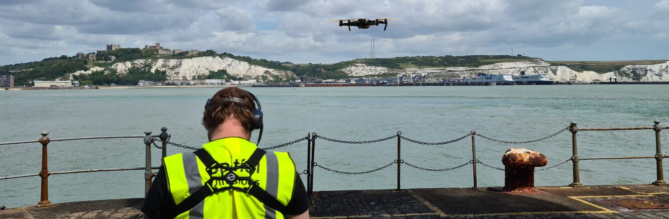
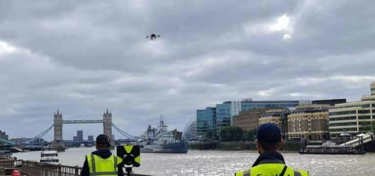
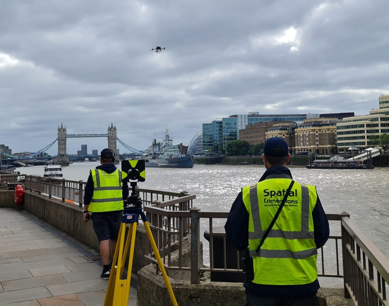
Drones provide surveyors with new ways to acquire data by allowing access to areas previously inaccessible such as unsafe roofs or high-level building elevations.
The use of drones in surveying can lead to significant and impressive cost and time savings. Integrating them into our surveying services and solutions ensure our clients get accurate, reliable and complete data.
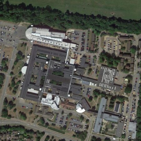
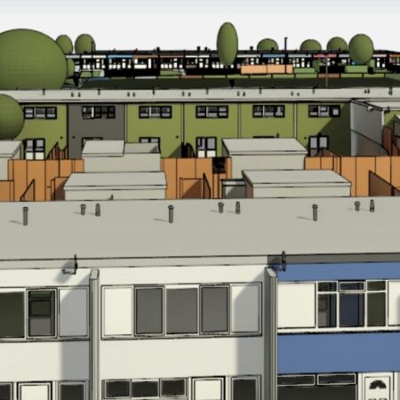
Our expert drone surveying team use the latest drone technology to provide a wide range of surveying and inspection services. These services include condition surveys of assets, construction progress imagery, high resolution orthomosaics for point cloud generation, roof plans and elevation CAD drawings for measured building surveys and topographical surveys.
Drone surveying services can be used for a wide range of applications including architectural design, civil engineering, construction, agriculture and Land Registry boundary verification.
Our drone survey teams are fully certified by the CAA to operate throughout the UK with unrivalled experience working in the most challenging congested areas of the UK.
THE BENEFITS OF DRONE SURVEYS
Improved accessibility for difficult and restricted site locations
Highly efficient and rapid method of site data collection
Completeness of data, creating a high-definition top-down dimensional record of a site.
Add value by capturing additional surrounding information
Permanent ‘point-in-time’ archive record for heritage purposes and reinstatement
Fast mobilisation
Quick Turnaround.
SPEED
One major advantage of employing drones for mapping and land surveying is the exceptional speed in covering vast areas. As a result, projects are completed more rapidly and efficiently, resulting in reduced costs and improved project timelines.
COST
Perhaps most surprisingly to our clients, the use of drones for mapping and topographical surveying is also cost-effective. A technology becomes more available, we can reduce costs for our clients. The reduced time and effort required to complete projects that previously would have been impossible translates to significant cost savings overall.
ACCESSIBILITY
A drones’ ability to access challenging locations is another huge benefit for our clients. The ability to fly at low altitudes means drones pick up challenging areas with relative ease. This feature is particularly beneficial for infrastructure development and resource management, where accessing remote locations is crucial and the safety of surveyors is at stake.
")


 Skip to content