Skip to content
Spatial Dimensions is a UK measured building survey company, founded in 2012, working from permanent offices in London, Sevenoaks and Nottingham and on site anywhere in the UK.
We produce measured building surveys to the RICS Code of Measuring Practice, 6th edition, at three defined levels of detail — LOD 2, LOD 3 and LOD 4 — and we draft every deliverable in-house under an ISO 9001:2015 checking workflow. Spatial Dimensions mobilises to site in an average of 5.3 working days from instruction.
In short: a measured building survey from Spatial Dimensions gives you a dimensionally accurate record of an existing building — floor plans, elevations, sections and reflected ceiling plans — supplied as 2D CAD drawings, a 3D Revit or IFC model, a point cloud, or any combination of the three. Prices start at £850.
or call 01732 458799
What is a measured building survey?
A measured building survey is an accurate dimensional record of a building as it actually stands, rather than as it was originally drawn. It captures the structure, the openings, the levels and the fixed elements, and turns them into drawings and models your design team can work from directly.
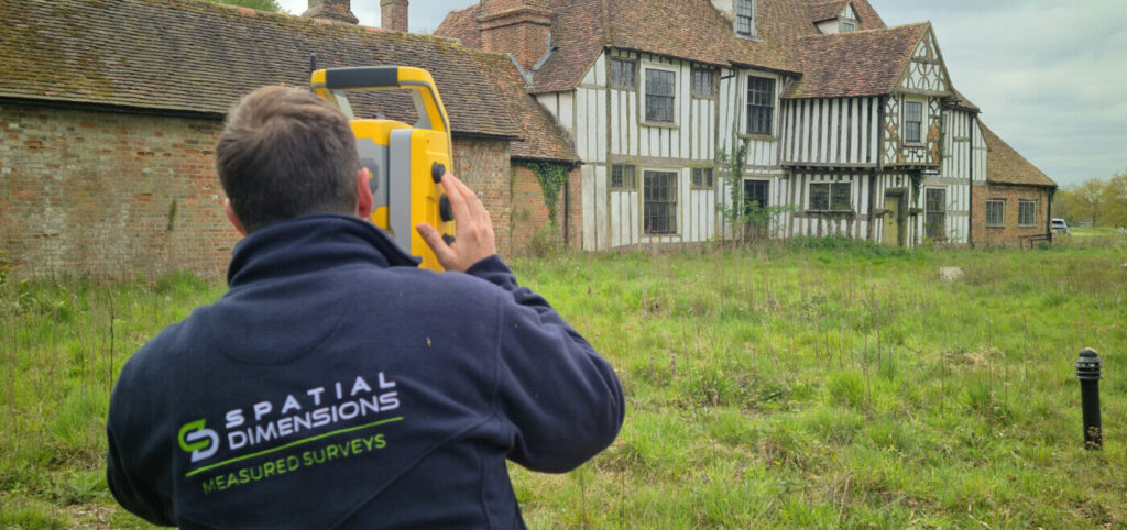
Spatial Dimensions captures that data using Leica BLK, RTC360 and P-series laser scanners, supported by calibrated robotic total stations and data-corrected GPS where external control is needed. The scan data is registered, checked and drafted by our own technicians — we do not outsource drafting.
Most people come to us for one of four reasons: a refurbishment or retrofit where the existing drawings are wrong or missing, a planning application that needs an accurate existing-conditions set, a lease or valuation that needs floor areas measured properly, or a building safety case that needs a verified record of what is there.

What drawings does a measured building survey include?
A full measured building survey from Spatial Dimensions can include floor plans, loft plans, roof plans, internal and external elevations, sections and reflected ceiling plans — each produced to a level of detail agreed in writing before we start.
- Floor plans — structural walls, columns, openings, stairs and floor levels at every level of detail; partitions, fixed and sanitary furniture and visible services from LOD 3; radiators, sockets, skirting boards and small service runs at LOD 4.
- Loft plans — structure, ceiling falls, ridge lines and skylights at every level; tanks, major plant, ridge boards and purlin beams from LOD 3; individual rafters, struts and braces at LOD 4.
- Roof plans — parapets, chimneys, ridge and eave lines with fall directions, skylights and dormers at every level; coping stones, fixed ladders and major plant from LOD 3; drainage runs, cable trays, lightning tape and aerials at LOD 4.
- Elevations — structural building lines, openings, roofs and parapets at every level; window and door fenestration, signage and pipes over 50 mm from LOD 3; brick-by-brick and stone-by-stone detail, detailed railings and structural defects at LOD 4.
- Sections — a section is a vertical cut through the building, showing how spaces and levels relate. Spatial Dimensions presents standard cut sections at LOD 3 on the cut line; where detail beyond the cut line is needed, elevated sections are drawn at LOD 2, LOD 3 or LOD 4.
- Reflected ceiling plans — structure above door head level and skylights at every level; cornicing over 50 mm, light fittings and smoke detectors from LOD 3; individual ceiling tiles and fine mouldings at LOD 4.
What level of detail do I need?
This is the question that decides the price and the programme, so it is worth getting right at the quotation stage. Spatial Dimensions defines three levels of detail in writing on every quote, so there is no ambiguity about what you are buying.
Swipe the table sideways to see all the columns.
| LOD 2 | LOD 3 | LOD 4 | |
|---|---|---|---|
| Drawing scale | 1:100 | 1:50 | 1:20 |
| Dimensional tolerance | ±20 mm | ±10 mm | ±5 mm |
| Smallest feature captured | 100 mm | 50 mm | 10 mm |
| Typically used for | Planning submissions, rights to light, feasibility | Architectural design, construction documentation | Heritage and conservation, detailed inspection, facilities management |
What each level includes on a floor plan:
Swipe the table sideways to see all the columns.
| Floor plan feature | LOD 2 | LOD 3 | LOD 4 |
|---|---|---|---|
| Structural walls and columns | ✓ | ✓ | ✓ |
| Stairs, steps, balconies and canopies | ✓ | ✓ | ✓ |
| Structural window and door details | ✓ | ✓ | ✓ |
| General floor levels | ✓ | ✓ | ✓ |
| Ceiling lines, beams and overhead structure | — | ✓ | ✓ |
| Window fenestration | — | ✓ | ✓ |
| Fixed partitions, panelling and boxing | — | ✓ | ✓ |
| Levels to window cills and heads, door heads, beams and ceilings | — | ✓ | ✓ |
| Fixed furniture and sanitary fittings | — | ✓ | ✓ |
| Rainwater pipes, vent pipes and incoming services | — | ✓ | ✓ |
| Service meters, electrical units, tanks and boilers | — | ✓ | ✓ |
| Manhole and service cover positions | — | ✓ | ✓ |
| Major plant and ducts, pipes 75 mm and over | — | ✓ | ✓ |
| Radiators | — | — | ✓ |
| Electrical sockets and switches | — | — | ✓ |
| Skirting boards | — | — | ✓ |
| Pipes and service runs under 75 mm, shown individually | — | — | ✓ |
Equivalent inclusion schedules for loft plans, roof plans, elevations, sections and reflected ceiling plans are set out in the Spatial Dimensions 2D Level of Detail guide, free to download from our guides page.
If you are not sure which level your project needs, tell us what the drawings are for and we will tell you which level is appropriate. Specifying LOD 4 where LOD 3 would do is one of the most common ways of overspending on a survey.

What deliverables will I receive?
Spatial Dimensions supplies measured building surveys in the formats your team already works in.
Swipe the table sideways to see all the columns.
| Deliverable | Formats | Notes |
|---|---|---|
| 2D CAD drawings | .DWG, .DXF | Floor plans, loft and roof plans, reflected ceiling plans, internal and external elevations, cross sections |
| 3D BIM model | .RVT (native Revit), .IFC | Modelled as parametric Revit families, not traced geometry; IFC for ArchiCAD and other platforms |
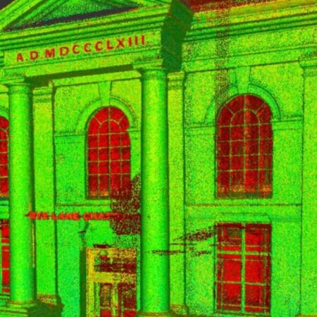
| Point cloud | .RCS, .RCP, .E57, .PTS, .PTG | Decimation available to keep file sizes workable |
| PDF plan sets | For non-technical stakeholders and planning submissions | |
| 360° virtual tour | Web-hosted | Point-in-time visual record, reduces site revisits |
| Spatial Twin | Web-hosted | Lightweight model your wider team can query in a browser, no CAD licence needed |
A note on Revit versions. Revit is not backwards compatible, so a model built in a newer version cannot be opened in an older one — and upgrading an old model to a new version can quietly harm its integrity, which is why we advise against it. Spatial Dimensions fixes the target Revit version at the quotation stage and delivers in your exact version. It is a small thing that causes a great deal of grief when it is missed.
Can Spatial Dimensions produce a 3D Revit model?
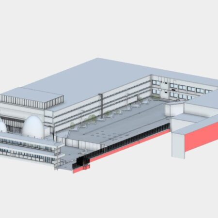
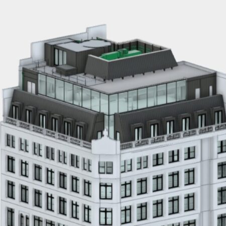
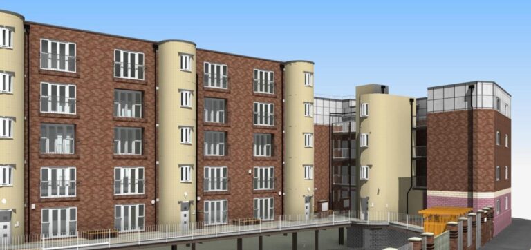
Yes. Spatial Dimensions has been producing 3D models from laser scan data for nearly 15 years, built in-house at LOD 2, LOD 3 or LOD 4 as parametric Revit families rather than traced geometry, and referenced to Ordnance Survey grid and datum unless you ask for a local grid.
- LOD 2 models (comparable to a 1:100 survey) contain structural walls, floors, ceilings, columns and beams, with windows and doors shown as basic openings — typically used for planning, project visualisation and rights of light.
- LOD 3 models (comparable to 1:50) add true window and door styles including openers, non-structural walls and boxing, and fixed furniture such as cupboards and countertops — typically used for architectural design and construction documentation.
- LOD 4 models (comparable to 1:20) add skirtings, dado rails, cornices, architraves and the full run of fixtures and fittings — typically used for detailed architectural work and heritage conservation.
Services are included as standard at LOD 3. On residential models that means boilers, water tanks, toilets, basins, sinks, fuse boxes, gas meters and service covers internally, and pipes over 50 mm, vents, lights, air handling units and major plant externally. Commercial plant rooms are modelled to the full extent of the large plant using mass modelling. Radiators, sockets, switches and internal lighting can be added — tell us at quotation stage.
Where we cannot see it, we say so in the model. Beams hidden behind fireproofing or boxing are modelled as a standardised member and named as boxing; where we can measure part of the beam elsewhere, it is modelled with “Assumed” in the family name. Walls whose thickness cannot be measured are marked under our assumed / unable-to-survey / cut-through convention. Reference levels are set floor by floor from slab levels at the stair core, with finished floor levels averaged in residential buildings.

How accurate is a Spatial Dimensions measured building survey?
Accuracy is stated in writing on every Spatial Dimensions quote, and 2D drawings and 3D models carry different tolerances, so we quote them separately.
2D drawings are drawn to a linear dimensional tolerance of ±20 mm at LOD 2, ±10 mm at LOD 3 and ±5 mm at LOD 4.
3D models and point clouds are measured against the RICS accuracy banding for measured surveys:
Swipe the table sideways to see all the columns.
| LOD 2 model | LOD 3 model | LOD 4 model | |
|---|---|---|---|
| Comparable 2D scale | 1:100 | 1:50 | 1:20 |
| RICS accuracy band | Band D | Band D | Band C |
| Plan accuracy (X,Y) | ±20 mm | ±20 mm | ±10 mm |
| Smallest modelled detail | 50 mm | 20 mm | 10 mm |
Height accuracy and the separate tolerances for hard and soft detail are set out in full in the Spatial Dimensions 3D Level of Detail guide, free to download from our guides page.
All of it stands on the control network. Spatial Dimensions establishes closed-loop control networks with redundant observations, anchored to Ordnance Survey benchmarks — OSGB36 in plan and Ordnance Datum in height unless you ask for a local arbitrary grid. On retrofit projects we anchor control to off-site hard standing so stations do not drift during enabling works. Our work follows the RICS guidance note on Measured Surveys of Land, Buildings and Utilities.
On buildings that are not square. Real buildings lean, settle and drift. Our default is to model straight and perpendicular where it is viable, so the model stays workable for your design team. Where a wall falls outside tolerance because of genuine lean or deformation, we flag it to you rather than quietly straightening it, and we either anchor the element to its ground-plane footprint or apply a computed best-fit in Revit. You get to decide which.
How long does a measured building survey take?
Spatial Dimensions mobilises to site in an average of 5.3 working days from instruction, anywhere in the UK.
Time on site and drafting time depend on the size of the building, the level of detail, and how much of the building we can access on the day. We give you both figures in the quote, not just the total, so you can see where the programme sits.
Access is the single biggest cause of delay. Locked rooms, occupied flats, live plant spaces and tenanted floors are the things that turn a one-visit survey into three. If you tell us the access constraints up front, we will plan around them.
How much does a measured building survey cost?
A measured building survey from Spatial Dimensions starts at £850. Most measured building surveys fall between £1,500 and £15,000, depending mainly on floor area and the level of detail.
The price of a measured building survey depends on five things: the floor area, the level of detail, the number of storeys and their complexity, how accessible the building is, and which deliverable formats you need.
Spatial Dimensions quotes a fixed price against a written specification — the LOD, the drawing schedule, the file formats and the Revit version are all stated before you commit, so the number does not move afterwards.
For a fixed price on your building, send us the address, the approximate floor area and what the drawings are for. We will come back with a written quote within 24 hours. All prices exclude VAT.
or call 01732 458799
How do I choose between survey quotes?
Compare the specification before the price. Most apparent price differences between survey quotes turn out to be specification differences — a different level of detail, a 2D deliverable against a 3D model, or excluded areas.
As a minimum, a measured survey proposal should state the level of detail and its tolerance, the drawing scale, the deliverable formats, what is excluded, the delivery date and the insurance position. If any of those are missing, ask.
Here is how Spatial Dimensions answers its own checklist: the LOD, tolerance and scale appear on every proposal we issue. Every survey is measured from a closed-loop control network anchored to Ordnance Survey benchmarks. We hold £10 million of cover in each of Professional Indemnity, Public Liability and Employers Liability. Every deliverable passes a multi-stage check under ISO 9001:2015 — the person who drafts a job is never the person who signs it off. And Spatial Dimensions has traded since 1 October 2012 with in-house production throughout, so the people who made your model will still be here to answer questions about it.
The full checklist — ten questions to ask any surveyor, including us — is in the Spatial Dimensions Survey Buyers Guide on our guides page.
What standards and accreditations does Spatial Dimensions hold?
Swipe the table sideways to see all the columns.
| Standard | Detail |
|---|---|
| RICS | Code of Measuring Practice 6th edition; Measured Surveys of Land, Buildings and Utilities guidance; RICS Property Measurement Professional Statements |
| Area measurement | IPMS, plus GIA, NIA and GEA area referencing reports |
| Quality management | ISO 9001:2015 certified, multi-stage checking on every deliverable |
| Professional bodies | Corporate member of The Survey Association (TSA) and CICES |
| Procurement | Constructionline Gold, Once For All Health and Safety Accreditation (SSIP scheme member) |
| Health & safety | CSCS cards for all field staff; DBS checks as standard; site-specific RAMS before mobilising |
| Insurance | £10 million professional indemnity, £10 million public liability, £10 million employers liability |
Spatial Dimensions is led by Managing Director Claire Fenwick FCICES, President of The Survey Association.
Every survey is captured, processed and checked by different people — never one person start to finish.
Who commissions measured building surveys from Spatial Dimensions?
Around 40% of our measured survey work comes from architects and space planners, 30% from property consultants, project managers, quantity surveyors and engineers, 25% from main contractors and site teams, and the remainder from private clients and domestic developers.
- Architects — RIBA Stage 2 to Stage 4 support, point clouds for spatial coordination, parametric Revit models for technical design.
- Planners — existing-conditions sets for planning submissions, rights to light modelling, 360° historic documentation.
- Contractors — as-built verification, setting out, structural monitoring.
- Consultants — area referencing to IPMS, due diligence, portfolio surveys.
- Estate agents — accurate floor areas and marketing plans.
- Lawyers and engineers — Land Registry compliant title plans, lease plans, boundary demarcation and engineering-grade control surveys.
Where has Spatial Dimensions carried out measured building surveys?
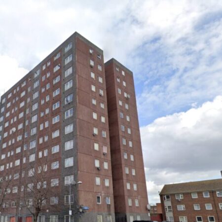
Spatial Dimensions has delivered measured building surveys across healthcare, education, defence, commercial offices, residential, sports and heritage estates.
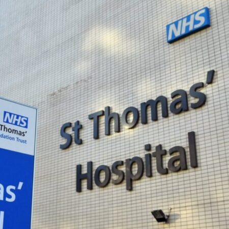
- Healthcare: St Thomas’ Hospital, King’s College Hospital, Basildon University Hospital, Kent and Canterbury Hospital, Southend University Hospital and The William Harvey Hospital, working alongside ADP Architecture, BDP, Gardiner & Theobald and NHS trusts.
- Education: University of Cambridge (Old Cavendish Buildings), Brunel University, University of Westminster, Benenden School and Dulwich Prep School.
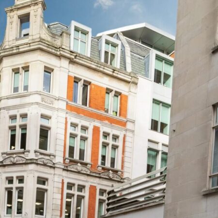
- Commercial offices: 4 Millbank, St Paul’s Churchyard, 77 Farringdon Road, Broadwalk House and Guildford Business Park, for clients including JLL, Scott Brownrigg, AtkinsRéalis, EPR Architects and Twelve Architects.
- Defence: Wellington Barracks, Victoria Barracks Windsor and the Royal Military Academy Sandhurst.
- Building safety: Places For People, Axis House, Greenwich Millennium Village and Stamford Hill, for Keegans, ECD Architects and Southern Housing Group.
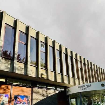
- Sports and heritage: Lincoln City FC, Robinson Pools & Fitness and Rye Lane Chapel.
Frequently asked questions
Do I need a measured building survey or a topographical survey?
A measured building survey records the building. A topographical survey records the land around it — levels, boundaries, drainage, trees and hard landscaping. Most refurbishment and extension projects need both, and Spatial Dimensions ties them to a single control network so the two sets align.
What should a measured survey proposal include as a minimum?
The level of detail and its tolerance, the drawing scale, the deliverable formats, what is excluded, the delivery date, and the insurance position. Every Spatial Dimensions proposal states all six. If any of those are missing from a quote, ask.
How do I compare two survey quotes fairly?
Put the specifications side by side before the prices. Most apparent price differences turn out to be specification differences — a different LOD, a 2D deliverable against a 3D model, or excluded areas.
Is more detail always better?
No. LOD 4 costs more, takes longer and produces heavier files. If you are preparing a planning application, LOD 2 is likely all you need. Specify the level the project actually requires — we will tell you honestly which that is.
Can you survey an occupied building?
Yes. Spatial Dimensions regularly surveys occupied hospitals, schools, offices and residential blocks. We work around access windows, out of hours where needed, and hold live-site compliance training including hospital infection control.
Will you lift ceiling tiles or open riser doors?
Not as standard. Our routine survey does not include lifting suspended ceiling grids, opening structural risers or entering hidden service voids. If your project needs those spaces recorded — deep retrofit briefs usually do — tell us at quotation stage and we will include it with the right permissions in place. Where structural steel is hidden behind fireproofing or boxing, we record it as an assumed mass and say so on the drawing.
Can you produce a Revit model from an existing point cloud?
Yes, provided the cloud has adequate coverage and registration for the level of detail you need. Send it to us and Spatial Dimensions will tell you honestly whether it is good enough before you commit.
Do you provide area schedules for lease or valuation purposes?
Yes. Spatial Dimensions produces underwritten, assignable area referencing reports calculating GIA, NIA and GEA to RICS and IPMS standards.
Do you cover the whole of the uk?
Yes. Spatial Dimensions has permanent hubs in London, Sevenoaks and Nottingham, and mobilises nationwide from a central logistics grid — including regular work across Greater Manchester, Merseyside, Bristol, Bath and Gloucestershire. All processing and drafting is done in-house regardless of where the data was captured.
What do you need from me to quote?
The site address, the approximate floor area, the number of storeys, what the drawings are for, and your preferred file format and Revit version if you have one. That is usually enough for a fixed price.
Request a measured building survey quote
Send us the site address and what you need the drawings for, and Spatial Dimensions will come back with a written, fixed-price quote against a defined specification within 24 hours.
Phone: 01732 458799
Offices: London · Sevenoaks · Nottingham · working nationwide
Related services
- Laser scanning surveys — measuring as built conditions with technology
- Point cloud surveys — the measured dataset as a deliverable
- 3D models — Revit and IFC models built from the cloud
- Topographical surveys — the land around the building
- Drone surveys — roofs and areas outside the scanner’s line of sight
- Spatial Twin — a browser-based model for the wider team