 Skip to content

SPATIAL TWIN
YOUR DIGITAL SITE
ANY TIME. ANYWHERE.
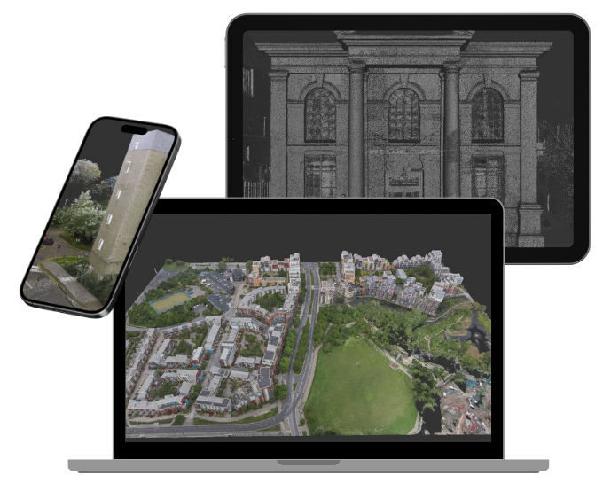
Spatial Twin is the web-hosted survey data service from Spatial Dimensions, the UK measured building survey and geospatial company founded in 2012, working from offices in London, Sevenoaks and Nottingham and on site anywhere in the UK.
A Spatial Twin takes the point cloud captured on site by our laser scanners — millions, and sometimes billions, of measured data points — and hosts it online, so your whole project team can open the site in an ordinary web browser. Nothing to install, nothing to download, no CAD or BIM licence needed.
In short: a Spatial Twin from Spatial Dimensions is a lightweight, web-hosted version of your survey data. Anyone you share it with can navigate the site, review it in detail and query dimensions from a browser on mobile, tablet or desktop, with password-protected access. From £37 per month, per site.
or call 01732 458799
What is a Spatial Twin?
A Spatial Twin is a digitally hosted version of the point cloud data from your survey. Laser scanning creates the point cloud — a collection of measured points, each with a precise position in a 3D coordinate system, which together form an extremely accurate record of a building or site. The Spatial Twin puts that data online, so it can be shared with your wider project team without waiting hours, or even days, for large files to download.
Spatial Dimensions built the Spatial Twin for the people who need to see and check the site but do not work in CAD — clients, building owners, facilities teams, agents and site staff. It lets non-technical stakeholders access, query and review site dimensions from a mobile or desktop browser, without dedicated CAD or BIM software.
WHY CHOOSE A SPATIAL TWIN?
We understand that accuracy, communication and reliability are paramount to a successful project.
A Spatial Twin combines all three!
So, why should you choose a Spatial Twin?
MOBILE, TABLET & DESKTOP ACCESS
EXACT & PRECISE DATA
USER FRIENDLY (NO DOWNLOADS)
EARLY ACCESS TO DATA
EASY TO SHARE
PASSWORD PROTECTED
LIGHTWEIGHT
EASY TO NAVIGATE

WHAT IS A BLACK & WHITE POINT CLOUD?
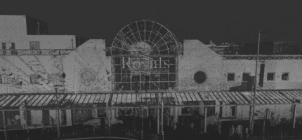
A black and white point cloud is a collection of data points in a 3D coordinate system where each point has a position (x, y, z) and a grayscale intensity value rather than RGB colour values.
Point cloud information is incredibly accurate and can be made up of billions of points per project!
WHAT IS IMAGERY?
Do you want to be able to look back at the scanned points?
Dive into the exact points where the data was taken (shown by the blue orbs below). Images taken by our laser scanners show the site in exact detail, giving you better insights.
WHAT IS A COLOURED
POINT CLOUD?
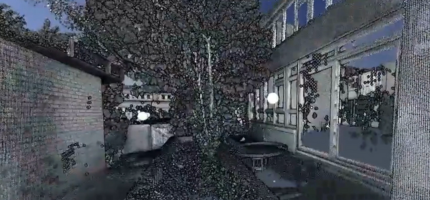
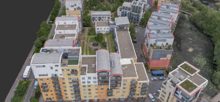
A coloured point cloud includes everything a black and white one does.
Having colour ensures more realistic visualisations. This makes it easier to identify objects, issues, surfaces and materials. This is the perfect choice for detailed and precision based projects.
What can you do in a Spatial Twin?
Open your site from anywhere, walk through it virtually and query dimensions — all in a browser. The Spatial Twin from Spatial Dimensions is:
- Accessible on mobile, tablet and desktop — it runs in the browser, with no downloads or installs
- Exact — the data is the survey-grade point cloud itself, not an artist’s impression
- Easy to share — send access to your wider project team rather than transferring huge files
- Password protected — access is controlled, not public
- Lightweight and easy to navigate — built for non-technical users
- Early access to your data — the hosted scan data can be made available ahead of drawn deliverables
Because the whole team works from the same measured dataset, questions that once meant another site visit can be answered from a desk.
Can I see photographs of the site in a Spatial Twin?
Yes, on every Spatial Twin. Our laser scanners capture images as they scan, and both SpatialTwin and SpatialTwin Colour let you open the exact positions where the data was taken — shown as blue orbs in the viewer — and look around the site in photographic detail, alongside the measurements.

How is a Spatial Twin created?
A Spatial Twin is produced from a Spatial Dimensions laser scanning survey. Our surveyors capture the site with Leica BLK, RTC360 and P-series scanners, and the scan data is registered and checked in-house — never outsourced — under our ISO 9001:2015 quality workflow before it is hosted.
It is the same dataset that produces your other deliverables — point cloud files, the 2D CAD drawings from a measured building survey, a 3D Revit model — so the Spatial Twin always agrees with the drawings and models on the project. If we have already surveyed your building, the Twin is an add-on, not a re-survey.
Should I choose a black and white or a coloured point cloud?
A black and white point cloud records each point with a position (x, y, z) and a greyscale intensity value. It is just as dimensionally accurate as colour and can run to billions of points per project.
A coloured point cloud includes everything a black and white one does, with true RGB colour added to every point. Colour makes the visualisation more realistic, which makes it easier to identify objects, issues, surfaces and materials — the right choice for detailed and precision-based work. The trade-off is that colour capture increases time on site and file size, so it costs more.
Tell us what the data is for and Spatial Dimensions will tell you plainly which your project needs. Full specification detail is in our 3D Level of Detail guide, free to download from our guides page.
How is a Spatial Twin different from a 3D model or a 360° tour?
They are three different deliverables from the same survey visit, and they answer different questions.
Swipe the table sideways to see all the columns.
| Spatial Twin | 3D Revit model | 360° virtual tour | |
|---|---|---|---|
| What it is | Web-hosted point cloud. | Parametric BIM model built from the scan data | Web-hosted photographic tour of the building |
| What you need to open it | A browser — mobile, tablet or desktop | Revit or IFC-compatible CAD/BIM software | A browser, including mobile |
| Measurements | Yes — query and review site dimensions | Yes — full design authoring, clash detection, MEP routing | No — it is a visual record, not measurement data |
| Best for | Sharing accurate site data with the whole team | Design and construction documentation | Condition records, heritage documentation, before-and-after evidence |
A Spatial Twin does not replace a 3D model for design work — architects and engineers still need the parametric model in their own software. Where a visual point-in-time record is all you need, a 360° photographic record may be enough. We will tell you honestly which combination fits.
How much does a Spatial Twin cost?
SPATIAL TWIN PRICE CARD
A Spatial Twin from Spatial Dimensions costs from £37 per month, per site. Most Spatial Twins fall between £37 and £75 per month, depending on the size of the site and the membership level.
The price of a Spatial Twin depends on three things: the size and complexity of the site (which sets how much scan data there is), whether the point cloud is black and white or coloured, and the membership level — Plus and Pro add the photographic scan imagery.
A Spatial Twin is usually supplied alongside a Spatial Dimensions laser scanning or measured building survey. We quote a fixed price against a written specification, so what is included is stated before you commit. All prices exclude VAT.
or call 01732 458799.
Who uses a Spatial Twin?
Anyone who needs the site data but not a CAD seat. During design, the Spatial Twin sits alongside the point clouds and models we supply to the design team, giving clients, consultants and site staff a way into the same data. After handover, at RIBA Stage 7, Spatial Dimensions supplies Spatial Twin infrastructure for property management and facility operation.
- Architects — share the surveyed building with clients and consultants who do not run Revit
- Planners — review existing conditions without site visits
- Contractors — check dimensions from the site cabin on a tablet
- Consultants — one shared reference dataset for the whole team, concept to in-use
- Estate agents — an accurate digital record of a property, accessible anywhere
Frequently asked questions
Do I need CAD or BIM software to use a Spatial Twin?
No. A Spatial Twin runs entirely in a web browser on mobile, tablet or desktop. No downloads, no plug-ins, no CAD licence — that is the point of it.
Can I take measurements in a Spatial Twin?
Yes. The Spatial Twin is built on the survey-grade point cloud captured by Spatial Dimensions’ laser scanners, and you can query and review site dimensions directly in the browser.
How is a Spatial Twin different from a point cloud?
It is the same data, delivered differently. Point cloud files (.RCS, .RCP, .E57, .PTS, .PTG) are for CAD and BIM users; the Spatial Twin is that point cloud hosted online so everyone else can use it too. Many projects take both.
Is my Spatial Twin secure?
Access is password protected and shared at your direction — it is not public. Spatial Dimensions also securely archives every project, so later site visits can be integrated with the original dataset.
Can I still get the raw survey files?
Yes. The Spatial Twin is an additional deliverable, not a replacement. Point clouds, 2D CAD drawings and 3D Revit or IFC models are supplied in the normal way, and on full payment you receive a permanent licence to use the data.
Can a Spatial Twin be used after the project finishes?
Yes. Facilities and property management teams use Spatial Twin infrastructure long after handover — an accurate digital record of the building they can query throughout its life.
Request a Spatial Twin
Tell us about your site and what your team needs from the data, and Spatial Dimensions will come back with a written, fixed-price quote.
Phone: 01732 458799
Offices: London · Sevenoaks · Nottingham · working nationwide
Related services
- Laser scanning surveys — how the data is captured
- Point cloud surveys — the same data as downloadable files
- Measured building surveys — drawings of the surveyed building
- 3D models — the parametric Revit model for design work
- 360° photographic records — a visual point-in-time record of the same space