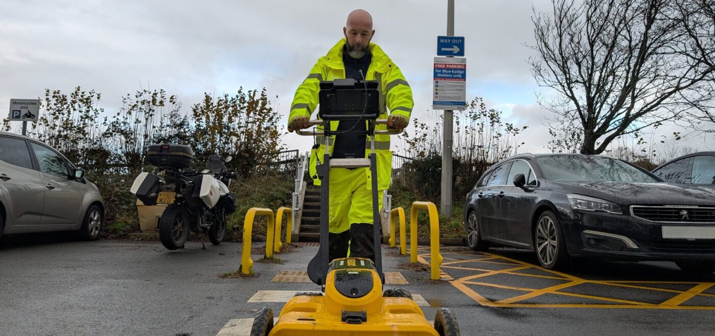
An underground utility survey is a type of survey used to determine the location and type of below-ground utility infrastructure.
An underground utility survey is a crucial process that involves locating and mapping buried utilities, such as gas pipes, water mains, electrical cables, and communication lines, beneath the ground. This survey is carried out to accurately identify and locate these underground utilities to prevent potential damages or disruptions during construction, excavation, or renovation projects.
HOW CAN UNDERGROUND UTILITY SURVEYS HELP OUR CLIENTS?
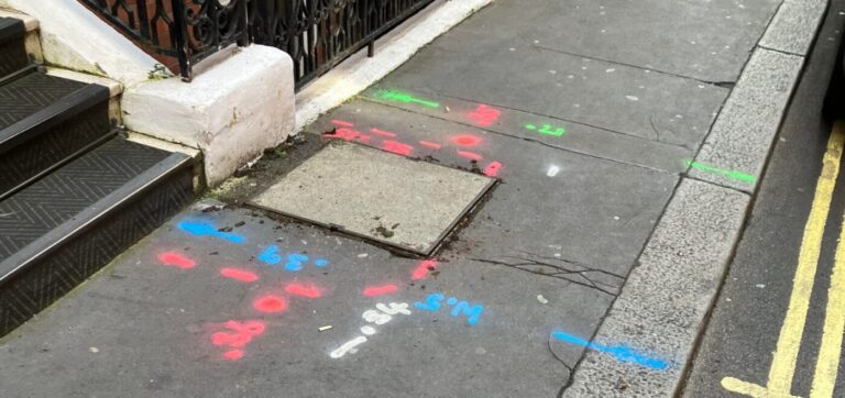
The information obtained from the survey helps create detailed utility maps, drawings, and reports. These records clearly illustrate the spatial layout and location of the underground utilities. These mapping materials are invaluable for architects, engineers, contractors, and other professionals involved in the project, as they provide essential information for ensuring safe and efficient construction operations.
By conducting an underground utility survey, we assist our clients in saving time, money, and avoiding potential risks. We understand the significance of accurate utility mapping, as it helps prevent accidents, project delays, and costly damage to underground infrastructure. Ultimately, our goal is to help our clients create spaces that are not only safe and functional but also comply with local regulations and standards.
THE BENEFITS OF UNDERGROUND UTILITY SURVEYS
Highly detailed and accurate maps of below-ground utilities
Reduces the risk of dangerous accidents
Complies with health and safety legislation
High-quality 2D or 3D linework with 3D points
Delivered in AutoCAD and/or Revit
Fast mobilisation
Quick Turnaround.
WHAT DOES UNDERGROUND UTILITIES COVER?
Electricity Cables
Oil and Gas Pipelines
Water Pipelines
Drainage and Sewage Pipelines
Telecoms and Fibre Optics Cables
If an underground survey is not performed before commencing a development project, there can be serious consequences. Rectifying any damage to utilities caused by development can prove extremely costly and cause unnecessary delays to the programme.
Likewise, there are obligations for project teams to comply with Health & safety regulations, such as The Construction (Design and Management) 2015 and provide the right protection for their workers. Contractors can work confidently prior to and during excavation by using our accurate and detailed underground utility survey maps.
WHAT DOES UNDERGROUND UTILITIES INFORM?
New Developments
Retrofit and refurbishment projects
Public realm and landscaping improvements
Utility repairs and upgrades
Excavations and trenching work
Data from underground utility surveys typically references the ordnance survey grid and level datum and can be combined with our Topographical surveys to give a complete understanding of the development area. Data can be supplied in 2D or 3D CAD drawing formats and added to a 3D Model if required. There is also the option to overlay an existing topographical survey
TYPES OF UNDERGROUND UTILITY SURVEYS
Our underground teams can carry out a range of expert services. These include but are not limited to.


 Skip to content