 Skip to content
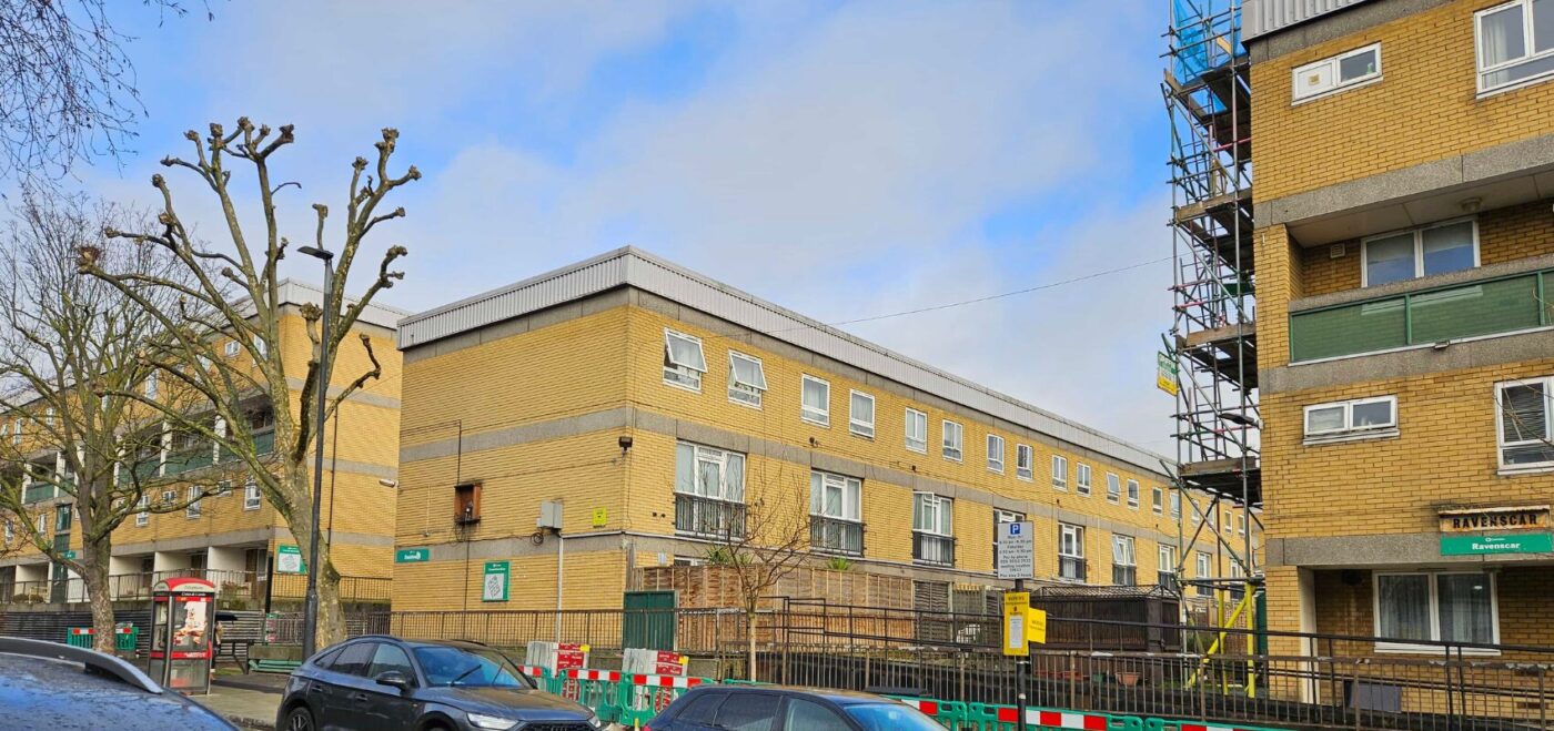
Spatial Dimensions produces the measured survey data that retrofit schemes are designed from — accurate structural opening dimensions for Passivhaus-standard windows and doors, absolute levels tied to a single site datum, and control networks that survive the enabling works.
We have surveyed retrofit projects across social housing, private residential blocks, universities, hospitals and commercial offices since 2012, working from offices in London, Sevenoaks and Nottingham.
In short: A retrofit survey is not a standard measured building survey with a different label. It needs tighter tolerances on openings, absolute levels rather than relative heights, a permanent off-site control network, and an explicit instruction about which hidden spaces are to be opened up. Spatial Dimensions captures retrofit data to support LETI energy use intensity targets of 50 kWh/m²/yr for constrained assets and 40 kWh/m²/yr for unconstrained ones. Surveys start at £850, quoted fixed price within 24 hours.
or call 01732 458799
What is a retrofit measured survey?
A measured survey specified for the demands of an energy retrofit. The building geometry is captured to support insulation depths, airtightness detailing and structural interventions — which means the survey has to answer questions a standard as-built drawing set never asks.
Spatial Dimensions’ retrofit surveys target RICS Band D accuracy on the baseline capture, with structural opening dimensions recorded precisely enough that Passivhaus-standard windows and doors can be manufactured and installed against them.

What goes wrong on retrofit surveys?
Four things, and they are all specification failures rather than fieldwork failures. Spatial Dimensions flags each of them at quotation stage:
1. Heights instead of levels. A retrofit brief written around relative heights from a finished floor surface falls apart as soon as strip-out reduces the floor build-up. Every level Spatial Dimensions records on a retrofit survey is an absolute level tied to a single site datum, so beam clearances and slab targets stay constant while the floors change around them.
2. Control that moves. Survey stations set on the working area drift once enabling works start. Spatial Dimensions establishes a permanent closed-loop control network anchored to off-site hard standing — concrete or asphalt — so the same control is still valid at handover.
3. Hidden spaces nobody instructed us to open. Standard survey routines do not lift suspended ceiling grids, open riser doors or enter concealed service voids without permission. A deep retrofit brief has to say explicitly that those spaces are to be accessed, or the thermal lining zones, column junctions and hidden services simply are not in the data. Where structural steel is concealed behind fireproofing or boxing and cannot be exposed, Spatial Dimensions records it as an assumed mass and says so on the drawing.
4. Orientation for renewables. If solar PV is part of the scheme, roof orientation has to be georeferenced properly. Spatial Dimensions ties topographical layouts to Ordnance Survey National Grid so panel configuration can be modelled against true orientation rather than an assumed north point.
Our free guide Specifying a Retrofit Measured Survey sets all of this out, and is free to download from our guides page.
What energy standards does the survey data have to support?
The London Energy Transformation Initiative (LETI) targets an energy use intensity of 50 kWh/m²/yr for constrained assets and 40 kWh/m²/yr for unconstrained properties. EnerPHit, the Passivhaus retrofit standard, is tighter still.
Hitting those numbers depends on airtightness and insulation continuity, and both depend on geometry that is right to a few millimetres at the junctions. That is the specific job Spatial Dimensions’ retrofit surveys are specified to do.
Which surveys does a retrofit project need?
Swipe the table sideways to see all the columns.
| Survey | What it gives you | Why it matters on a retrofit | From |
|---|---|---|---|
| Measured building survey | Floor plans, elevations, sections, opening schedules | The base geometry every design decision rests on | £850 |
| Laser scanning survey | High-density point cloud, to the LOD tolerances below | Captures junctions, soffits and reveals you did not know you would need | £850 |
| 3D models | Revit or IFC model at an agreed level of detail | Thermal modelling, clash detection, fabric-first design | £500 |
| Topographical survey | Site levels, boundaries, external works, orientation | Solar PV orientation, external wall insulation setting out, drainage | £595 |
| 360° photographic records | Navigable panoramic record | Pre-works condition record and remote design review | £500 |
| Underground utility survey | Buried services traced to PAS 128 | Ground source heat pump arrays, new service routes, external works | £850 |
All prices are starting points. Every job is quoted as a fixed price against a written specification.
What level of detail does a retrofit survey need?
Higher than most people specify. Spatial Dimensions works to three defined levels:
Swipe the table sideways to see all the columns.
| Level of detail | Scale | Tolerance | Retrofit use |
|---|---|---|---|
| LOD 2 | 1:100 | ±20 mm | Feasibility and stock-level assessment only |
| LOD 3 | 1:50 | ±10 mm | Most retrofit design work |
| LOD 4 | 1:20 | ±5 mm | Window and door openings for off-site manufacture, junction detailing, historic fabric |
If the scheme involves prefabricated or Passivhaus-standard window units, specify the opening tolerance explicitly and agree it in writing before the fieldwork. Specifying LOD 2 for a retrofit and then ordering windows against it is one of the most expensive mistakes on this list.
Can you survey occupied homes and blocks?
Yes. Most social housing and residential retrofit work is done with residents in place. Spatial Dimensions offers out-of-hours working as standard, and all site staff are DBS checked — which matters when the survey involves entering people’s homes. Access windows are agreed in the quote and communicated to residents in advance through the client or managing agent.
Named residential and building safety work includes Places For People, Greenwich Millennium Village, Axis House, Stamford Hill, Kensington Court Gardens and Crispe House in Barking and Dagenham, working with Keegans, ECD Architects, Southern Housing Group and Antony Patrick Associates.
Which retrofit projects has Spatial Dimensions surveyed?
Swipe the table sideways to see all the columns.
| Project | Scale | Working with |
|---|---|---|
| Lancaster West Estate | 17 acres, over 700 homes | Karakusevic Carson, Penoyre & Prasad and ECD Architects |
| The Netherfield Estate, Milton Keynes | 304 homes, fabric-first retrofit under SHDF Wave 1 | — |
| Camden retrofit project | Camden Council owns approximately 33,000 properties | Camden Council |
| Portsmouth retrofit project | Delivered at LOD 3, drone used for roofs and inaccessible areas | Portsmouth City Council |
| Cambridge retrofit project | Deep retrofit pilot; every household volunteered | ECD Architects, for Cambridge City Council |
| Kent retrofit project | SHDF Wave 2.1 | ECD Architects |
| Milton Keynes retrofit project | SHDF Wave 2.1 | ECD Architects |
Lancaster West Estate is the estate surrounding Grenfell Tower. After the 2017 fire, the government committed to transforming it into a model social housing estate for the twenty-first century, with 40 residents representing every block involved in selecting the design team. Spatial Dimensions laser scanned and topographically surveyed all 17 acres and over 700 homes, and produced the 3D Revit model, against tight planning and tendering deadlines.
The Netherfield Estate needed measured surveys on 304 homes to support a bid for SHDF Wave 1 funding. We laser scanned the externals of the worst energy-performing properties, flew a drone to capture roof-mounted services and areas that could not be reached, and delivered point clouds so the retrofit design team could familiarise themselves with the estate before setting foot on it.
Cambridge City Council chose deep retrofit for most of its pilot housing specifically so residents could stay in their homes during the works, cutting the council’s rehousing costs. Every household on the pilot volunteered.
What do retrofit clients receive?
Deliverables are agreed before we mobilise. On retrofit schemes Spatial Dimensions most often issues 2D CAD plans (.DWG and .PDF), 3D Revit or IFC models, registered point clouds (.E57 or .RCP), 360° photographic records and topographical surveys georeferenced to Ordnance Survey National Grid and Ordnance Datum. Drawings state explicitly which elements were captured directly and which are recorded as assumed mass.
What credentials does Spatial Dimensions hold?
- ISO 9001:2015 certification, with multi-stage checking on every deliverable
- Constructionline Gold and Once For All Health and Safety.
- The Survey Association (TSA) corporate membership and CICES membership
- £10M professional indemnity, £10M public liability and £10M employer’s liability insurance
- DBS-checked site staff and CSCS cards for all field personnel
Spatial Dimensions is led by Managing Director Claire Fenwick FRICS FCICES, who is President of The Survey Association.
How much does a retrofit survey cost?
Measured building surveys start at £850, topographical surveys at £595 and 3D models at £500. On a retrofit the price is driven by the level of detail — LOD 4 opening dimensions cost more than LOD 2 shell geometry — by the number of units or blocks, by whether concealed spaces are being opened up, and by how much of the work is out of hours.
Spatial Dimensions quotes a fixed price against a written specification, so the figure in the quote is the figure on the invoice. Out-of-hours access is priced into that figure at quotation stage rather than added afterwards. We also operate a price match guarantee. On phased programmes we can align survey visits with funding stages.
or call 01732 458799
Frequently asked questions
A retrofit survey uses absolute levels tied to a single site datum rather than relative heights, a permanent control network anchored off-site, and tighter tolerances on structural openings. Spatial Dimensions specifies all three at quotation stage rather than after the fieldwork.
LOD 4, at ±5 mm. Spatial Dimensions records structural opening dimensions at that tolerance so Passivhaus-standard window and door units can be manufactured and installed against the survey.
Only if the brief instructs it. Standard Spatial Dimensions routines do not lift suspended ceiling grids, open riser doors or enter concealed service voids without permission. Deep retrofit briefs should say explicitly that those spaces are in scope.
Where steel is concealed behind fireproofing or boxing and cannot be exposed, Spatial Dimensions records it as an assumed mass and states that clearly on the drawing rather than presenting an estimate as a measurement.
Yes. Spatial Dimensions surveys occupied social housing and residential blocks regularly, including 304 homes on the Netherfield Estate and over 700 on Lancaster West. All site staff are DBS checked, and out-of-hours working is standard so visits can be arranged around residents.
Yes. Spatial Dimensions georeferences topographical layouts to Ordnance Survey National Grid so roof orientation is captured accurately and PV panel configuration can be modelled against true orientation.
LETI energy use intensity targets of 50 kWh/m²/yr for constrained assets and 40 kWh/m²/yr for unconstrained properties, and EnerPHit-standard detailing where the scheme is going that far.
Measured building surveys start at £850. Spatial Dimensions quotes a fixed price against a written specification within 24 hours, backed by a price match guarantee.
Request a retrofit survey quote
Send us the site address and what the retrofit scheme involves, and Spatial Dimensions will come back with a written, fixed-price quote against a defined specification within 24 hours. If you are not sure what level of detail you need, tell us what you are designing and we will say.
Phone: 01732 458799
Offices: London · Sevenoaks · Nottingham · working nationwide