Skip to content
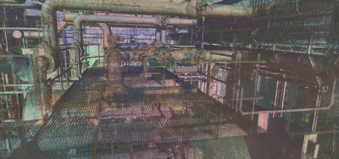
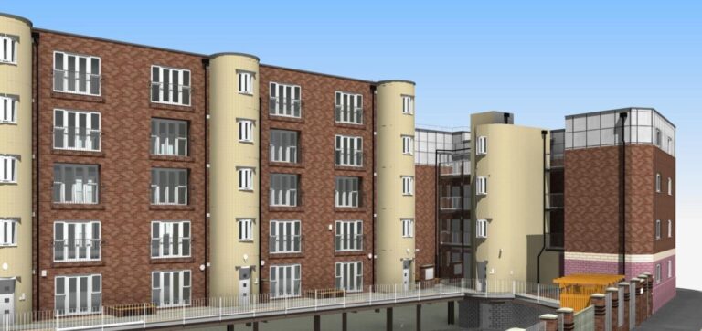
Spatial Dimensions surveys warehouses, distribution centres, factories, breweries and heavy industrial plant — capturing structural clearances, volumetric data and buried services on sites that keep operating while we work. Recent work includes Iron Mountain’s London headquarters and the Shepherd Neame brewery at Faversham, Britain’s oldest brewer.
We work from offices in London, Sevenoaks and Nottingham and survey industrial sites nationwide.
In short: Industrial surveys are usually about three things — how much headroom there actually is, what is buried under the yard, and how much material is sitting on it. Spatial Dimensions delivers clearance and structural geometry by laser scanning, volumetric quantities from digital terrain models, and buried services traced to BSI PAS 128:2022. We work out of hours as standard, mobilise in an average of 5.3 working days and quote a fixed price within 24 hours. Topographical surveys start at £595 and measured building surveys at £850.
or call 01732 458799
What are industrial measured surveys used for?
- Structural clearance mapping. Racking layouts, mezzanine design, crane rails, vehicle envelopes and door heights all depend on knowing the real clear height, not the design height. Laser scanning gives you the as-built figure, including the deflection and the services hanging below the steel.
- Volumetric reporting. Stockpiles, spoil, bunding and cut-and-fill balances, calculated from a digital terrain model.
- Buried services. Yards, service roads and hardstanding hide power, gas, water, drainage and process pipework. Striking any of it stops the site.
- Repurposing and reconfiguration. Older industrial buildings being adapted for logistics, data centres or new production lines need an accurate base record first.
How do you calculate volumes on an industrial site?
From a surveyed surface, not an estimate. Spatial Dimensions builds a digital terrain model — a continuous triangulated surface across the site — and calculates volumetric earthworks and cut-and-fill balances from it. On large or open sites the surface is usually captured by drone photogrammetry, which covers ground quickly and safely; on smaller or enclosed areas by total station and GPS.
Topographical deliverables are supplied at four levels: 3D points, 3D contours, a digital terrain model, or a full 3D BIM topographical model in Revit with roads, kerbs, fences and chambers as intelligent objects.
How do you find buried services under a yard?
By tracing them, then saying how confident we are. Spatial Dimensions works to BSI PAS 128:2022, which grades subsurface data from Quality Level D to Quality Level A:
Swipe the table sideways to see all the columns.
| PAS 128 level | What it is | What it gives you |
|---|---|---|
| D | Desktop utility search | Statutory records from utility and pipeline owners onto an OS base |
| C | Site reconnaissance | Visual mapping of covers, valves and posts to validate the records |
| B | Detection | Active tracing with electromagnetic location and ground penetrating radar |
| A | Verification | Visual confirmation and depth proving, usually by vacuum excavation or trial hole |
Where both EML and GPR are used together, depth accuracy is held to ±15%. A single technology widens that to ±40%, and we tell you which was used rather than presenting one as the other. Process pipework, private mains and abandoned lines have real detection limits, and those limits are stated in the report.
Which industrial sites has Spatial Dimensions surveyed?
Swipe the table sideways to see all the columns.
| Site | What we did | Working with |
|---|---|---|
| Iron Mountain, London HQ | Mapped the concrete slabs around the building foundations, produced heat maps showing level change, topographical survey, 2D CAD and a Revit Toposurface model | Adept Civil and Structural Consulting Engineers |
| Shepherd Neame Brewery, Faversham | Topographical survey to OS grid and Ordnance datum, measured building survey, LOD 1 massing Revit model | — |
Iron Mountain: proving whether the slabs were sinking
In March 2024 Adept Civil and Structural Consulting Engineers instructed Spatial Dimensions at Iron Mountain’s London headquarters. The concern was movement in the concrete area running alongside the main building — the client suspected the slabs were sinking, and the condition was getting worse.
We mapped the slabs surrounding the building foundations and produced heat maps showing the change in level across the area, alongside a topographical survey delivered as 2D CAD and a 3D Revit Toposurface model. Because the condition was deteriorating, speed mattered: the data went back over a week ahead of the scheduled delivery date.
Shepherd Neame: massing a working brewery
Shepherd Neame is Britain’s oldest brewer and its Faversham site supports 4,500 jobs. Spatial Dimensions carried out a topographical survey tied to OS grid and Ordnance datum plus a measured building survey, and built an LOD 1 massing model in Revit so the client could understand building volumes and roofscapes across the site while assessing redevelopment options. Floor plans were captured at varying levels of detail, agreed building by building with the client rather than applied uniformly. Site work completed in February 2023.
Which surveys does an industrial project need?
Swipe the table sideways to see all the columns.
| Survey | What it gives you | Typical industrial use | From |
|---|---|---|---|
| Topographical survey | Levels, boundaries, yards, drainage, terrain model | Site development, volumes, drainage and access design | £595 |
| Measured building survey | Floor plans, elevations, sections, clear heights | Racking, mezzanines, reconfiguration, lettings | £850 |
| Laser scanning survey | High-density point cloud, to the LOD tolerances below | Structural steel, plant, pipework, clearance checking | £850 |
| Underground utility survey | Buried services traced to PAS 128 | Any excavation, new plant bases, service diversions | £850 |
| Drone surveys | Aerial photogrammetry and volumetric capture | Large sites, stockpiles, roofs that cannot be walked | £550 |
| CCTV drainage survey | Non-man-entry drainage condition and routing | Yard drainage, interceptors, process effluent routes | £900/day |
| Monitoring surveys | Movement, tilt and deformation tracked over time | Structures near excavation or heavy plant | £850/round |
All prices are starting points. Every job is quoted as a fixed price against a written specification.
Can you survey while the site is operating?
Yes. Warehouses run shifts, factories run lines, and neither stops for a survey. Spatial Dimensions offers out-of-hours working as standard — evenings, nights, shutdown weekends and planned maintenance windows — with the access window agreed and priced into the quote rather than negotiated on the day.
Where daytime working is the only option, our surveyors work to the site’s traffic management and permit systems, with site-specific RAMS issued in advance and CSCS cards held by all field personnel. Laser scanning means one visit captures the building, which on a live logistics site is worth more than the time it saves.
How accurate is the survey data?
Swipe the table sideways to see all the columns.
| Level of detail | Scale | Tolerance | Typical industrial use |
|---|---|---|---|
| LOD 2 | 1:100 | ±20 mm | Site feasibility, massing, indicative layouts |
| LOD 3 | 1:50 | ±10 mm | Racking and mezzanine design, most reconfiguration |
| LOD 4 | 1:20 | ±5 mm | Plant replacement, prefabrication, tight-tolerance installations |
Control is tied to Ordnance Survey benchmarks using calibrated robotic total stations and multi-frequency corrected GPS, and models are georeferenced to OSGB36 and Ordnance Datum unless a local grid is requested.
What credentials does Spatial Dimensions hold?
- ISO 9001:2015 certification, with multi-stage checking on every deliverable
- Constructionline Gold (PAS 91) and Once For All Health and Safety (formerly Acclaim, SSIP)
- The Survey Association (TSA) corporate membership and CICES membership
- £10M professional indemnity, £10M public liability and £10M employer’s liability insurance
- CSCS cards for all field personnel, site-specific RAMS, clean RIDDOR record
Spatial Dimensions is led by Managing Director Claire Fenwick FCICES, who is President of The Survey Association.
How much does an industrial survey cost?
Topographical surveys start at £595, measured building surveys at £850, underground utility surveys at £850 and drone surveys at £550. CCTV drainage surveys are £900 a day and monitoring £850 a round. On industrial sites the price is driven mainly by area — these are large sites — along with the level of detail, how much of the work is out of hours, and whether subsurface work is included.
Spatial Dimensions quotes a fixed price against a written specification, so the figure in the quote is the figure on the invoice. Out-of-hours access is priced into that figure at quotation stage rather than added afterwards. We also operate a price match guarantee.
Frequently asked questions
Yes. Out-of-hours working is standard for Spatial Dimensions — nights, shutdown weekends and planned maintenance windows — with the access window agreed in the quote. Site-specific RAMS are issued in advance.
Yes. Laser scanning records the as-built underside of the structure including deflection and anything suspended below it, which is usually lower than the design clear height on the drawings.
Yes. Spatial Dimensions builds a digital terrain model of the surface and calculates volumes and cut-and-fill balances from it, usually capturing large or open sites by drone.
By tracing them to BSI PAS 128:2022, using electromagnetic location and ground penetrating radar together. Dual-technology detection holds depth accuracy to ±15%; a single technology widens that to ±40%, and Spatial Dimensions states which was used.
Yes. CCTV drainage surveys use non-man-entry tracking robots to WRc Model Contract Document standards, recording condition and routing.
Yes. At Iron Mountain’s London headquarters Spatial Dimensions mapped the concrete slabs around the building foundations and produced heat maps showing the change in level, so the structural engineers could see where the ground had dropped and by how much.
Yes. Spatial Dimensions provides monitoring surveys tracking movement, wall tilt and deformation over time, which is normally specified where excavation or heavy plant is working close to an existing structure.
Spatial Dimensions mobilises in an average of 5.3 working days from instruction and returns a written quote within 24 hours.
Topographical surveys start at £595 and measured building surveys at £850. Spatial Dimensions quotes a fixed price against a written specification within 24 hours, backed by a price match guarantee.
Resources for your profession
Request an industrial survey quote
Send us the site address and what the survey is for, and Spatial Dimensions will come back with a written, fixed-price quote against a defined specification within 24 hours.
Email: website@spatial-dimensions.co.uk
Phone: 01732 458799
Offices: London · Sevenoaks · Nottingham · working nationwide