 Skip to content

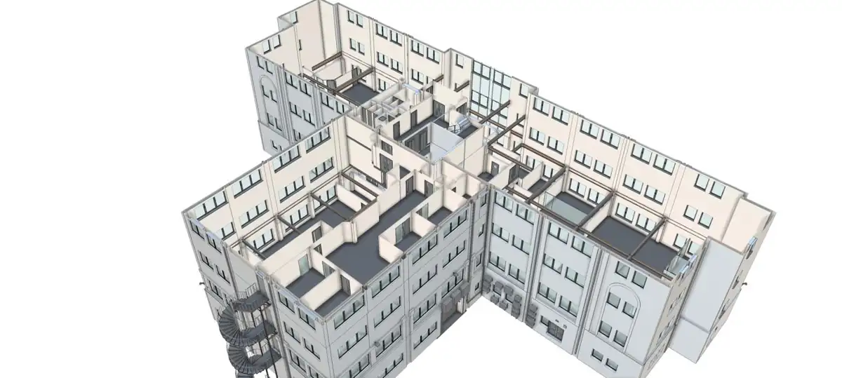
Three of London’s best-known office buildings are being kept and reworked rather than knocked down. On every one of them, the design starts from the building that is already there, which makes the office retrofit survey the first piece of work that has to be right.
In short: An office retrofit survey records an existing building exactly as it stands, so design teams can plan new floors, facades and fit-outs around the frame they are keeping. Spatial Dimensions laser scans the building, registers the scans into a point cloud and, where needed, builds a Revit model from it, with the scan and the model priced separately. Laser scanning starts from £850 and a 3D model from £500, both excluding VAT, and our average time from instruction to site is 5.3 working days.
What is happening to London’s big office buildings?
Owners are keeping three of the capital’s best-known office buildings, stripping them back and rebuilding them around their existing structure. All three stories broke in the past month, and together they say a lot about where office work in London is heading.
No 1 Poultry. As reported by Building on 6 October, fit-out contractor Ambit will revamp James Stirling’s post-modern landmark in the City, completed in 1997. Buildington reports that the 125,000 sq ft project covers a Category A office fit-out across six levels, a new reception, new end-of-journey facilities, lift and facade refurbishment, and a roof extension.
10 Cabot Square. On 8 October, Building reported that the 1991 Canary Wharf block has been given a certificate of immunity from listing. The Twentieth Century Society had pushed for grade II listing, but Historic England advised against it. That clears the way for plans by Howells to part-demolish the 10-storey building, add three floors, replace the facade and add terraces, taking it from 575,000 sq ft to 630,000 sq ft. Canary Wharf Group’s own project page says the scheme would reuse much of the existing building, including the foundations, the structural frame, the basement and the lift and stair cores.
One Spitalfields. Building reported on 30 September that lenders have agreed more than £1bn of funding for the redevelopment, with Multiplex due to carry out the work. Bisnow adds that the Foster + Partners scheme keeps the existing structural frame and extends it, creating more than 700,000 sq ft of offices, with completion expected in 2029.
Is this part of a wider shift in London’s office market?
These three aren’t one-offs. According to Savills’ Central London Office Market Watch, published on 6 August, office development starts in the City fell to just 0.9 million sq ft in the first half of 2026, across seven schemes, and all seven were refurbishments. At the same time, the best space is scarce. Savills puts vacancy in the City’s Grade A towers at just 1.9%, with City prime rents at £116.73 per sq ft, up 19% on a year earlier. In other words, owners are reworking the buildings they already have, and occupiers are paying a premium for the best of the result.
Why does keeping the frame make the survey more important?
Because every new decision on a retrofit starts from something old. On a cleared site, the design team sets out the grid. On a retained building, the grid, the slab levels, the core positions and the column sizes are already fixed, and the design has to fit around them.
In fact, the drawings that come with a 30-year-old building are rarely a reliable record of it. After all, tenants come and go, risers get added, ceilings drop, plant moves. However, a new facade has to be fixed to the frame where it really is, not where a 1990s drawing says it is. On top of that, new floors added to an existing roof have to line up with columns and cores that were built to their own tolerances. Cutting back a floorplate to bring in daylight means knowing exactly where the slab edge sits today.
That’s why the office retrofit survey carries more weight than the survey for a new build. If it’s wrong, every drawing that follows it copies the error, and it usually surfaces on site, when it is most expensive to fix.
Where does an office retrofit survey help?
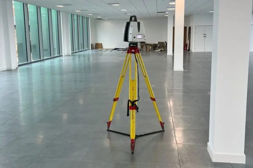
Spatial Dimensions surveys occupied and empty offices across London from our office at Westminster Bridge Road. On a retrofit like the three above, the survey typically does five jobs.
- A complete record of the building. A laser scanning survey measures millions of points on every visible surface. The registered point cloud is the measured building, floor by floor, in one coordinated dataset.
- A model to design in. A point cloud shows where a wall is; however, it doesn’t know it’s a wall. Our scan-to-BIM service turns the cloud into a native Revit model, so the design team can cut sections, schedule and host new elements.
- Drawings for the planning and design stages. Where the team works in 2D, a measured building survey gives plans, elevations and sections at an agreed level of detail. Our guide to measured building surveys for refurbishment covers this in depth.
- Floor areas before and after. When a building grows from 575,000 to 630,000 sq ft, somebody has to prove both numbers. An area referencing report gives measured floor areas to RICS and IPMS standards.
- A record of the strip-out. A 360° photographic record captures the condition of the building before work starts.
When the new floors go up, a construction verification survey checks the new work against the design while it is still easy to correct.
How accurate is the survey, and what does it cost?
Accuracy depends on the Level of Detail (LOD), the grading agreed at quotation that fixes the tolerance a survey is captured and drawn to. Spatial Dimensions states the figure for each deliverable in writing before work starts, because a 3D model and a 2D drawing are measured against different tables.
The ±5 mm figure at LOD 4 is the tolerance for a 2D drawing and for height on hard detail. It is never the plan tolerance for a model or point cloud.
Spatial Dimensions prices the site survey and the modelling separately, so you can see exactly what you are paying for. Prices for the services a retrofit usually needs:
The ranges are the span across each whole service, not one job. A price match guarantee applies to measured building surveys and 3D models. All prices exclude VAT. We will come back with a written quote within 24 hours.
What can’t a laser scan see?
A laser scanner only records surfaces it can see. That is worth being clear about at the start, because it shapes what the survey can and can’t tell the design team.
For example, a scan won’t show what is inside a wall, above a closed suspended ceiling or under a raised floor. Likewise, it records the casing around a steel column, not the steel itself. So if the design depends on hidden structure, someone has to open it up. Spatial Dimensions will tell you before the survey where lifting ceiling tiles or floor panels would add useful information, and where a structural engineer’s intrusive investigation is the right tool instead.
Similarly, in an occupied building, furniture and stored equipment also block the scanner’s line of sight. We plan scan positions to work around them, but a cleared floor always gives a more complete record. If part of a building can only be surveyed after strip-out, we’ll say so plainly and price a return visit for that stage.
What does this mean for design and development teams?
In practice, it means commissioning the office retrofit survey before the concept, not after it. That goes for the whole team, from the developer and project manager to the architect, the structural engineer and the building services engineer, because they all design from the same measured building. A few decisions at that point save a lot of rework later.
First, decide what you need: a point cloud, a Revit model, 2D drawings, or a mix. Also, it is worth checking which one a quote is actually for. Second, set the Level of Detail by area rather than for the whole building. LOD 4 might matter at the facade interface and nowhere else. Third, if the building is occupied, say so early. We regularly work in live hospitals, schools and occupied offices, and we plan out-of-hours access around tenants.
Spatial Dimensions has surveyed many office buildings for retrofit across prime central London, including 1 Vine Street and 77 Farringdon Road. As ECD Architects put it: “We have and would recommend Spatial Dimensions to other Architects and construction professionals. They deliver a great balance of price and programme often beating their competitors by weeks which is key to some of our Retrofit projects”

“Keeping a building is the right thing to do, but it means designing around decisions someone else made 30 years ago. The only way to do that confidently is to measure what is really there before anyone draws a line. That’s the bit we take care of, so the design team can get on with the bit that matters.”
Claire Fenwick
Managing Director, Spatial Dimensions, and President of the Geospatial Survey Association
Office retrofit survey FAQs
What is an office retrofit survey?
It is a measured record of an existing office building, captured before a retrofit is designed. Spatial Dimensions usually delivers it as a laser scan point cloud, with a Revit model or 2D drawings built from the same data.
Do I need a point cloud or a Revit model?
A point cloud is the measured building; a Revit model is what you design in. Many retrofits need both. Spatial Dimensions prices them separately, with laser scanning from £850 and a 3D model from £500, excluding VAT.
How accurate is a laser scan survey of an office?
It depends on the Level of Detail. For a 3D model or point cloud, the plan tolerance is ±20 mm at LOD 3 and ±10 mm at LOD 4. For 2D drawings it is ±10 mm at LOD 3 and ±5 mm at LOD 4.
Can you survey an office while it is still occupied?
Yes. Spatial Dimensions regularly works in live hospitals, schools and occupied offices, and plans access around tenants, including out of hours.
How quickly can you get on site?
Our average time from instruction to site is 5.3 working days. We send a written quote within 24 hours of the enquiry.
Can the same survey give me floor areas?
Yes. An area referencing report can be calculated from the same site visit, giving areas such as GIA and NIA to RICS and IPMS standards. Reports start from £250, excluding VAT.
Spatial Dimensions has surveyed buildings for architects, engineers and developers since 2012, with permanent in-house teams of surveyors, CAD and Revit technicians and project managers. We never subcontract our core work. Our London team works from Build Studios on Westminster Bridge Road, alongside our offices in Sevenoaks and Nottingham. Our Managing Director, Claire Fenwick FCInstCES, is President of the Geospatial Survey Association. Call us on 01732 458799 or get in touch.
Planning a model of an existing building? Download our Level of Detail for 3D Models guide.