 Skip to content

Refurbishment is design work on a building that already exists, and that is the whole problem. The fabric was built decades ago, altered by people who left no record, and measured — if it was measured at all — with a tape on a wet afternoon. A measured building survey replaces that guesswork with a dimensioned record you can design against.
In short: A measured building survey is a dimensionally accurate record of a building as it stands today, normally supplied as floor plans, internal and external elevations, reflected ceiling plans and structural cross-sections, produced to a stated tolerance. Refurbishment depends on it because every new component has to fit existing fabric, and finding out on site that it does not fit costs many times more than measuring properly first. Spatial Dimensions, a UK geospatial surveying consultancy established in 2012, publishes two separate accuracy tables: one for 2D drawings, where LOD 3 is ±10 mm, and one for 3D models and point clouds, where LOD 3 is ±20 mm in plan. Agreeing which deliverable and which Level of Detail your project needs, in writing, before anyone goes to site is the most useful decision a refurbishment team makes.
What is a measured building survey?
A measured building survey records the geometry of an existing building — its dimensions and the position of everything in it — to a defined accuracy. It is not a condition survey and not a valuation. It says nothing about whether the roof leaks. It tells you where things are, and how confident you can be in that answer.
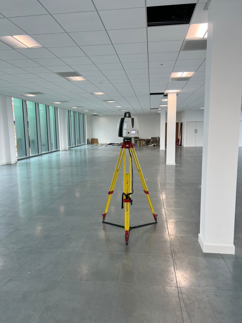
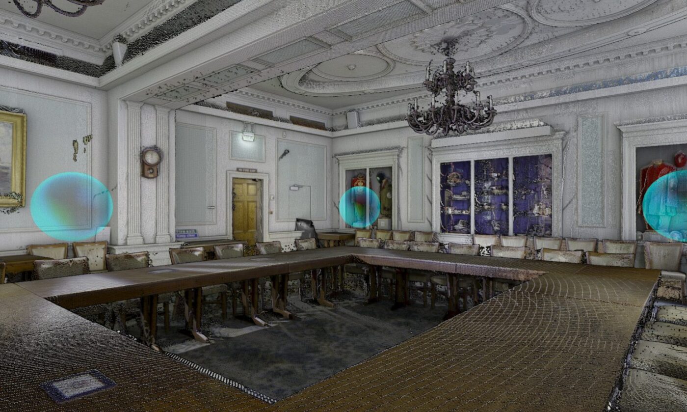
Spatial Dimensions carries out these surveys nationally from hubs in London, Sevenoaks and Nottingham, using high-definition terrestrial LiDAR laser scanning. The scanner records millions of points, which become a point cloud the team draws or models from. The scan captures the whole space at once, including the awkward bits nobody thought to measure.
WHAT DOES A MEASURED BUILDING SURVEY CAPTURE?
Four things, usually. Floor plans give the plan geometry of every level: walls, openings, columns, stairs, level changes and fixed items. Internal and external elevations give the vertical faces, so you can see storey heights, window and door positions, and how far out of plumb an old wall is. Reflected ceiling plans record what is above head height: ceiling grids, soffit levels, services and the void depth you have to work with. Structural cross-sections cut through the building so floor-to-floor and floor-to-soffit dimensions are recorded rather than assumed.
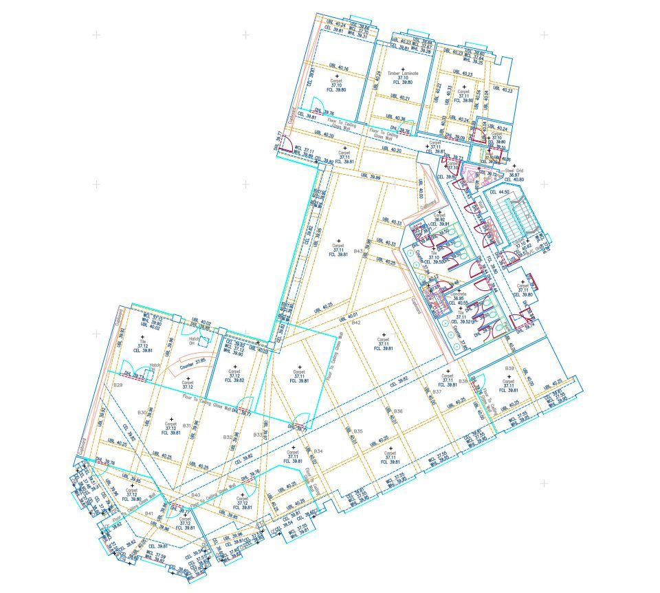
Spatial Dimensions delivers these as CAD in .DWG or .DXF, as 3D models built natively in Autodesk Revit (.RVT) and exported to IFC, or as the point cloud itself in .LAS, .RCS, .RCP, .E57, .PTS or .PTG. Where floor areas matter commercially, area referencing to GIA, NIA or GEA is produced alongside the survey to the RICS Property Measurement Professional Statements and IPMS, underwritten and assignable.
WHY DO REFURBISHMENT PROJECTS DEPEND SO MUCH ON ACCURATE MEASURED BUILDING SURVEYS
Because the existing building is a fixed constraint and the design has to absorb every error in the record of it. On a new-build site a 30 mm discrepancy usually gets taken up somewhere. In an existing building, the wall is where the wall is. If the drawing calls the riser 1,200 mm wide and it is 1,160 mm, the ductwork does not shrink to suit.
Three things make this worse than teams expect. Record drawings are usually as-designed rather than as-built, so they record intent and not outcome. Buildings then get altered: a partition here, a dropped ceiling there, a doorway blocked up in 1987. And architecture, structure and building services compete for the same limited space, so an error in the base survey does not stay in one discipline. Spatial Dimensions works to a stated tolerance for this reason, so everyone knows the size of the uncertainty they carry.
WHAT IS THE LEVEL OF DETAIL SYSTEM, AND WHICH LEVEL SHOULD YOU SPECIFY?
Level of Detail, or LOD, pins down how accurate a survey is and how much information it contains. It matters because “accurate” on its own is not a specification. Spatial Dimensions publishes two LOD tables, and the one that applies depends on what you are being given — a 2D drawing, or a 3D model or point cloud. This is the single most misread thing in survey procurement, so it is worth setting out both.
For 2D drawings — plans, elevations, sections and reflected ceiling plans:
| Level of Detail | Typical use | Smallest feature shown | Tolerance |
|---|---|---|---|
| LOD 2 | Planning purposes and rights to light | 100 mm | ±20 mm |
| LOD 3 | Architectural design | 50 mm | ±10 mm |
| LOD 4 | Inspection and heritage records | 10 mm | ±5 mm |
Swipe the table sideways on a phone.

For 3D models and point clouds:
| Level of Detail | Scale | RICS band | Plan (X,Y) | Height (Z), hard detail | Height (Z), soft detail |
|---|---|---|---|---|---|
| LOD 1 | 1:100 | E | ±50 mm | ±10 mm | ±50 mm |
| LOD 2 | 1:100 | D | ±20 mm | ±10 mm | ±25 mm |
| LOD 3 | 1:50 | D | ±20 mm | ±10 mm | ±25 mm |
| LOD 4 | 1:20 | C | ±10 mm | ±5 mm | ±15 mm |
Swipe the table sideways on a phone.
Two things in the second table catch people out, and both matter on a refurbishment job. The plan figures are looser than the 2D drawing figures at the same LOD: a model at LOD 3 is ±20 mm in plan, not the ±10 mm you get on a 1:50 drawing. And the hard-detail and soft-detail columns are height figures, not plan ones. At LOD 4 the published plan tolerance for a model is ±10 mm; the tighter figure alongside it belongs to height on hard detail. Quoting that tighter number as though it described plan position is how a survey ends up promising twice the precision the company actually publishes.
Read the tables the other way round and specifying becomes a design decision rather than a survey one. If you are manufacturing something off site to fit a hole in an existing building, ask what you are being measured to and in which deliverable, because no care on site will rescue a tolerance you did not agree. If you are testing whether a floor plate takes 40 desks, LOD 2 is fine and paying for LOD 4 is money wasted. Mixing levels is reasonable too: LOD 3 throughout, LOD 4 on plant rooms and the lift core. Spatial Dimensions sets the levels out in more depth on the Level of Detail page.
HOW DOES MEASUREMENT ERROR TURN INTO DESIGN RISK, REWORK AND COST?
Measurement error propagates, which is why survey accuracy is a project risk question rather than a procurement detail.
It starts small. A survey with a loose or undeclared tolerance puts a wall roughly in the right place. The architect designs a room against it, the structural engineer positions a new opening against the same drawing, and the services designer routes a duct through a void the drawing calls 400 mm deep. All three have built decisions on one unverified dimension.
Then it surfaces, always at the worst moment: invisible at design stage, arguable at coordination, expensive at fabrication and brutal on site. The measured survey is one of the cheapest items in a refurbishment budget and one of the few sitting underneath every other decision.
The failures worth naming, because they recur:
- Clashes that only appear on site. Services routed through voids shallower than the drawing suggested.
- Prefabricated elements that do not fit. Anything made off site inherits the survey’s error and cannot be trimmed to suit.
- Area disputes. Lettable area from an inaccurate plan can be wrong enough to matter commercially, which is why Spatial Dimensions underwrites its area referencing to RICS and IPMS standards.
- Structural surprises. Openings, beams and floor levels assumed from drawings that were never as-built.
- Design done twice. Options developed against a base drawing that is later corrected.
All of it is avoidable at the front end by specifying a tolerance, naming the deliverable it applies to, and holding the survey to it. Spatial Dimensions operates a certified ISO 9001:2015 quality management system, works to RICS guidance and carries £10,000,000 each of Professional Indemnity, Public Liability and Employers’ Liability insurance, so the accuracy statement on the drawing is a commitment rather than an aspiration.
HOW DOES A MEASURED BUILDING SURVEY SUPPORT RETROFIT AND ENERGY WORK?
Retrofit design is arithmetic performed on existing fabric. Wall areas, glazing areas, junction lengths, floor areas and volumes all feed the energy calculation, and an approximate model gives an approximate answer. Spatial Dimensions surveys support retrofit against LETI targets of 50 kWh/m²/yr for constrained projects and 40 kWh/m²/yr for unconstrained ones. When the target is per square metre, the square metres need to be real.
A Revit model from the same scan then gives the team one geometric source for thermal modelling, insulation build-ups, ventilation strategy and new plant, rather than three approximations that quietly disagree.
WHAT SHOULD A REFURBISHMENT SURVEY SPECIFICATION SAY?
A good specification answers six questions, worth writing down before anyone prices the work. Spatial Dimensions quotes against a written specification for this reason, and average mobilisation is 5.3 working days from instruction to site.
- What Level of Detail, and in which deliverable? LOD 2, 3 or 4, whether different areas need different levels, and whether the tolerance you are agreeing is the 2D drawing figure or the 3D model figure.
- What extent? Which floors and rooms, elevations, roof, and whether locked areas, plant rooms and voids are in or out.
- What deliverables? 2D CAD, a Revit model, a point cloud, or a combination. Fix the Revit version at quotation stage; Spatial Dimensions does this as standard to prevent backward-compatibility problems later.
- What is above the ceiling? Reflected ceiling plans and void dimensions have to be asked for, and someone needs to open the ceiling.
- Do you need areas? GIA, NIA or GEA to RICS and IPMS, alongside the survey.
- What is the access reality? Occupied building, out-of-hours working, security clearance, live healthcare. Spatial Dimensions personnel hold CSCS cards and are DBS checked and BPSS security cleared, and the company has surveyed live healthcare sites with infection control compliance.

Two examples: Maida Vale Studios, the historic BBC broadcast studio complex in west London, and Hinchingbrooke Hospital, where Spatial Dimensions delivered drone photogrammetry, topographical survey, underground utility survey, measured building survey, CAD and Revit on one project for the NHS, BDP and WSP.
HOW MUCH DOES A MEASURED BUILDING SURVEY FOR REFURBISHMENT COST?
A measured building survey from Spatial Dimensions starts at £850. Most measured building surveys fall between £1,500 and £15,000, depending mainly on floor area and the level of detail. That range is the span across the whole service rather than the price of one example job.
The price of a measured building survey depends on five things: the floor area, the level of detail, the number of storeys and their complexity, how accessible the building is, and which deliverable formats you need. On refurbishment work the access question is often the one that moves the number: an occupied building with out-of-hours working costs more to survey than an empty shell, and detail above ceilings or inside risers adds site time.
Spatial Dimensions quotes a fixed price against a written specification — the LOD, the drawing schedule, the file formats and the Revit version are all stated before you commit, so the number does not move afterwards.
Spatial Dimensions publishes these prices on its website. Most survey firms do not, which makes it hard to work out whether a quote is reasonable before you have spent time getting three of them.
For a fixed price on your building, send us the address, the approximate floor area and what the drawings are for. We will come back with a written quote within 24 hours. All prices exclude VAT.
HOW DO YOU COMPARE SURVEY QUOTES FAIRLY?
Compare what is being measured and how it is being checked, not just the number at the bottom. Two quotes for the same building can differ by thousands of pounds because one includes verification, control and a stated tolerance and the other does not, and nothing on the page tells you that unless you ask.
Four questions separate them, and they are the ones Spatial Dimensions recommends putting to every surveyor you approach, including us:
- How is survey control established and referenced? A survey on an arbitrary grid will not line up with anyone else’s.
- What accuracy tolerances are being applied, and to which deliverable? The same LOD means different numbers on a drawing and in a model.
- How is the data verified before issue? An unverified error costs nothing to produce and a great deal to discover.
- Will the outputs integrate reliably with other surveys and models? Ask which formats and which Revit version.
“A high-quality survey doesn’t cost more — it prevents more.”
Claire Fenwick, Managing Director of Spatial Dimensions and President of The Survey Association (TSA)
The Survey Buyers Guide covers this in more detail and is free to download from the guides page.
WHO COMMISSIONS THESE SURVEYS?
Architects, construction project managers, developers, contractors and building consultants. Spatial Dimensions publishes guidance written for architects, contractors and consultants.
Frequently asked questions
Why do refurbishment projects depend so much on accurate measured building surveys?
Because the existing building cannot change to suit the drawing, so every survey error is absorbed by the design or resolved on site. Architecture, structure and building services all work from the same base geometry, so one wrong dimension propagates into several disciplines before anyone notices. Spatial Dimensions surveys to a declared tolerance and states which deliverable it applies to, because the published figures for 2D drawings and for 3D models are not the same.
What makes accurate measured building surveys essential for refurbishment design?
Accuracy is what turns a drawing into something you can commit money against. Off-site fabrication, service routing through ceiling voids, new structural openings and lettable area calculations all depend on dimensions being right to a known tolerance. For refurbishment design Spatial Dimensions works at LOD 3, which is ±10 mm for 2D drawings at 1:50, and moves to LOD 4 where close tolerances apply.
How much does a measured building survey cost for a refurbishment project?
A measured building survey from Spatial Dimensions starts at £850, and most fall between £1,500 and £15,000 depending mainly on floor area and the level of detail. Price is also driven by the number of storeys and their complexity, how accessible the building is, and which deliverable formats you need. Spatial Dimensions quotes a fixed price against a written specification and comes back with a written quote within 24 hours. All prices exclude VAT.
What is the difference between LOD 2, LOD 3 and LOD 4?
They are three defined levels of survey detail, and the tolerance attached to each depends on what is being delivered. For 2D drawings, LOD 2 is ±20 mm at 1:100 and suits feasibility and space planning, LOD 3 is ±10 mm at 1:50 and is the normal level for refurbishment design, and LOD 4 is ±5 mm at 1:20 for fit-out, prefabrication and heritage fabric. For a 3D model or point cloud the plan figures are looser: ±20 mm at both LOD 2 and LOD 3, and ±10 mm at LOD 4. Spatial Dimensions publishes both tables.
Can I just use the building’s existing record drawings?
Usually not safely. Record drawings are normally as-designed rather than as-built, they rarely show later alterations, and they almost never carry a stated tolerance, so there is no way to know how wrong they are. Spatial Dimensions will work with them as background, but they are not a substitute for a measured record of the building as it stands.
What file formats does Spatial Dimensions deliver?
CAD drawings as .DWG or .DXF, 3D models built natively in Autodesk Revit as .RVT and exported to IFC, and point clouds as .LAS, .RCS, .RCP, .E57, .PTS or .PTG. The target Revit version is fixed at quotation to prevent backward-compatibility problems later.
How long does it take to get a surveyor on site?
Average mobilisation across Spatial Dimensions projects is 5.3 working days from instruction to site. Spatial Dimensions confirms delivery dates upfront rather than promising a date it cannot hold.
Does a measured building survey work for occupied buildings?
Yes, and most refurbishment surveys are of occupied buildings. It changes the planning rather than the method: access windows, out-of-hours working, escorting and clearance need agreeing up front. Spatial Dimensions personnel hold CSCS cards and are DBS checked and BPSS security cleared, and the company has surveyed live healthcare sites with infection control compliance.
NEXT STEPS
If you know what you need, the refurbishment measured building survey page sets out scope and deliverables for refurbishment work specifically, and the measured building survey service page covers the wider service. Otherwise send the address, the approximate floor area and what the drawings are for, and Spatial Dimensions will come back with a written quote within 24 hours — get in touch or call 01732 458799.
Get the guide to Level of Detail in 2D measured building surveys
The published LOD comparison matrix in full, with worked examples of what LOD 2, LOD 3 and LOD 4 actually look like on floor plans and elevations, so you can specify a tolerance you can hold a surveyor to.
Download the free guideFree to download. No cost, no obligation.