 Skip to content

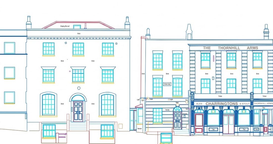
plans, sections and elevations of an existing building come from a measured building survey, and the level of detail you choose sets how much is drawn and how tightly it is measured. Spatial Dimensions delivers 2D measured building survey drawings at LOD 2 (±20 mm), LOD 3 (±10 mm) or LOD 4 (±5 mm) as .DWG or .DXF files, on Ordnance Survey grid and datum, starting from £850 and mobilising on average 5.3 working days after instruction. All prices exclude VAT.
What is a plan, a section and an elevation?
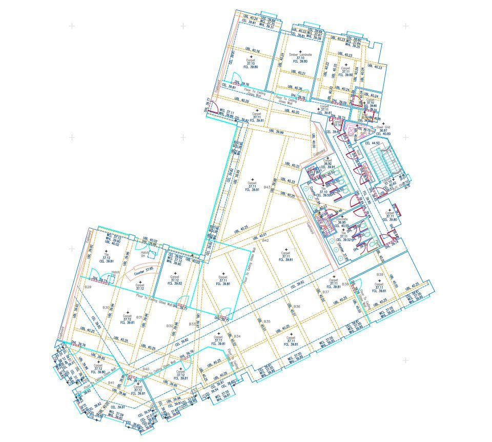
A plan is a view looking down on one floor. A section is a vertical slice through the building. An elevation is a view of one face of the building from outside, or of one wall from inside.
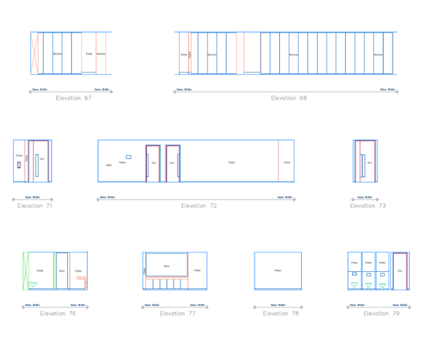
Together they describe an existing building in the way an architect expects to receive it. A measured building survey records the building once, on site, and the three views are drawn from that single record. That is why a door in the plan sits at the same position in the elevation.
What does a standard drawing set include?
A standard set from Spatial Dimensions includes floor plans, sections and elevations, and can add roof plans and reflected ceiling plans. The table shows what each drawing is for.
| Drawing | What it shows | Used for |
|---|---|---|
| Floor plans | Walls, openings, columns, stairs and fixed features on each floor, looking down | Layout, space planning, area measurement |
| Sections | A vertical slice through the building at an agreed line, with floor-to-floor and internal heights | Heights, stair design, structure, extensions |
| Elevations | Each face of the building, with openings, levels and features | Facade design, planning drawings, heritage records |
| Roof plans | The roof as seen from above, with ridges, eaves and rooflights | Roof works, rooflight and plant design |
| Reflected ceiling plans | The ceiling as if mirrored onto the floor, with bulkheads and fixtures | Ceiling and lighting design |
Swipe the table sideways on a phone.
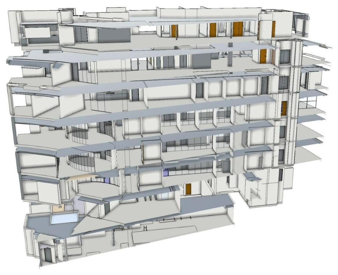
Standard cut sections are presented at LOD 3 on the cut line, so the structure and floor build-up are shown at architectural-design detail where the section passes through the building. Reference levels are set floor by floor, with mezzanines added where required, and taken from the stair core to give slab level.
Our article on levels and heights explains what the numbers on a survey drawing mean, and why a level and a height are not the same thing.
 READ NEXTPOST STRIP-OUT SURVEYS IN LONDON: WHEN TO BOOK ONE AND WHAT YOU GET
Which level of detail do you need?
You need the level of detail that matches what the drawings will be used for. A higher level shows smaller features and is measured more tightly, and it takes longer to survey and draw.
The table gives the published figures for 2D measured building survey drawings, which means floor plans, elevations, sections, roof plans and reflected ceiling plans.
| LOD | Typical use | Minimum size of feature shown | Tolerance |
|---|---|---|---|
| LOD 2 | Planning purposes and rights to light | 100 mm | ±20 mm |
| LOD 3 | Architectural design | 50 mm | ±10 mm |
| LOD 4 | Inspection and heritage records | 10 mm | ±5 mm |
Swipe the table sideways on a phone.
Prefer to watch? Our seven-minute explainer, The Blueprint to Perfect 2D Surveys, walks through the levels of detail for 2D measured survey drawings and why the choice matters. More explainers are on our YouTube channel.
As a guide, LOD 2 is roughly 1:100, LOD 3 is roughly 1:50 and LOD 4 is roughly 1:20. There is no LOD 1 row for 2D drawings; the table starts at LOD 2.
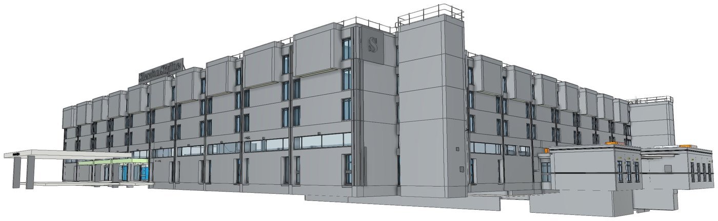
The level of detail can also change within one building. At The Athenaeum Hotel in Mayfair, Spatial Dimensions laser scanned the building to produce 13 external elevations at LOD 2 or LOD 3, along with four cut sections showing internal heights and level datum. Different faces and different purposes needed different detail, so each drawing was specified separately.
Are 3D models measured to the same tolerances as 2D drawings?
No. A 3D model or point cloud has its own table, and the numbers are different. Mixing the two tables is the most common mistake in survey specifications.
The table below applies to 3D models and point clouds. The height figures are split into hard detail, such as kerbs and structure, and soft detail, such as vegetation and ground surfaces.
| LOD | Plan accuracy (X, Y) | Height (Z), hard detail | Height (Z), soft detail | Minimum size of detail shown |
|---|---|---|---|---|
| LOD 2 | ±20 mm | ±10 mm | ±25 mm | 50 mm |
| LOD 3 | ±20 mm | ±10 mm | ±25 mm | 20 mm |
| LOD 4 | ±10 mm | ±5 mm | ±15 mm | 10 mm |
Swipe the table sideways on a phone.
Three points are easy to get wrong:
- ±5 mm is the height accuracy for hard detail in a LOD 4 3D model. It is not a plan accuracy, and the LOD 4 plan accuracy for a model or point cloud is ±10 mm.
- A LOD 3 3D model has a plan accuracy of ±20 mm. The ±10 mm figure at LOD 3 belongs to 2D drawings, and to the height of hard detail in a 3D model.
- Hard detail and soft detail are both height figures, and soft detail is always looser.
So when you write a specification, name the deliverable in the same sentence as the number. LOD 3 measured building survey drawings at ±10 mm is right. A LOD 3 point cloud at ±10 mm plan accuracy is not. Our article on how accurate a survey is goes through the RICS bands and what they mean, and our guide to level of detail for measured building surveys sets out the full tables.
PLANNING A PROJECT?
Tell us about your site and what you need, and we will come back to you with a quote.
What formats do the drawings come in?
Drawings are delivered as .DWG or .DXF files, which open in any CAD package. Models are delivered as .RVT, exported to IFC, and point clouds as .E57 or .RCP.
If you also need a 3D model, Spatial Dimensions fixes the target Revit version at quotation, which prevents backward-compatibility problems later. Where a drawing set is all you need, our CAD drawing service delivers it without the model.
What should you tell the surveyor before you commission drawings?
Tell the surveyor six things, and the quote will match what you need:
- the address, and the number of floors to be surveyed;
- what the drawings are for, such as planning, design or a heritage record;
- which drawings you want: plans, sections, elevations, roof plans or reflected ceiling plans, and where sections should be cut;
- the level of detail, or the use, so we can recommend one;
- the file formats and the Revit version, if a model is included;
- the date you need the drawings by.
Spatial Dimensions writes all of this into a fixed-price quote before you commit, with a dedicated project manager assigned to the job. Our page for architects explains how we work with design teams.
How much do plans, sections and elevations cost?
A measured building survey from Spatial Dimensions starts at £850. Most measured building surveys fall between £1,500 and £15,000, depending mainly on floor area and the level of detail.
A CAD drawing package starts at £250, and most fall between £500 and £7,500. A 3D model starts at £500, and most fall between £800 and £10,000.
| Service | From | Most jobs fall between | Basis |
|---|---|---|---|
| Measured building survey | £850 | £1,500 – £15,000 | per job |
| CAD drawing package | £250 | £500 – £7,500 | per job |
| 3D model (Revit) | £500 | £800 – £10,000 | per job |
Swipe the table sideways on a phone.
Those ranges are the span across each whole service, not the price of one job. The price of a measured building survey depends on five things: the floor area, the level of detail, the number of storeys and their complexity, how accessible the building is, and which deliverable formats you need.
Spatial Dimensions quotes a fixed price against a written specification, with the level of detail, the drawing schedule, the file formats and the Revit version stated before you commit, so the number does not move afterwards. We also offer a price match guarantee on measured building and 3D model work.
For a fixed price on your building, send us the address, the approximate floor area and what the drawings are for. We will come back with a written quote within 24 hours. All prices exclude VAT.
Plans, sections and elevations: FAQs
What is the difference between a plan, a section and an elevation?
A plan looks down on a floor, a section is a vertical slice through the building, and an elevation shows one face of it. A measured building survey from Spatial Dimensions gives you all three, drawn from the same survey data, so they agree with each other.
Which level of detail do I need for plans, sections and elevations?
LOD 2 suits planning purposes and rights to light, LOD 3 suits architectural design and LOD 4 suits inspection and heritage records. These match the published tolerances for 2D measured building survey drawings: ±20 mm, ±10 mm and ±5 mm.
How accurate are the 2D drawings compared with a 3D model?
A 2D measured building survey drawing at LOD 3 has a tolerance of ±10 mm, while a 3D model or point cloud at LOD 3 has a plan accuracy of ±20 mm. The two tables differ, so Spatial Dimensions always names the deliverable alongside the figure.
What file formats do you deliver drawings in?
Drawings are delivered as .DWG or .DXF, models as .RVT or .IFC, and point clouds as .E57 or .RCP. Spatial Dimensions fixes the Revit version at quotation so the model opens cleanly in your software.
What grid and datum are the drawings on?
Measured building surveys from Spatial Dimensions are provided to Ordnance Survey grid and datum as standard. Revit models follow the same rule unless you specify a local grid.
How much do plans, sections and elevations cost?
A measured building survey from Spatial Dimensions starts at £850, and most fall between £1,500 and £15,000, depending mainly on floor area and the level of detail. A CAD drawing package starts at £250. All prices exclude VAT.
How quickly can you start a measured survey in London?
Spatial Dimensions averages 5.3 working days from instruction to site, working from offices in London, Sevenoaks and Nottingham. We confirm the survey and delivery dates in the written quote.
Next steps
Tell Spatial Dimensions the address, the drawings you need and what they are for, or call 01732 458799. You can also read how we work, see our credentials or get in touch. We have offices in London, Sevenoaks and Nottingham, and our London office is at Build Studios, 203 Westminster Bridge Road.
Get the Survey Buyers Guide
Free to download. It explains what to ask any surveyor, how to compare quotes and what separates a good survey from a cheap one.
Download the free guideFree to download. No cost, no obligation.
 DEVELOPER
 CONSULTANT
 ARCHITECT
 ENGINEER
 SURVEYOR
 PLANNER
 CONTRACTOR
 ESTATE AGENT
 LAWYER
 HOMEOWNER