 Skip to content

Spatial Dimensions publishes its survey prices. This guide sets out the published prices in one place, explains what moves a price up or down, and is honest about what a starting price does not cover.
In short: In the UK, a measured building survey from Spatial Dimensions starts at £850 and most fall between £1,500 and £15,000. A topographical survey starts at £595, with most between £750 and £2,500. An underground utility survey starts at £850, with most between £1,200 and £3,500, and a 3D Revit model starts at £500. The price of any survey is driven mainly by the size of the building or site and the level of detail you need. Spatial Dimensions, a UK geospatial surveying consultancy established in 2012, quotes a fixed price against a written specification within 24 hours. All prices exclude VAT.
How much does a survey cost in the UK?
It depends on the survey. Every survey listed below has a published starting price, and all but one have a typical range as well. The ranges are the span across the whole service, not the price of one example job, so a small, simple job sits near the bottom and a large or complex one near the top. All prices exclude VAT.
Building surveys and 3D deliverables
| Survey | Starts from | Most jobs fall between | Priced |
|---|---|---|---|
| Measured building survey | £850 | £1,500 – £15,000 | per job |
| Laser scanning survey | £850 | £850 – £5,000 | per job |
| Point cloud survey | £850 | £850 – £5,000 | per job |
| 3D model (Revit) | £500 | £800 – £10,000 | per job |
| CAD drawing package | £250 | £500 – £7,500 | per job |
| 360° photographic record | £500 | £750 – £2,500 | per job |
| Area referencing report | £250 | £500 – £2,500 | per job |
| Land Registry plan | £250 | £350 – £550 | per plot |
Swipe the table sideways on a phone.
Land and site surveys
| Survey | Starts from | Most jobs fall between | Priced |
|---|---|---|---|
| Topographical survey | £595 | £750 – £2,500 | per job |
| Drone photographic survey | £550 | £650 – £850 | per job |
| Drone mapping survey | £850 | £850 – £2,500 | per job |
Swipe the table sideways on a phone.
Underground utility surveys
| Survey | Starts from | Most jobs fall between | Priced |
|---|---|---|---|
| Underground utility survey | £850 | £1,200 – £3,500 | per job |
| PAS 128 survey | £850 | £1,200 – £3,500 | per job |
| Desktop utility search | £450 (enhanced +£175) | £450 – £1,250 | per order, 1 km² each |
| Utility verification (QL-A) | £350 per trial hole | £850 – £2,500 per job | per trial hole |
| GPR survey | £800 per day | £1,200 – £3,500 | per day on site |
| EML survey | £800 per day | £1,200 – £3,500 | per day on site |
| CCTV drainage survey | £900 per day | £1,000 – £3,500 | per day on site |
| Visual inspection survey | £500 per day | £650 – £950 | per day on site |
| Site mark out | £700 per day | £850 – £1,000 | per day on site |
Swipe the table sideways on a phone.
Construction-stage surveys
| Survey | Starts from | Most jobs fall between | Priced |
|---|---|---|---|
| Setting out survey | £700 per day | £850 – £1,000 | per day on site |
| Construction verification report | £850 | £950 – £2,500 | per job |
| Monitoring survey | £850 per round | not published | per visit, set-up extra |
Swipe the table sideways on a phone.
What makes one survey cost more than another?
Two things drive almost every survey price: how much there is to measure, and how much detail you need from it. Everything else adjusts the number at the edges.
- Size. Floor area for a building, site area for land, the area scanned for a
utility survey. More ground means more time on site and more drawing time afterwards. - Level of detail. On a measured building survey, LOD 2 drawings at ±20 mm
are quicker to produce than LOD 4 drawings at ±5 mm, because LOD 4 records features down to
10 mm across. Spatial Dimensions explains the levels on its
Level of Detail page. - Deliverable. 2D CAD linework, a point cloud and a full Revit model of the same
building are three different pieces of work and are priced differently. - Complexity. More storeys, more rooms, more services in the ground, more
features to record. - Access. An occupied building that has to be surveyed out of hours, a congested
street that needs traffic management, or a locked area that forces a return visit all add time.
That is why Spatial Dimensions publishes a range rather than a single number. It is also why the quickest way to a real figure is a quote against your own building or site.
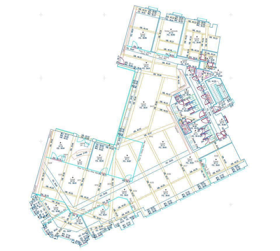
How much does a measured building survey cost?
A measured building survey from Spatial Dimensions starts at £850. Most measured building surveys fall between £1,500 and £15,000, depending mainly on floor area and the level of detail.
The price of a measured building survey depends on five things: the floor area, the level of detail, the number of storeys and their complexity, how accessible the building is, and which deliverable formats you need.
Spatial Dimensions quotes a fixed price against a written specification — the LOD, the drawing schedule, the file formats and the Revit version are all stated before you commit, so the number does not move afterwards — and offers a price match guarantee.
For a fixed price on your building, send us the address, the approximate floor area and what the drawings are for. We will come back with a written quote within 24 hours. All prices exclude VAT.
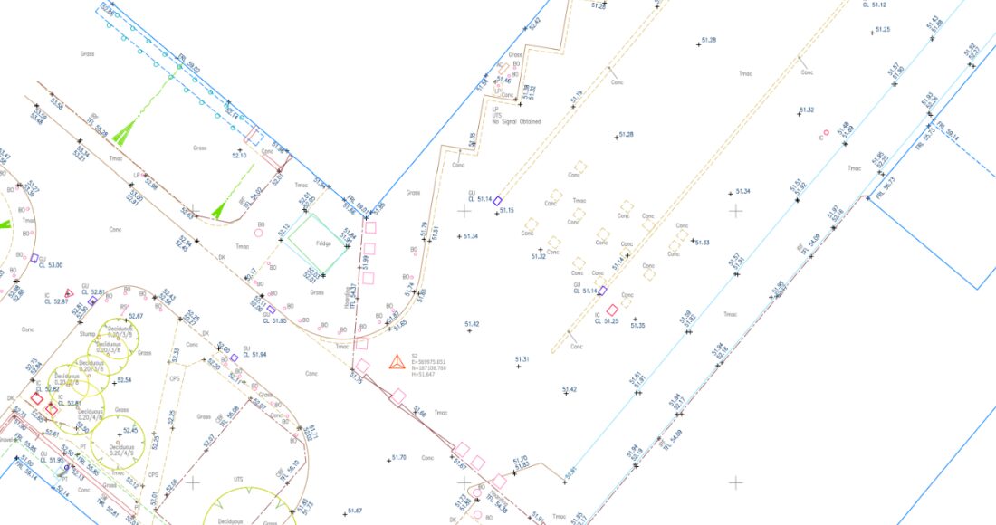
How much does a topographical survey cost?
A topographical survey from Spatial Dimensions starts at £595. Most topographical surveys fall between £750 and £2,500, depending mainly on the area covered and the detail required.
The price of a topographical survey depends on four things: the area to be covered, the detail required — the standard schedule plus any on-request items such as drainage invert levels or contours — the deliverable tier, from 2D CAD linework up to a full 3D Revit topography, and how accessible the site is.
Spatial Dimensions quotes a fixed price against a written specification, with the content schedule, formats and timescales stated before you commit, and offers a price match guarantee.
For a fixed price on your site, send us the address, the approximate area and what the survey is for. We will come back with a written quote within 24 hours. All prices exclude VAT.
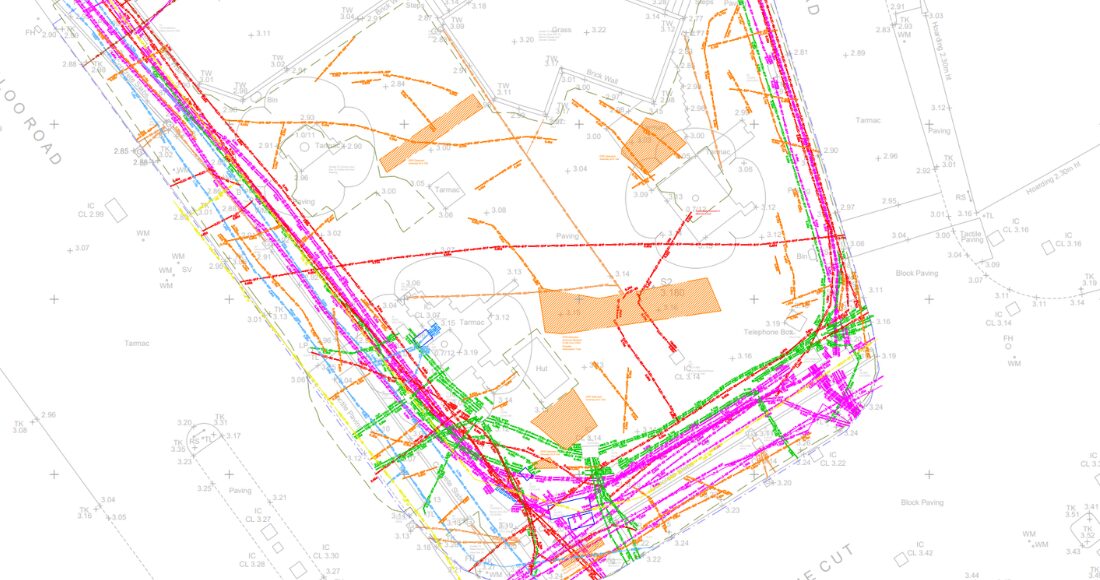
How much does an underground utility survey cost?
An underground utility survey from Spatial Dimensions starts at £850. Most underground utility surveys fall between £1,200 and £3,500, depending on the PAS 128 quality level and the size of the site. Desktop utility searches are a fixed £450 per order, and QL-A verification is priced per trial hole from £350.
The price depends on the PAS 128 quality level (desktop search, detection and verification are priced very differently), site size and congestion, whether a usable topographical base exists, traffic management, the chamber count for any CCTV work, and access — a return visit forced by obstructed ground is chargeable, and drain jetting is not standard.
Spatial Dimensions quotes a fixed price against a written specification stating the quality level, methods and deliverables, and offers a price match guarantee.
For a fixed price, send us the site address, the approximate area and which quality level you need. We will come back with a written quote within 24 hours. All prices exclude VAT.
The quality levels run from QL-D, a desktop search of utility records, to QL-A, where a service is exposed and verified. Detection itself uses electromagnetic location (EML) and ground penetrating radar (GPR). With both technologies together, Spatial Dimensions states depth accuracy of ±15%; with a single technology it is ±40%. That difference is worth knowing before you pick the cheaper quote.
How much does a 3D model or scan-to-BIM cost?
A 3D model from Spatial Dimensions starts at £500. Most 3D models fall between £800 and £10,000, depending on the size of the building and the level of detail.
The model is only half of scan-to-BIM. The other half is the laser scanning capture that feeds it, which starts at £850, with most laser scanning surveys between £850 and £5,000. Some companies show scan-to-BIM as a single price. Spatial Dimensions itemises the site survey and the modelling, so you can see what each part costs. If you already hold a usable point cloud, you only need the model; if you need a colour point cloud, expect more site time and larger files.
The price of a 3D model depends on five things: the size and complexity of the building, the level of detail, whether extra MEP elements are included beyond the standard schedule, the formats you need, and whether Spatial Dimensions scans the building or models from a point cloud you already hold. The LOD, the inclusions, the file formats and the Revit version are all stated before you commit, and the work carries a price match guarantee. Send us the address, the approximate floor area and what the model is for, and we will come back with a written quote within 24 hours. All prices exclude VAT.
How much does a drone survey cost?
Spatial Dimensions flies two different drone services, and they are priced differently. Drone photographic surveys start from £550. Most fall between £650 and £850. Drone mapping surveys start from £850. Most of those fall between £850 and £2,500.
A drone photographic survey records what a site or building looks like from the air. A drone mapping survey produces measured, mapped outputs. Ask which one a quote is for, because a quote for “a drone survey” that does not say could be either. We will come back with a written quote within 24 hours. All prices exclude VAT.
Why is the cheapest survey sometimes the most expensive?
Because a survey is the base every designer works from, and an error in it does not stay in the survey. It moves into the planning drawings, the drainage strategy, the structural openings and the services design, and it usually surfaces on site, when it is most expensive to fix.
Cheaper surveys often rely on GPS-only capture, omit verification, or generalise features, and none of that shows on the quote. Survey control matters just as much: it is the fixed network of points the whole survey hangs from, and poor control is one of the most expensive survey failures. Spatial Dimensions is regularly asked to step in where a survey was delivered on an arbitrary grid or the wrong datum, after design work had already moved on. Re-surveying at that point costs far more than surveying properly the first time.
“A high-quality survey doesn’t cost more — it prevents more.”
Claire Fenwick FCICES, Managing Director of Spatial Dimensions and President of The Survey Association (TSA)
When you compare quotes, put the same four questions to each surveyor: how is survey control established and referenced, what accuracy tolerance applies and to which deliverable, how is the data verified before issue, and will the outputs integrate with other surveys and models. The Survey Buyers Guide goes further.
What does a starting price not include?
A “from” price is the floor for the simplest version of a job, and it is worth knowing what can sit on top of it. On underground utility work, traffic management and site congestion both affect the price, a return visit forced by obstructed ground is chargeable, drain jetting is not standard, and the £350 per trial hole for QL-A verification does not include backfilling and reinstatement. On monitoring, the £850 per round does not include installing the targets or sensors. On any survey, out-of-hours working in an occupied building takes longer than surveying an empty one. The written specification sets out the scope before you commit, so you can see what the quote covers.
How do you get an accurate survey quote quickly?
Send three things: the address, the approximate floor area or site area, and what the survey is for. That last one matters most, because it decides the level of detail and the deliverable, and those decide the price. Spatial Dimensions will come back with a fixed-price written quote within 24 hours, against a written specification stating the scope, the deliverables and the formats.
Average mobilisation is 5.3 working days from instruction to site. Spatial Dimensions works nationally from offices in London, Sevenoaks and Nottingham, is certified to ISO 9001:2015, and carries £10,000,000 each of Professional Indemnity, Public Liability and Employers’ Liability insurance.
Frequently asked questions
How much does a measured building survey cost in the UK?
A measured building survey from Spatial Dimensions starts at £850, and most fall between £1,500 and £15,000, depending mainly on floor area and the level of detail. The number of storeys, access and the file formats you need also affect the price. All prices exclude VAT.
What is the cheapest survey Spatial Dimensions offers?
The lowest published starting price is £250, for example for a CAD drawing package or a Land Registry plan, which is priced per plot. A topographical survey starts at £595 and a measured building survey at £850. The cheapest survey is only the right one if it answers the question you need answered. All prices exclude VAT.
How much does a desktop utility search cost?
A desktop utility search from Spatial Dimensions is £450 per order, with an enhanced search an extra £175. Each order covers one square kilometre, and most desktop searches come to between £450 and £1,250. A desktop search is PAS 128 quality level D: it collects the utility records but does not detect anything on site. All prices exclude VAT.
Why do survey quotes for the same site vary so much?
Because they are rarely quotes for the same thing. One may include survey control, on-site verification and a stated accuracy tolerance, and another may leave all three out. Spatial Dimensions quotes a fixed price against a written specification, so you can see exactly what the number covers before you compare it.
What do I need to send to get a survey quote?
The site address, the approximate floor area or site area, and what the survey is for. With those three things Spatial Dimensions will come back with a fixed-price written quote within 24 hours.
Are survey prices quoted with or without VAT?
Without. Every price Spatial Dimensions publishes, and every figure in this guide, excludes VAT.
How soon can a surveyor be on site?
Average mobilisation at Spatial Dimensions is 5.3 working days from instruction to site. Spatial Dimensions confirms delivery dates upfront.
Next steps
If you already know which survey you need, each service page linked in the tables above has more detail on that survey. Architects can start with the guidance for architects, and contractors with the guidance for contractors. Otherwise send the address, the approximate area and what the survey is for, and Spatial Dimensions will come back with a written quote within 24 hours — get in touch or call 01732 458799. All prices exclude VAT.
Get the Survey Buyers Guide
The questions to ask before you commission a survey, with straight answers to each, so you can tell a good survey from a cheap one before you sign anything.
Download the free guideFree to download. No cost, no obligation.