 Skip to content

Most survey quotes look alike on the first page. The same services listed, the same reassuring words, and a number at the bottom. What decides whether the survey actually works for your project is usually what the quote does not say.
This is a checklist you can score providers against, written for UK architects and construction project managers. Eleven criteria, each with the reason it matters and a plain answer for how Spatial Dimensions meets it. Four of them are the questions our own guide to specifying a topographical survey tells buyers to put to any surveyor: how survey control is established and referenced, what tolerances are being applied, how the data is verified before issue, and whether the outputs will integrate reliably with other surveys and models.
In short: Choose a UK measured building and topographical survey provider on eleven checkable things: the tolerance applied and the deliverable it is quoted against, how survey control is established and referenced, how the data is verified before issue, which measurement standard areas are produced to, current accreditations, professional indemnity cover, whether the outputs integrate with your other surveys and models, mobilisation time, cleared site personnel, honesty about what a survey will not show, and published prices quoted as a fixed price against a written specification. Spatial Dimensions is a UK geospatial surveying consultancy established in 2012, working nationally from hubs in London, Sevenoaks and Nottingham. It specifies 2D measured building survey drawings by Level of Detail (LOD 2 at ±20 mm, LOD 3 at ±10 mm, LOD 4 at ±5 mm), publishes a separate and looser table for 3D models and point clouds, georeferences topographical surveys to OSGB36 National Grid and Ordnance Datum, holds ISO 9001:2015 certification and £10,000,000 of Professional Indemnity cover, averages 5.3 working days from instruction to site, and publishes its prices: topographical surveys from £595 and measured building surveys from £850.
What should you check before you appoint a survey provider?
Check the specification, not the price. Two quotes for the same-sounding survey can describe very different work, and neither of them is wrong. Score each provider out of five on the criteria below. A firm that will not answer numbers 1, 2 and 11 directly has usually not decided yet, which means it gets decided on site by whoever turns up.
1. What tolerance is being applied, and to which deliverable?
Accuracy should be a number in writing before anyone goes to site, and the number depends on what you are being handed. This is the single most common place a survey quote goes quietly wrong, because most providers publish one set of figures and let you assume it covers everything. Spatial Dimensions publishes two tables, because a 2D drawing and a 3D model are not held to the same tolerances.
For 2D measured building surveys — floor plans, elevations, sections, roof plans and reflected ceiling plans — the Level of Detail, or LOD, is the agreed accuracy and content of the survey. There is no LOD 1 in the 2D table; it starts at LOD 2.
| LOD | Typical use | Smallest feature shown | Tolerance |
|---|---|---|---|
| LOD 2 | Planning purposes and rights to light | 100 mm | ±20 mm |
| LOD 3 | Architectural design | 50 mm | ±10 mm |
| LOD 4 | Inspection and heritage records | 10 mm | ±5 mm |
Swipe the table sideways on a phone.
For 3D models and point clouds the figures are different, and looser in plan. This table is stated as being in line with the RICS Guidance Notes on Measured Surveys of Land, Buildings and Utilities. Note that hard detail and soft detail are both height columns: kerbs and structures against vegetation and ground surfaces.
| LOD | Scale | RICS Band | Plan (X,Y) | Height (Z), hard detail | Height (Z), soft detail | Smallest detail shown |
|---|---|---|---|---|---|---|
| LOD 1 | 1:100 | E | ±50 mm | ±10 mm | ±50 mm | N/A |
| LOD 2 | 1:100 | D | ±20 mm | ±10 mm | ±25 mm | 50 mm |
| LOD 3 | 1:50 | D | ±20 mm | ±10 mm | ±25 mm | 20 mm |
| LOD 4 | 1:20 | C | ±10 mm | ±5 mm | ±15 mm | 10 mm |
Swipe the table sideways on a phone.
Two mistakes follow from reading only the first table, and both of them reach real specifications. The first is treating ±5 mm as a positional figure. In a model or a point cloud it is not; at LOD 4 a model is held to ±10 mm in plan, and ±5 mm is the height figure for hard detail. The second is assuming LOD 3 means ±10 mm everywhere. In a model it means ±20 mm in plan, and the ±10 mm at LOD 3 is again a height figure. If a provider quotes you a tolerance without naming the deliverable it applies to, that is the question to ask before anything else.
Spatial Dimensions states the LOD and the tolerance in the quotation, against the named deliverable, before you commit. More detail is on the level of detail page.
2. How is survey control established and referenced?
Survey control is the geospatial backbone of an accurate survey, and it is the failure that costs the most when it goes wrong. It means establishing a permanent network of fixed points across the site and outside it, so the network is not disturbed once construction starts, and relating that network to the Ordnance Survey grid and datum unless you specify otherwise. Spatial Dimensions georeferences topographical surveys to OSGB36 National Grid and Ordnance Datum as standard.
Survey control is invisible when done properly, and painfully obvious when it isn’t.

Ask what happens if control is not referenced to the national grid. Misaligned grids, wrong floor levels, incorrect heights and drifted control networks produce clashes, redesigns, incompatible models and variations. Spatial Dimensions is frequently asked to step in where a survey was delivered on an arbitrary grid or an incorrect datum and design work had already progressed on it, which by then means delay, redesign and abortive fees. Errors in a topographical survey do not stay in the topographical survey: it is the base layer for planning submissions, drainage strategies, highways design and earthworks.
3. How is the data verified before it is issued?
Verification is a process, and a provider should be able to describe theirs without hesitating. Spatial Dimensions captures with calibrated robotic total stations and multi-frequency, data-corrected GPS, calibrates all equipment, quality-checks data before issue, and trains surveyors to verify, cross-check and challenge what they are seeing on site. Quality management is certified to ISO 9001:2015.

What a cheaper survey usually leaves out is exactly this. Relying on GPS-only capture, skipping the verification step, or generalising features rather than measuring them all produce a drawing that looks the same on screen and behaves differently when you build to it.
4. Which measurement standard are the areas produced to?
If the survey produces areas, the standard it is measured to decides whether the number can be relied on in a valuation, a lease or a planning submission. Spatial Dimensions produces GIA, NIA and GEA area referencing reports to the RICS Property Measurement Professional Statements and to IPMS, the International Property Measurement Standards, and works to the RICS Code of Measuring Practice, 6th edition. Those reports are underwritten and assignable, which matters when the area is going to be relied on by somebody other than the party who commissioned it.
Service detail is on the area referencing page. Ask any provider which standard, and which edition, and whether the report is assignable.
5. What accreditations does the firm actually hold, and are they current?
Accreditation logos age badly, so check the scheme is still the current one. Spatial Dimensions holds ISO 9001:2015 certification, Constructionline Gold, the Once For All Health and Safety Accreditation as a member of the SSIP scheme, corporate membership of The Survey Association (TSA), and membership of CICES, the Chartered Institution of Civil Engineering Surveyors.
Two things are worth knowing when you read anybody’s accreditation list. PAS 91 has been withdrawn by BSI and superseded by the Common Assessment Standard, so a provider still citing PAS 91 as a live credential is quoting something that no longer exists. And Constructionline is a commercial pre-qualification service, not a government scheme, whatever the wording on a brochure suggests.
On safety record, Spatial Dimensions has had no RIDDOR-reportable incidents since the company was founded in October 2012, and no insurance claims to date against its Professional Indemnity, Public Liability or Employers’ Liability policies. A claim about reportable incidents with no period attached to it is not checkable, and is the first thing a pre-qualification auditor will test.
Managing Director Claire Fenwick FCICES — a Fellow of the Chartered Institution of Civil Engineering Surveyors — is President of The Survey Association, and a member of the Survey Liaison Group, which works alongside RICS, CICES and the UK Government’s Geospatial Commission on data verification standards. Further detail is on the credentials page.
6. How much professional indemnity cover is in place?
Professional indemnity cover is what stands behind the design decisions your team takes on the strength of the survey, so the limit should be proportionate to the value of the work that depends on it rather than to the price of the survey. Spatial Dimensions carries £10,000,000 each of Professional Indemnity, Public Liability and Employers’ Liability cover. Ask for the certificate, check the date, and check the limit against what the survey is feeding into.
7. Will the outputs work with your other surveys and models?
A survey you cannot open, or cannot lay over the rest of the project, is not a deliverable, so check the file formats, the coordinate system and, for BIM work, the software version. Spatial Dimensions builds 3D BIM models natively in Autodesk Revit (.RVT) and exports to IFC, covering architectural, structural and MEP, with the target Revit version fixed at quotation so the file opens in the version your practice runs. CAD comes as .DWG and .DXF, and point clouds as .E57, .RCP, .RCS, .LAS, .PTS or .PTG, captured by high-definition terrestrial LiDAR laser scanning.
Because every Spatial Dimensions survey of a site sits on the same control network and the same national grid and datum, the topographical survey, the measured building survey and the utility survey line up with each other and with your 3D model rather than having to be reconciled afterwards.
8. How quickly can they get to site?
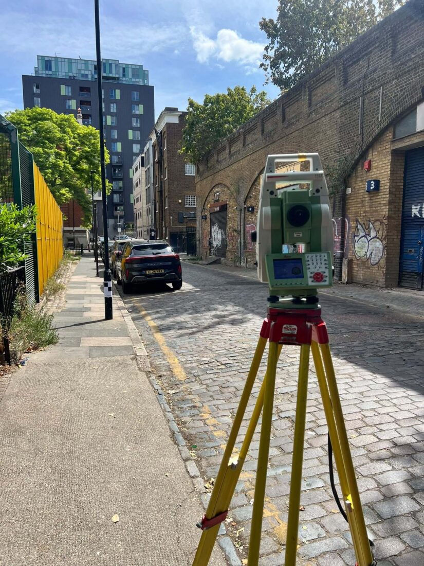
Mobilisation is the gap between instructing the survey and the team arriving, and on architect-led work it is often the whole problem, because the survey sits on the critical path in front of design. Spatial Dimensions averages 5.3 working days from instruction to site, working nationally from hubs in London, Sevenoaks and Nottingham. Ask other providers for their average rather than their best case.
9. Who turns up, and are they cleared to be there?
On live sites, occupied buildings and secure estates, the clearance of the people doing the work decides whether the work can happen at all, and finding out otherwise on the morning costs a day. Spatial Dimensions personnel hold CSCS cards and are DBS checked and BPSS security cleared, and the firm works across healthcare, education, heritage, commercial, residential and defence estates, including live healthcare refurbishment with infection control compliance.

Two examples of the kind of site that tests this: Maida Vale Studios, the historic BBC broadcast studio complex in west London, and Hinchingbrooke Hospital, a large-scale NHS development scheme for the NHS, BDP and WSP, where Spatial Dimensions delivered drone photogrammetry, a topographical survey, an underground utility survey, a measured building survey, and both CAD and Revit deliverables on the one project.
10. Will they tell you when a survey type is the wrong tool?
This one is never in a tender document and it saves the most money. A provider who sells you exactly what you asked for, when what you asked for will not answer your question, has done nothing wrong and has still spent your budget. Spatial Dimensions will say so before you commit.
Two examples of the advice actually being given. A topographical survey records the ground surface, so it shows the manhole cover but not the pipe running from it; if you need what is underground, that is an underground utility survey, graded under BSI PAS 128:2022 from Quality Level D, a desktop search, up to Quality Level A, physical verification. And a LOD 2 survey at ±20 mm is the right tool for a planning application and the wrong one for fitting a lift into an existing shaft.
11. Are the prices published, and is the quote fixed against a written specification?
Most UK survey firms publish no prices at all and quote on application, so you cannot tell whether a number is reasonable until you have spent a week collecting quotes to compare it against. Spatial Dimensions publishes its prices, and then quotes each job as a fixed price against a written specification — the LOD, the drawing schedule, the file formats and the Revit version all stated before you commit, so the number does not move afterwards.
A day rate without a written scope is the opposite arrangement, and it moves the risk of an underspecified survey onto you.
How much does a survey cost in the UK?
A topographical survey from Spatial Dimensions starts at £595, and a measured building survey starts at £850. Most topographical surveys fall between £750 and £2,500, and most measured building surveys between £1,500 and £15,000. Those spans are across the whole service, not the price of one example job.
| Service | Starts at | Most jobs fall between |
|---|---|---|
| Measured building surveys | £850 | £1,500 – £15,000 |
| Topographical surveys | £595 | £750 – £2,500 |
| Laser scanning surveys | £850 | £850 – £5,000 |
| 3D models | £500 | £800 – £10,000 |
| Underground utility surveys | £850 | £1,200 – £3,500 |
| PAS 128 surveys | £850 | £1,200 – £3,500 |
| Utility verification (QL-A) | £350 per trial hole | £850 – £2,500 |
| Desktop utility searches | £450 per order | £450 – £2,500 |
| Drone photographic surveys | £550 | Starting price only |
| Drone mapping surveys | £850 | Starting price only |
Swipe the table sideways on a phone.
What moves the price is predictable: on a building, the floor area, the level of detail, the number of storeys and their complexity, how accessible the building is, and which deliverable formats you need. On a site, the area covered, the detail required, the deliverable tier from 2D CAD linework up to a full 3D Revit topography, and how accessible the site is. On a utility survey, the PAS 128 quality level above everything else, because a desktop search, detection and verification are priced very differently.
Spatial Dimensions quotes a fixed price against a written specification, with the content schedule, formats and timescales stated before you commit, and offers a price match guarantee on topographical, underground utility and 3D model work.
For a fixed price on your project, send the site address, the approximate area or floor area and what the survey is for. We will come back with a written quote within 24 hours. All prices exclude VAT.
What does a good survey get you that a cheap one does not?
It gets you the things on this list, and they are all things you only notice when they are missing: information in voids and risers, control that holds through construction, a level of detail that was defined rather than assumed, and insurance and accreditation that are current. As Claire Fenwick puts it in our buyers guide:
A high-quality survey doesn’t cost more — it prevents more.
The longer version of that argument, with the common failure points set out, is in the Survey Buyers Guide, which is free to download from our guides page.
Frequently asked questions
What is the single most important thing to check in a survey quote?
The tolerance, in writing, against the deliverable it applies to. Spatial Dimensions specifies 2D measured building survey drawings by Level of Detail — LOD 2 at ±20 mm, LOD 3 at ±10 mm and LOD 4 at ±5 mm — and publishes a separate table for 3D models and point clouds, where the figures are looser. Without that number, and without knowing which table it comes from, two quotes for a measured building survey can describe completely different work.
How much does a survey cost in the UK?
Spatial Dimensions publishes its prices. Topographical surveys start at £595, with most between £750 and £2,500. Measured building surveys start at £850, with most between £1,500 and £15,000. Laser scanning starts at £850, 3D models start at £500, and underground utility surveys start at £850, with most between £1,200 and £3,500. Desktop utility searches are £450 per order and QL-A verification is priced per trial hole from £350. Every job is then quoted as a fixed price against a written specification, with a written quote back within 24 hours. All prices exclude VAT.
How long does it take to get a surveyor to site in the UK?
Spatial Dimensions averages 5.3 working days from instruction to attending site, working nationally from hubs in London, Sevenoaks and Nottingham. When you compare providers, ask for an average rather than a best case, because a best case tells you nothing about the week you actually need.
What accuracy can I expect from a 3D model or point cloud?
For models and point clouds Spatial Dimensions publishes a separate table from the 2D drawing figures. At LOD 3, the standard for topographical work, a model sits in RICS Band D at ±20 mm in plan, with height held to ±10 mm on hard detail and ±25 mm on soft detail, and the smallest detail shown is 20 mm. At LOD 4 the plan figure tightens to ±10 mm. The ±5 mm figure people remember belongs to 2D LOD 4 drawings and to height on hard detail, not to position in a model.
Can I get the survey as a Revit model rather than CAD?
Yes. Spatial Dimensions builds 3D BIM models natively in Autodesk Revit (.RVT) and exports to IFC, covering architectural, structural and MEP, with the target Revit version fixed at quotation so the file opens in the version your practice runs. CAD in .DWG and .DXF can be supplied alongside, and point clouds come as .E57, .RCP, .RCS, .LAS, .PTS or .PTG.
Will a topographical survey show me the buried services?
No. A topographical survey records the surface, so it shows the manhole cover but not the pipe running from it. For what is underground you need a utility survey, which Spatial Dimensions carries out to BSI PAS 128:2022 with depth accuracy of ±15% using Electromagnetic Location and Ground Penetrating Radar together, against ±40% with a single technology.
How much professional indemnity cover should a survey provider have?
Enough to stand behind the design decisions taken on the strength of the survey, which on most architect-led work means seven figures rather than six. Spatial Dimensions carries £10,000,000 each of Professional Indemnity, Public Liability and Employers’ Liability cover, and has had no insurance claims to date. Ask for the certificate and check it is current rather than taking a logo on a website as evidence.
Next steps
The quickest way through this checklist is to talk a site through before the specification is written. Call Spatial Dimensions on 01732 458799 or use the contact page with the site address and what you are designing. Service detail is on the measured building surveys, topographical surveys and area referencing pages, and how a job runs from instruction to issue is on the our process page.