Skip to content

Spatial Dimensions is a UK measured building survey and geospatial company providing CAA-certified drone surveys from permanent offices in London, Sevenoaks and Nottingham, operating on site anywhere in the UK — including the congested and restricted airspace of central London.
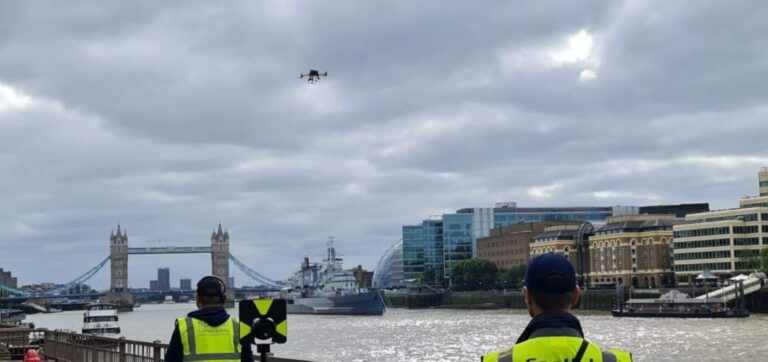
Our drone pilots hold the CAA General Visual Line of Sight Certificate (GVC), fly under a valid Operator ID, and carry public liability aviation insurance on every flight. Every mission is planned with a site-specific Flight Risk Assessment and Method Statement issued before we arrive.
In short: a drone survey from Spatial Dimensions gives you accurate aerial data of roofs, facades, large sites and hard-to-reach structures — delivered as orthomosaics, point clouds, 3D mesh models, 2D CAD roof plans and elevations, or a full 3D BIM model — without scaffolding, cherry pickers or anyone working at height. Surveys start at £550.
or call 01732 458799
What is a drone survey?
A drone survey uses an unmanned aerial vehicle (UAV) fitted with a survey-grade camera or LiDAR sensor to capture measurable data from the air. Spatial Dimensions primarily uses drones to reach the places a ground-based surveyor cannot safely or economically get to: complex roofscapes, high-level facades, live highways, active construction sites and large open land.
Drone flights can be flown under direct remote control or autonomously along pre-programmed flight paths. Either way, under UK law the Spatial Dimensions pilot maintains visual line of sight with the aircraft throughout the flight.
Most clients come to us for one of four reasons: a roof plan or roof inspection where access is unsafe or costly, a topographical survey of a large or difficult site, high-level elevation data to complete a measured building survey, or a thermal inspection of a building or solar array.


What can a drone survey be used for?
Spatial Dimensions carries out drone surveys for:
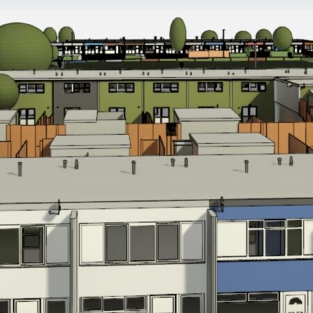
- Roof surveys and roof inspections — CAD roof plans and high-resolution condition imagery without scaffolding
- Building externals — facade and elevation capture for measured building surveys
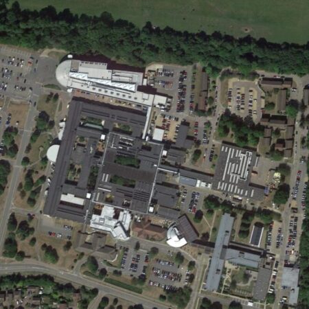
- Large-scale topographical surveys — quarries, farms, infrastructure corridors and development land
- Thermal inspections — heat-loss surveys of buildings and fault detection on solar panel arrays
- Construction progress monitoring — repeat flights producing a dated visual and dimensional record
- Earthworks and stockpile calculations — volumetric measurement from photogrammetry
All drone flights are weather dependent — we do not fly in rain or strong wind — and restricted areas require permission in advance, which in rare cases can take up to a month to secure.

How accurate is a drone survey?
Drone surveys are not automatically more accurate than ground-based methods, and Spatial Dimensions will tell you plainly when a drone is the wrong tool. Accuracy depends on the positioning method used.
Swipe the table sideways to see all the columns.
| GNSS (standard GPS) | RTK (Real-Time Kinematic) | PPK (Post-Processed Kinematic) | |
|---|---|---|---|
| How it works | Standard satellite positioning | Corrections applied in real time during flight | Corrections applied after the flight |
| Typical accuracy | ~1–3 metres | ~1–3 cm horizontal, ~2–5 cm vertical | ~1–3 cm horizontal, ~2–5 cm vertical |
| Best for | General mapping where precision is not critical | Projects needing immediate, high-accuracy results | Sites with poor signal coverage — no live connection needed |
Spatial Dimensions also places Ground Control Points (GCPs) — physical reference markers coordinated by GNSS or total station — to tie the drone data into the same coordinate system as our terrestrial laser scanning and topographical surveys, so every dataset on a project fits together.
Accuracy is also affected by flight altitude, camera calibration, Ground Sampling Distance (GSD), weather and the character of the site itself. If your project needs precision engineering tolerances, we will specify a ground survey or a hybrid approach instead — see below.
When is a drone survey the wrong choice?
A drone on its own is not acceptable when:
- Precision engineering accuracy is required
- Dense vegetation hides the ground surface
- Detailed internal building measurements are needed
- Underground utilities or hidden features must be located
- The site has restricted flying conditions
- Legal boundary definition is required
In most of these cases Spatial Dimensions recommends a hybrid drone-and-topographical survey: the drone captures the overall site quickly, GNSS or total station observations control the accuracy, ground survey picks up critical features, kerbs, utilities and hidden areas, and everything is combined into one accurate topographical model. Drone surveys cannot see through buildings, vegetation or the ground — whatever the format, they only record what the sensor can see.
What deliverables will I receive?
Swipe the table sideways to see all the columns.
| Deliverable | Format | What it is |
|---|---|---|
| Orthomosaic | .JPG / .TIF | Geometrically corrected, high-resolution aerial map stitched from hundreds of overlapping photos — measurable |
| Point cloud | .E57, .RCP and others | 3D data points on a known coordinate system, from LiDAR or photogrammetry |
| 3D mesh model | .OBJ and others | Photo-realistic digital replica of the structure or site |
| DSM / DTM | GeoTIFF | Colour-coded surface and terrain models — with or without vegetation and buildings |
| 2D CAD | .DWG | Roof plans and facade elevations with mm-referenced linework |
| 3D BIM | .RVT / .IFC | Models defined at LOD 1, 2 or 3, with drone data filling hard-to-reach areas |
| Photos and video | .JPG / .MP4 | Condition and inspection imagery |
Once full payment clears you receive a permanent licence to use the data, and every project is securely archived so later site visits can be integrated with the original dataset.

How long does a drone survey take?
Field capture is fast — a drone can cover tens of hectares or a complex roofscape in minutes to hours. The parts of the programme that need planning are:
- Pre-flight planning — every Spatial Dimensions flight gets a risk assessment, permissions check and a weather-suitable survey date before fieldwork begins.
- Permissions lead-in — Flight Restriction Zone (FRZ) applications need a minimum of 14 days’ notice; applications in the restricted areas of central London may take longer.
- Processing — depends on survey size, typically between 1:1 and 1:5 (one day on site producing one to five days of processing).
If your programme is tight, tell us the deadline at enquiry stage and we will build the permissions lead-in around it.
Is it legal? Who regulates drone surveys in the UK?
All commercial drone surveying in the UK is regulated by the Civil Aviation Authority (CAA). As of 2026 the rules require:
- Pilots to keep the drone within visual line of sight and below 120m
- A valid Flyer ID for the pilot and Operator ID for the company — and from 1 January 2026, any drone over 100g must be registered with the CAA (previously 250g)
- Airspace permission for Flight Restriction Zones near airports, military sites and event restrictions
- Landowner consent for take-off, landing and data capture over land
Spatial Dimensions obtains every required permit and permission before flying, and where flights are sensitive we plan ahead with local authorities, councils and police. Our pilots complete all site inductions, and our drone-specific RAMS integrates with your existing site rules and CDM framework, supporting the Principal Contractor and Principal Designer.
One caution when comparing quotes: a drone licence alone can be gained quickly, even by a beginner. Reliable survey data depends on surveying skill and experience, not just a licence — Spatial Dimensions combines CAA certification with in-house chartered surveying expertise, which is the difference between aerial photography and survey-grade data.
How much does a drone survey cost?
A drone survey from Spatial Dimensions starts at £550. Most drone surveys fall between £850 and £2,500, depending on the size of the site and the deliverables required.
Prices in the market vary widely, and a low quote can indicate unqualified operators, outdated equipment or overpromised accuracy. A Spatial Dimensions quote always states the positioning method, the accuracy you will get, and the deliverables — with no hidden costs.
For a fixed price, send us the site address and what the survey is for. We will come back with a written quote within 24 hours. All prices exclude VAT.
or call 01732 458799
Frequently asked questions
Yes. Much of central London sits inside Flight Restriction Zones, so flights need prior authorisation — Spatial Dimensions regularly obtains these permissions and operates in some of the most congested airspace in the UK. Allow at least 14 days for FRZ applications, longer for restricted areas.
No. Drones cannot fly safely in rain or strong wind, so all flights are weather dependent. Spatial Dimensions monitors forecasts for every project and builds a weather contingency into the programme.
LiDAR measures distance directly with laser pulses, producing precise point clouds even over vegetation. Cameras capture images and derive 3D data through photogrammetry, but cannot directly measure depth. Spatial Dimensions specifies whichever suits the site and the deliverable — often both.
Sometimes. For large open sites, stockpile volumes and progress monitoring, drone-only is fine. Where you need engineering precision, boundary definition or features under vegetation, Spatial Dimensions combines drone and ground survey into one coordinated model.
Spatial Dimensions retains the intellectual property; on full payment you receive a permanent, non-transferable licence to copy and use all drawings and data in print and digital form.
Request a drone survey quote
Send us the site address, what the survey is for and any programme dates; Spatial Dimensions will reply with a written, fixed-price quote within 24 hours — and flag any permissions lead-in straight away.
Email: website@spatial-dimensions.co.uk
Phone: 01732 458799
Offices: London · Sevenoaks · Nottingham · working nationwide
Related services
- Laser scanning surveys — ground-based capture at millimetre precision
- Measured building surveys — drone data completes the high-level elevations
- Topographical surveys — the hybrid partner on large or difficult sites
- Monitoring surveys — repeat capture tracking movement over time
- Point cloud surveys — the measured dataset itself
- 3D models — Revit models built from drone and scan data
- CAD drawings — roof plans and elevations drafted from the capture
- Spatial Twin — a browser-based model of the whole asset