THE BRIEF
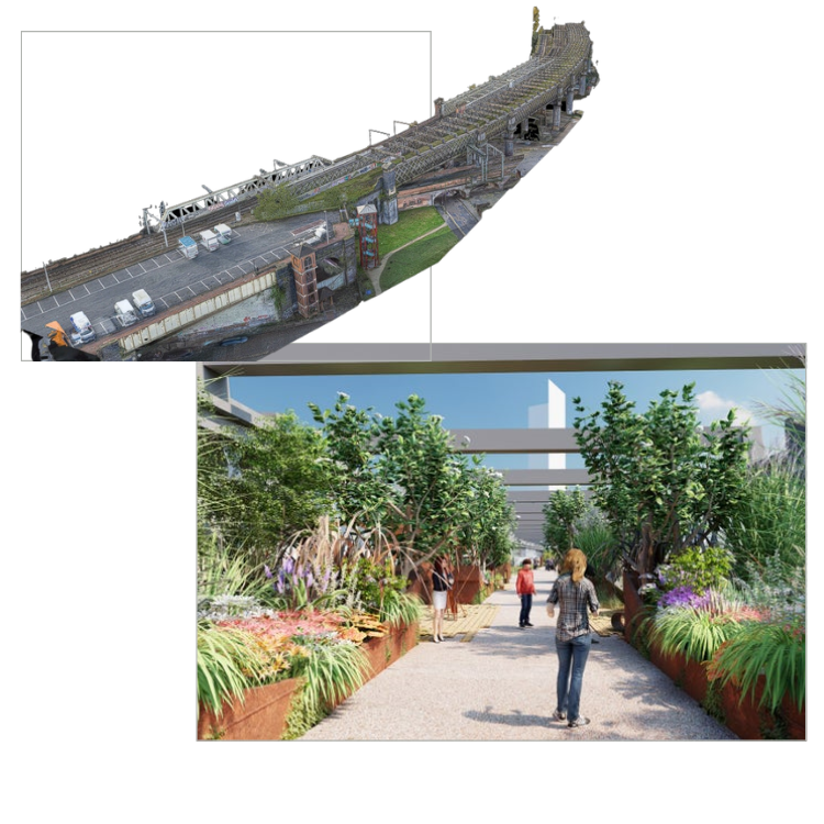
The National Trusts vision is to transform Castlefield viaduct into a free-to-access park and meeting place for people and nature. Imagine a hidden oasis sitting above this busy city. It will be a space that respects the listed structure, celebrates the nature, beauty and history of the viaduct, and fits in with existing plans for the city.
Accurate information was needed urgently to inform the designs, and progress a planning application for phase 1 – a temporary park opening on the site in the spring of 2022, with further phases planned. Any delays in receiving this vital survey information would affect the deadline for planning and the planned opening of the park in the summer of 2022.
Accuracy was paramount, not only to inform the architectural design, but also for the structural engineer’s perspective. Any structure erected on the viaduct would need to sit on top of the existing steel structure, so detailed drawings were needed of the structure both on top of the viaduct and of the soffits beneath.
Secondly, the site was heavily constrained by a working rail line to the south and the Manchester Tram line running underneath. At ground level the Bridgewater canal split the site in half beneath the viaduct. All of these factors made this a highly complex surveying project.
OUR WORK
The Spatial Dimensions team completed a fully controlled measured building and topographical survey, with CAD drawings in plan, elevation and sections of the structure.
Coloured point clouds and mesh models were also delivered to aid the design teams understanding of the site.
Due to the constraints, a drone was mobilised to gather data from above and to the south (over Network Rail land).
THE OUTCOME
Planning was successfully granted in November 2021 with listed building consent for works associated with temporary change of use to an urban park.

