 Skip to content

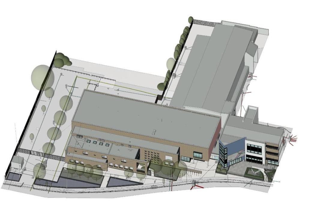
University estates are being asked to do more with the buildings they already have. Before anyone can decide how a campus should work harder, a university estate survey has to show how much space there really is and how it is laid out.
In short: A university estate survey measures a campus as it stands, so estates teams and architects can plan with real floor areas instead of inherited ones. Spatial Dimensions produces area referencing reports to RICS and IPMS standards, alongside measured building surveys and Revit models from the same site visit. Area referencing reports start from £250 and measured building surveys from £850, both excluding VAT, and we have surveyed for the University of Cambridge, Brunel University, the University of Westminster and the University of Kent.
Why do universities need an estate survey now?
Because budgets are tight and universities are not using their buildings as well as they could. Writing in Building on 30 September, Lisa Pike, higher education practice leader at Perkins&Will (the practice we worked with on Brunel University’s Bannerman Centre), argued that many campuses still reflect an older model of higher education, with siloed buildings and low use of the space they have.
Her case is that universities can’t solve today’s money, teaching and research pressures with yesterday’s estate strategies. For example, maintenance costs are rising, budgets are constrained, and students and staff expect a wider mix of spaces, from quiet study to busy shared areas. She suggests universities learn from how workplace design has changed: plan around how people actually use buildings, and make better use of the space already there.
That last point is where the work begins. A university cannot make better use of its space until it knows how much space it has.
Why do estates teams need measured floor areas first?

Because the floor areas most universities work from are estimated, scaled off old drawings, or inherited from a previous project. Spatial Dimensions regularly finds that the drawings held for an older campus building no longer match the building.
That matters more than it might seem. Estates teams work out space planning, utilisation studies, maintenance budgets, cleaning contracts and refurbishment costs per square metre. As a result, a small error in the area repeats through every figure built on it. On top of that, a utilisation study compares how a room is used with how big it is. If the size is wrong, the conclusion is wrong too.
So the first question for any estate review is a simple one: how big is each building, floor by floor, measured on a stated basis?
What does an area referencing report measure?
An area referencing report is an independent calculation of the areas in a building, measured on site and reported against a defined standard. Spatial Dimensions measures each building with laser scanners, calculates the areas in-house and states the standard on the face of the report.
The same building gives a different figure on each basis, which is why the basis always has to be named:
- GIA (gross internal area): the whole area measured to the inside face of the external walls, floor by floor. Cost consultants often use it for building cost work.
- GEA (gross external area): the whole area measured to the outside face of the external walls. Planning applications often use it.
- NIA (net internal area): the usable area inside the building, excluding areas such as stairwells, lifts and plant rooms. The closest measure to the space people actually use.
The traditional UK bases come from the RICS Code of Measuring Practice, 6th edition. IPMS, the International Property Measurement Standards, is a newer framework for measuring floor areas consistently, and since 2018 RICS has expected its members to use it for offices and homes, with the Code still used for other building types. Spatial Dimensions works to whichever an instruction requires, and can report more than one basis from a single visit. There is more detail on our area referencing reports page.
Where else does a university estate survey help?
Once the estate is measured, the same data supports most of what comes next. Spatial Dimensions has surveyed education estates since 2012, and on a campus the survey usually does more than one job.
- Refurbishment and remodelling. A measured building survey gives the floor plans, elevations, sections and reflected ceiling plans the architect designs from.
- A model for the long term. A 3D Revit model built from the scan supports BIM-led schemes and gives the estates team a record it can keep using.
- Listed and complex buildings. A laser scanning survey captures plant rooms, sports halls and historic buildings without repeat visits.
- The ground between buildings. A topographical survey records levels, boundaries and landscaping for new blocks and access changes.
- A condition record. A 360° photographic record captures how a building looks at a point in time.
We have worked with BDP at the University of Cambridge’s Old Cavendish Buildings, with Perkins&Will at Brunel University’s Bannerman Centre, and with Box Architects at the University of Westminster. At the University of Kent, we surveyed for a phased boiler and plant room replacement across a 300-acre campus. See our education sector page for more.
How long does it take, and what does it cost?
Campuses are working buildings, so the survey has to fit around them. Spatial Dimensions works out of hours and in holidays as standard, and our average time from instruction to site is 5.3 working days. Spatial Dimensions personnel hold CSCS cards and are DBS checked and BPSS security cleared.
The ranges are the span across each whole service, not one job. All prices exclude VAT. We will come back with a written quote within 24 hours.
What can’t an area report tell you?
An area referencing report tells you how big a space is. It doesn’t tell you how well that space is used. That distinction matters for any utilisation review.
A utilisation study needs two sets of facts: the size and layout of each room, and how often and how many people use it. Spatial Dimensions provides the first. The second, however, comes from timetabling data, booking systems or occupancy counts held by the estates team. Put the two together and the findings stand up. On the other hand, use estimated areas with good occupancy data, and the conclusions are only as good as the weakest figure.
An area report also measures the building at one point in time. If walls move during a refurbishment, the areas move with them. That’s why it is worth updating the measured record after major works, so the next review starts from the building as it now is, rather than as it was.
There is a practical point on the basis, too. You can’t compare one university’s NIA figures directly with another’s GIA figures. If you are benchmarking across buildings or campuses, agree one basis and stick to it.
What does this mean for architects and estates teams?
It means measuring before deciding. If a university is reviewing how its space is used, the measured floor areas should come first, before the study, the brief or the design.
In practice, three things help. First, agree the measurement basis at the start. NIA suits most utilisation work, but a cost plan may need GIA. Second, survey the whole building once and take more than one deliverable from it: areas, drawings and a model can all come from the same visit. Third, plan the visit around the academic year, so the survey happens when rooms are free.

“Every estate review starts with the same question: how much space have we actually got? Most universities are working from figures nobody has checked in years. Measure it properly once, and every decision after that is built on something solid.”
Claire Fenwick
Managing Director, Spatial Dimensions, and President of the Geospatial Survey Association
University estate survey FAQs
What is a university estate survey?
It is a measured record of a campus’s buildings and grounds as they stand. Spatial Dimensions delivers it as floor areas, drawings, a point cloud or a Revit model, depending on what the estate needs.
What is an area referencing report?
It is an independent calculation of a building’s floor areas, measured on site and reported against a stated standard such as GIA or NIA. Spatial Dimensions measures to RICS and IPMS standards, with reports from £250, excluding VAT.
Which floor area measure should a university use?
NIA, the net internal area, is the closest to the space people actually use, so it suits most utilisation work. GIA, the gross internal area, is often used for building cost work. Spatial Dimensions can report both from one visit.
Can you survey a campus during term?
Yes, but we usually plan around the academic year. Spatial Dimensions works out of hours and in holidays as standard, so teaching carries on.
Can one visit give us areas, drawings and a model?
Yes. The laser scan captured on one visit can produce an area referencing report, measured building survey drawings and a Revit model.
Which universities has Spatial Dimensions surveyed for?
Our education work includes the University of Cambridge, Brunel University, the University of Westminster and the University of Kent, as well as many schools and colleges.
Spatial Dimensions has surveyed education estates since 2012, with permanent in-house teams of surveyors, CAD and Revit technicians and project managers. We never subcontract our core work. We work from offices in Sevenoaks, London and Nottingham and survey campuses across the UK. Our Managing Director, Claire Fenwick FCInstCES, is President of the Geospatial Survey Association. Call us on 01732 458799 or get in touch.
Read our Measured surveys for the education sector brochure, free on our education page.