Skip to content
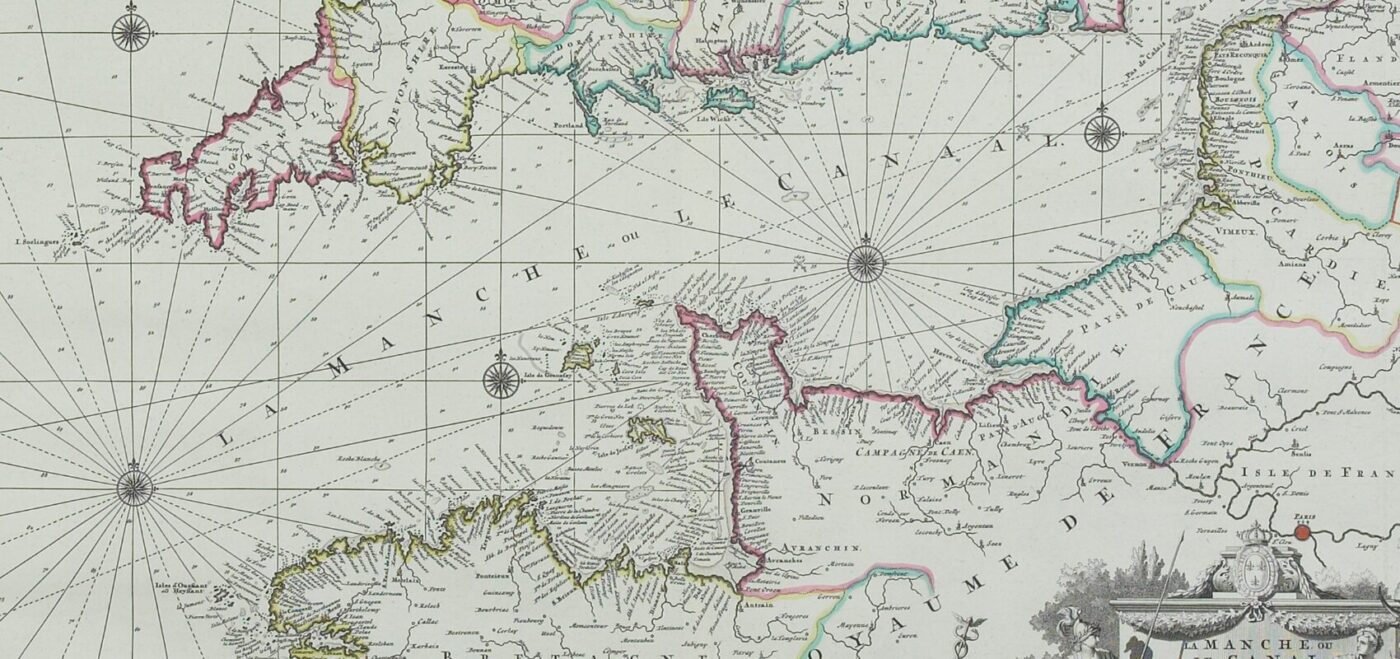
THE START OF A GROUNDBREAKING SURVEY
In the rich tapestry of the surveying industry’s history, few threads are as significant as the Anglo-French Survey. It marked a moment when the profession of surveying leapt forward. The Anglo-French Survey set a precedent that has influenced professionals throughout our field to this very day. The survey was the very first precise survey in Britain and was the predecessor to the Ordnance Survey. The OS originated the year after the Anglo-French Survey finished in 1790.
In the early 18th century, accurately measuring the Earth was a scientific challenge and a pressing practical necessity. At the heart of this endeavour was the Anglo-French Survey, a collaborative effort between Great Britain and France. This project wasn’t just about mapping; it was aimed at determining the precise shape of the Earth – a question that had puzzled scholars for centuries.
In 1784, under the stewardship of figures such as General William Roy in Britain and Jean-Dominique Cassini in France, teams embarked on an ambitious task. Using the relatively new and ingenious method of triangulation, they set out to measure the distance between the Royal Greenwich Observatory in London and the Paris Observatory. Communication was slow and equipment rudimentary by today’s standards, making their success is all the more remarkable.

NEW HORIZONS FOR SURVEYING
The Anglo-French Survey was groundbreaking for several reasons. First and foremost, it provided invaluable insights into the true shape of the Earth. This contributed to the ongoing debate between the supporters of Isaac Newton, who argued the Earth was an oblate spheroid (flattened at the poles), and those who followed René Descartes, who believed it was prolate (elongated at the poles). The findings of the survey strongly supported Newton’s theory, a cornerstone upon which modern geodesy is built.
But beyond its scientific achievements, the survey was a pioneering moment in international scientific cooperation. The Anglo-French Survey stood as a powerful example of what could be accomplished when countries worked together towards a common goal. This spirit of cooperation is something we hold dear in our profession today. As surveyors, we know that the challenges we face often transcend borders and disciplines.
For the surveying industry, the Anglo-French Survey is a beacon of professionalism, precision, and perseverance. It showcased the importance of meticulous planning, accuracy, and the need for constant innovation. The techniques and principles applied during this monumental project laid the groundwork for modern surveying practices. It demonstrated early on the potential of applying scientific principles to the practical challenges of measuring and mapping our world, an ethos that continues to drive our profession forward.
THE SURVEY WORK
ESTABLISHING THE BASELINE
The initial setup of the baseline was performed on Hounslow Heath in 1784, a location chosen due to its suitable flat and open terrain. The engineers employed a rigorous process using the most advanced equipment of the time. The instrumentation primarily consisted of wooden rods. They were carefully calibrated and aligned under specific temperature conditions to mitigate any variations caused by thermal expansion. At the time these tools were highly advanced, with the laser scanning techniques used today outside the realm of thought.
In the spirit of meticulousness that defines our industry, the team convened once more in 1787 on the Romney Marsh. There, they pursued the confirmation and refinement of their earlier measurements. It was this unremitting dedication to accuracy that allowed the teams, shepherded by Roy and Cassini, to lay down the pivotal groundwork for the methodical triangulation to be conducted across the English Channel. These actions not only spanned across nations but into the future and informed surveying practices for generations to come.

THE INSTRUMENTS
Prior to the Anglo-French Survey, 18th-century surveyors often used ‘Gunter’s chains.’ This was a measuring chain made up of 100 links and 22 yards (or 20.1 metres). This was of course unsuitable for a survey spanning two countries and the English channel.
For this reason, General Roy approached Jesse Ramsden to commission the theodolite, named ‘The Royal Society Theodolite.’ The final report of the Anglo-French Survey tells us the instrument was 37 inches across, normally mounted on a stand which placed the telescope between 5 and 6 feet high, and weighed roughly 200 pounds. A large-scale portable scaffold frame was also used throughout surveying.
The horizontal circular scale was divided very accurately with divisions at 15-minute intervals using a dividing engine (a device to mark graduations). The marks on the 36-inch diameter scale would be about 1/6th of an inch apart. Positioning could be read to the nearest quarter of a degree by the human eye, with exact positioning between divisions read with the aid of microscopes fitted with cross-wired in the focal plane.
Standard measured distances during the survey were around 20 miles or less, with lines crossing the channel
reaching up to 45 miles in length. Measurements at this size weren’t possible without a tool like this. After many delays, the instrument was finally delivered in the summer of 1787.
In our current era, where technology offers tools our predecessors could scarcely have imagined, the legacy of the Anglo-French Survey reminds us of the enduring value of collaboration, curiosity, and commitment to excellence. Now, as then, our work not only demands technical skill but also an understanding of its broader implications for society.

THE TRIANGULATION METHOD
The triangulation method is the technique that all modern land surveying is built upon. Triangulation in surveying is a method where surveyors create a network of triangles across an area to accurately measure and map it with the use of a control point. By knowing the distance between two points, such as the baseline at Hounslow Heath, and the angles to a third point, they can determine precise locations.
This method wasn’t a new idea and had been introduced in medieval times. However, it hadn’t been done on a scale as large as the Anglo-French Survey before.
In modern terms, the method itself seems simple however the logistical challenges to survey on this scale in 1787, along with access to just one instrument, required astute planning. Large portable scaffolding was created to house the theodolite and was paramount in irregular ground. In a time before trucks, manoeuvering this from A-B was difficult! Other constraints included using white lights to signal long distances, including across the channel. Planning and timing here had to be exact and conducted at night in most cases.
The surveyors faced numerous challenges, from technical difficulties with their equipment to the physical hardships of working in the field. Their ability to overcome these obstacles speaks to qualities that are as essential for surveyors today as they were back then.

THE REPORT
William Roy continuously worked on proofs of the data until his death in 1790 before being concluded by Isaac Dalby. The anticipated report was published in the same year as Roy’s death.
The report focused on key aspects including the exact distances between Greenwich and Paris, as well as the latitude, longitude and height of the British triangulation stations. Alongside this, the survey laid the groundwork for future topographical surveys across England. The ability to survey such a vast piece of land quickly led to surveying projects like the Principal Triangulation of Great Britain and birthed new life and knowledge into land surveying.
CONCLUSION
As we assist our clients in designing and building amazing spaces, we draw upon the same pool of knowledge, dedication, and cooperation that powered the Anglo-French Survey. It inspires us to approach each project with the same level of care and precision.
The Anglo-French Survey is more than just a historical footnote; it is a shining example of the surveying profession’s core values. It encapsulates the essence of what it means to be a surveyor: to be exact in our measurements, to champion collaboration between people and to dream big so our environments can positively evolve.