 Skip to content

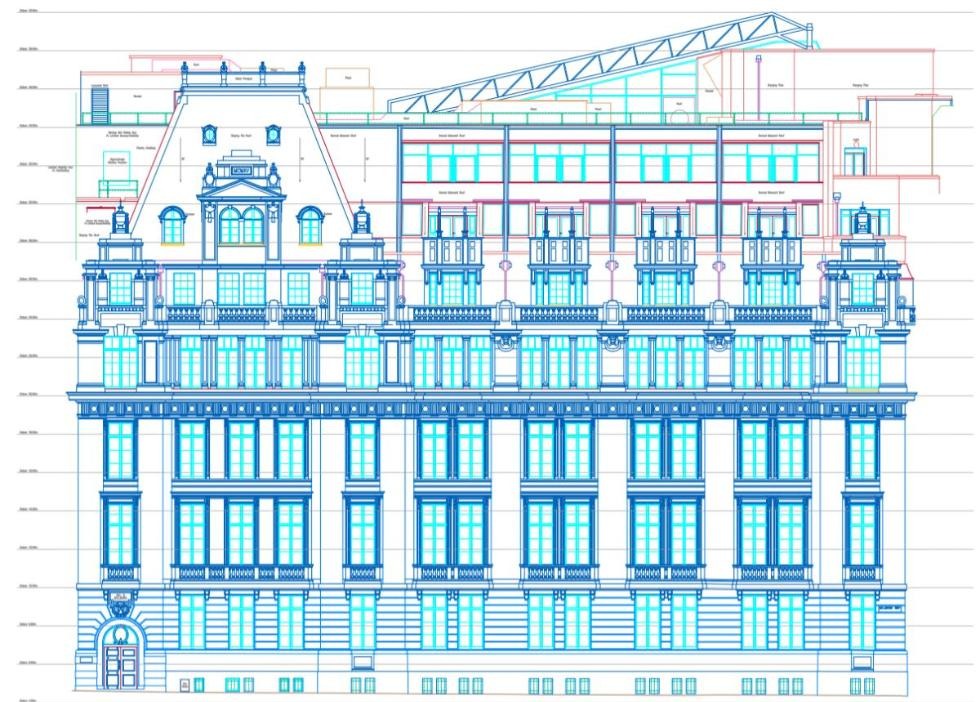
Ordnance Datum Newlyn (ODN) is the zero point for levels across mainland Great Britain. It is the mean sea level measured at Newlyn, Cornwall, between 1915 and 1921, and it has been held fixed ever since. A level marked “m AOD” on a drawing means metres above that datum. Spatial Dimensions delivers measured building surveys, topographical surveys and Revit models to Ordnance Survey grid and datum as standard, so every survey on a project can be laid over the next without adjustment.
What is Ordnance Datum Newlyn?
Ordnance Datum Newlyn (ODN) is the national height reference used by Ordnance Survey for mainland Great Britain. A height datum is an agreed reference level: the zero from which heights and depths are measured. ODN was established from the average sea level recorded at Newlyn, near Penzance in Cornwall, between 1915 and 1921.
Heights relative to this datum are commonly expressed in metres above Ordnance Datum, abbreviated to m AOD. A floor level of 52.81 m AOD, for example, is 52.81 metres above the ODN reference level.
Surveyors describe these as orthometric heights. They provide a practical reference for comparing ground, building and water levels.
Spatial Dimensions references its surveys on mainland Great Britain to ODN unless the client specifies another datum. Using a shared height reference helps designers, engineers and contractors coordinate their work.
Where did Ordnance Datum Newlyn come from?

ODN came from a tide gauge Ordnance Survey built at Newlyn harbour in 1915. The gauge took hourly readings for six years, and recording ended on 30 April 1921. Averaging those readings gave the mean sea level that became the national datum.
Newlyn was chosen partly because of its stable granite geology and its exposure to the open Atlantic. Its position reduced the influence of estuary silting and delays in the movement of tides associated with rivers. Ordnance Survey also operated tide gauges at Felixstowe and Dunbar during the wider programme.
Before Newlyn, levels were measured from a Liverpool datum, based on a short run of sea level readings in 1844. Newlyn replaced it from the 1920s.
A brass bolt inside the Newlyn Tidal Observatory provides a physical reference for the datum. Located at National Grid reference SW 4676 2855, it has an adopted height of 4.751 m above ODN. The observatory and part of South Pier were Grade II listed in December 2018.
 READ NEXTSURVEYING HOTELS THAT NEVER CLOSE: HOW TO MEASURE AN OCCUPIED HOTEL BEFORE A REFURBISHMENT
How does a level get from Cornwall to your site?
Historically, surveyors transferred heights across the country by precise spirit levelling: measuring the difference in height between successive points. Ordnance Survey built about 200 fundamental bench marks, each an underground chamber, and then around three-quarters of a million smaller bench marks cut into walls, churches and bridges. About half a million survive.
Today, surveyors commonly establish site control using satellite positioning. GNSS stands for Global Navigation Satellite System; GPS is one of the systems it includes.
GNSS measures height relative to a mathematical reference surface called an ellipsoid. To obtain ODN heights, surveyors apply Ordnance Survey’s OSGM15 geoid model to suitable GNSS observations.
OS states that OSGM15 has a nominal accuracy of 8 mm RMS on mainland Britain. This describes the model’s accuracy, rather than the overall accuracy of a survey. The final result also depends on the observations, equipment, site conditions and survey methods.
Spatial Dimensions uses calibrated robotic total stations and multi-frequency GNSS equipment with correction services. Unless the client specifies otherwise, its survey control networks are related to the Ordnance Survey National Grid for horizontal position and ODN for height.
Why does ODN matter on a building project?
ODN provides a common height reference for the surveys, drawings and models used on a project.
When a topographical survey, measured building survey, utility survey and neighbouring development drawings use the same height datum, their levels can be compared consistently. Their horizontal coordinates must also use a compatible grid, and the survey control and accuracy must suit the project.
An assumed local datum can work well within a defined project. However, if its relationship to ODN is unknown or undocumented, combining it with other information can introduce errors and require additional survey work.
A common height datum supports several important decisions:
- Flood risk: Flood levels are usually given in metres AOD. So the floor level of a new building has to be set on the same datum, or the comparison means nothing.
- Drainage: Sewer records and new drainage runs are designed by invert levels. Those need a common datum, so the falls actually reach the public sewer.
- Planning: Ridge heights, eaves and the relationship to neighbouring buildings all have to agree between drawings prepared by different firms.
- Construction: Setting out and construction verification check what is built against the design. Both need to work from the same levels.
Spatial Dimensions is regularly asked to resolve discrepancies where an earlier survey used an undocumented local grid or an incorrect height datum. If design work has already progressed, resolving those differences can require drawing revisions and further coordination. Establishing and documenting the correct grid and datum at the outset helps avoid that rework.

“A level on a drawing is only useful when its datum is clear. Establish ODN at the outset, and every team on the project has a shared height reference.”
Claire Fenwick
Managing Director, Spatial Dimensions, and President of the Geospatial Survey Association
PLANNING A PROJECT?
Tell us about your site and what you need, and we will come back to you with a quote.
What are the limits of ODN?
ODN is a fixed historical reference, rather than today’s sea level. It is based on observations made at Newlyn between 1915 and 1921. Mean sea level has changed since then and varies around the coast. A height of 0 m AOD therefore does not represent present-day mean sea level at every location.
For coastal and flood assessments, water levels and land levels must be expressed relative to a clearly identified, common datum.
Older benchmarks need careful assessment. The lower-order benchmark network is no longer routinely maintained, and some marks may have moved through subsidence or changes to the structures carrying them. Their published heights should not be assumed to remain valid.
Fundamental benchmarks are a separate case: OS continues to maintain and use them. For establishing high-accuracy ODN heights, OS recommends OS Net and OSGM15 in preference to relying on older benchmarks.
ODN does not apply everywhere. Some offshore islands and island groups use separate height datums, including Orkney, Shetland, the Outer Hebrides, the Isles of Scilly and the Isle of Man. Northern Ireland uses the Belfast datum. The appropriate reference should always be confirmed for the survey location.
Offshore work also requires care. OSGM15 includes an extended surface called “ODN Offshore”, which has lower quality than the land-based datum. Marine projects should confirm the required vertical reference before combining survey, tidal or chart information.
A local datum can still be appropriate. For an internal fit-out, for example, levels may only need to relate to one another. An assumed local datum can meet that need if it is clearly documented.
Where a survey may later support external drainage, flood assessment, planning or wider site development, a connection to ODN is usually more useful.
A local grid and a local height datum are separate choices. A survey can use a local horizontal grid while retaining ODN heights. Spatial Dimensions agrees the required grid and height datum with the client and records them in the survey information.
Ordnance Datum Newlyn FAQs
What does AOD mean on a drawing?
AOD means “above Ordnance Datum”. On mainland Great Britain, that is Ordnance Datum Newlyn. A level of 51.65 m AOD is 51.65 metres above that fixed reference.
Is ODN the same as today’s sea level?
No. ODN is based on mean sea level recorded at Newlyn between 1915 and 1921. It remains fixed even though sea level changes.
Can I rely on an Ordnance Survey bench mark for my levels?
An older benchmark should be assessed before use because its published height may no longer represent its current position. OS recommends OS Net and OSGM15 for establishing high-accuracy ODN heights. Fundamental benchmarks remain maintained by OS.
Does GPS give levels above Ordnance Datum?
Not directly. GNSS provides ellipsoidal heights. Suitable observations can be converted to ODN heights using OSGM15. Survey accuracy depends on the observations and methods as well as the transformation model.
Is ODN used in Northern Ireland and the Scottish islands?
No. Northern Ireland uses the Belfast datum. Orkney, Shetland, the Outer Hebrides, the Isles of Scilly and the Isle of Man each have their own local height datum.
Does Spatial Dimensions survey to Ordnance Datum Newlyn as standard?
Yes. Unless the client specifies otherwise, Spatial Dimensions references its measured building and topographical surveys on mainland Great Britain to the Ordnance Survey National Grid and ODN. Revit models derived from those surveys retain the agreed project positioning and height reference. It uses a local grid only when the client specifies one.
If your project needs survey levels that every consultant can trust, talk to Spatial Dimensions on 01732 458799 or through our contact page. We will come back with a written quote within 24 hours.
Not ready to talk yet? Our free guide, Specifying a Topographical Survey, explains survey control, datums and what to ask for before you commission a survey.
Next in this series: levels vs heights, the difference and why it matters.
Sources: Ordnance Survey: Ordnance Datum Newlyn; Ordnance Survey blog: Ordnance Datum Newlyn, 100 years old; Ordnance Survey: National Geoid Model OSGM15; Wikipedia: Ordnance datum.
 DEVELOPER
 CONSULTANT
 ARCHITECT
 ENGINEER
 SURVEYOR
 PLANNER
 CONTRACTOR
 ESTATE AGENT
 LAWYER
 HOMEOWNER