Skip to content
Have you ever wondered what a typical day looks like for a Geospatial surveyor? Well, strap in and get ready for a behind-the-scenes glimpse into the life of a surveyor at Spatial Dimensions! We will take you through the various tasks and activities that make up a surveyor’s day. So, let’s dive right in!
WHERE DO WE START?
The work as a surveyor often starts days or even weeks before the actual visit! Before site visit information is shared between the project management and surveying teams to ensure complete transparency. The job briefs allow our surveyors to start planning and collecting the correct equipment for the job at hand.
During this process, qualifications are checked and permits are granted if necessary to ensure safety on site. Certifications include, but are not limited to:
- CSCS Card (all contractors)
- DBS (working around children e.g. school work)
- Asbestos Awareness
- Working At Heights
- Lone Working
- Confined Spaces
- Harness Training
06.30am
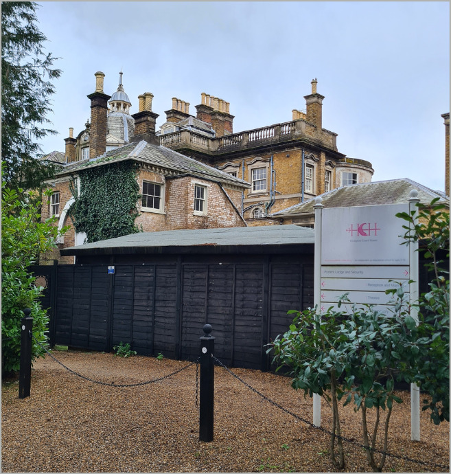
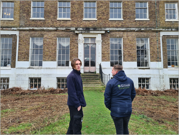
As a surveyor, one of the first things we do each morning is drive to the site. As a national company, we service the whole of the UK. Our strategically located offices mean we can mobilise quickly. However, some jobs require getting to the area the day before and staying overnight. Today we’ve been travelling to Hampton Court House School in South West London. It is located an equal distance between our London and Kent offices.
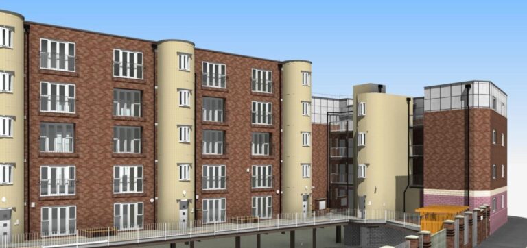
Our work at Hampton Court House School today entails laser scanning the remaining rooms following two previous days on-site, and topographical surveys of the school’s land. The laser scanning of the internal sections will lead to Level of Detail (LOD 3) 2D CAD drawings and 4 elevated sections at LOD 3. The topographical survey gives a 2D picture of the natural and built environment. It will include the footprint of the current built environment as well as trees, boundaries, ground surface, service covers, basic drainage and other relevant information. This particular survey will also be in 2D CAD at LOD 3.
CAD drawings, particularly at LOD 3, help our clients make informed decisions through high levels of detail and communication. The nature of CAD drawings helps to streamline the design process through information, helping to save our clients time and money.
07.30am
Upon arrival, we have a morning brief with our colleagues to discuss the day’s plan. This is an opportunity to review any specific details or requirements for the project. From here, we meet the site contact and check-in, ensuring we have all the necessary access and permissions.
08.00am
Efficiency is key in the world of surveying, so the next step is to plan our day to maximise productivity. This involves liaising with the site contact to determine the best times and locations to carry out your work. For example, if we’re surveying a hotel, we’d want to avoid interfering with their kitchen during prep and meal times. By collaborating with the site contact, you can ensure a smooth workflow and minimise any disruptions.
Today, we are working through a school during holiday time. There are teacher training courses in the large hall from 9.30 am, meaning we will laser scan this room first, using a Leica RTC scanner. This will avoid any disruption to our clients.
08.30am
With the planning phase complete, it’s time to familiarise ourselves with the site. This entails conducting a site walk, where we take the opportunity to get to know the lay of the land. We align our understanding with the client’s specifications and conduct a thorough risk assessment.
09.05am
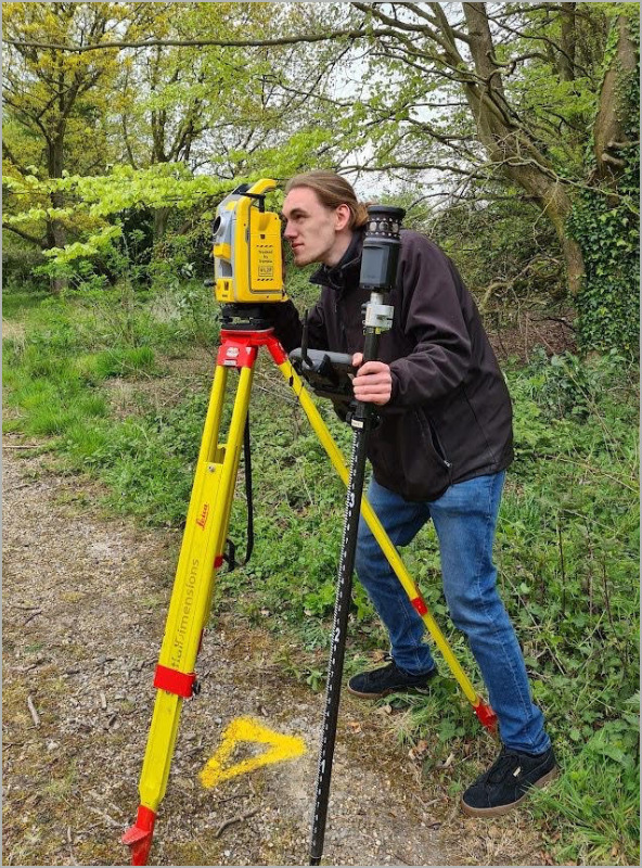
Now comes the exciting part! After scanning the final room indoors, we moved on to the Topographical (land). Today, we will be mapping all of the external surroundings of the site. We set out known locations (control stations) around the site, which will be marked by a nail or a wooden peg in the ground. All nails will be flush with the surface, but some pegs may stick out of the ground; these mustn’t be moved until the survey is complete.
Global Positioning System (GPS) is used in surveying to determine the position of points on the Earth’s surface. In surveying, GPS provides surveyors with an efficient and accurate method. GPS receivers establish control points and specify their positions with great accuracy. This leads to faster data collection, reducing the need for manual measurements which has led to greater efficiency for the surveying community.
We will measure the position and heights of many features such as buildings, boundaries, walls and steps. All features will be measured from the control points using a Total Station. This is an electronic measurement device that we set up on tripods to record distances and angles.
By meticulously laser scanning the plans discussed with the site contact, we ensure that every inch of the required site is captured.
As you laser scan the site methodically, you capture detailed data that will be used to create thousands of data points. This is where the magic happens, and the space comes to life! This data can be transformed into CAD Drawings, 3D models and more. While scanning, we also take photos, both internally and externally, to assist the drawing team later on. Our 360° Photographic records play a key role in capturing immersive visual representations of a space. These photos help provide context and a visual reference for creating accurate drawings and models.
Once the scanning is complete, we repeat the GPS station measurements to double-check and ensure accuracy. This extra step ensures that the data you’ve collected is reliable and can be relied upon for subsequent stages of the project.
2.35pm
Wrapping up the day on-site, we sign out and hand back any keys or access cards we were given. It’s important to maintain professionalism and accountability throughout the entire process.
From here, we leave the site. Depending on times and work load we either head back to the office or head home.
3.50pm
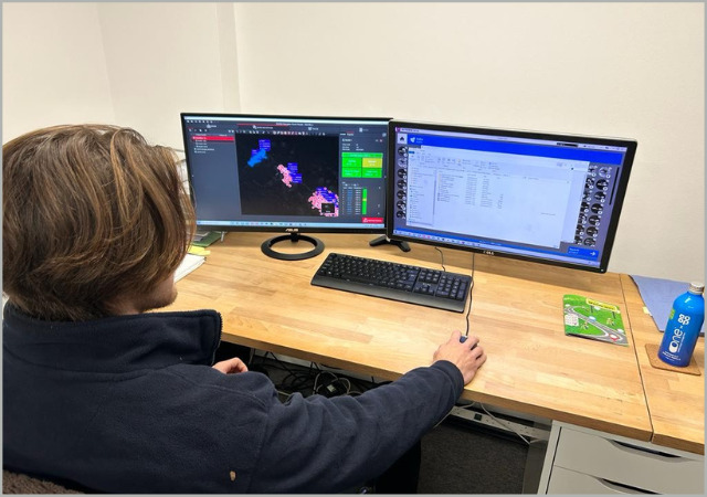
Today, we returned to the office to unload the van and begin the post-processing phase.
This involves downloading the data from the survey equipment and importing it into the necessary software. This step is crucial as it allows us to organise and analyse the data, transforming it into usable information for the client. We also take the time to recharge equipment, ensuring that it’s ready for the next site visit!
And there you have it – a day in the life of a Geospatial surveyor at Spatial Dimensions! It’s a dynamic and fulfilling role that involves meticulous planning, accurate measurement, and the creation of detailed models.
At Spatial Dimensions, we take pride in our commitment to customer service, affordability, and quality. Our mission is to measure, map, and model to help our clients create spaces everybody loves. We believe that by putting the customer and their project at the heart of everything we do, we can deliver exceptional results and exceed expectations.
So the next time you see a surveyor on-site, remember the intricacies of their work and the expertise required to bring spaces to life. The surveyor’s role is essential in redeveloping and creating the spaces we inhabit and enjoy.