 Skip to content

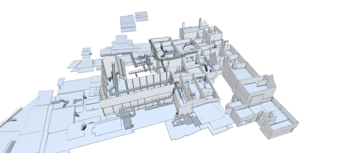
Before a warehouse or logistics site is extended, the design team needs three things measured: the ground and everything on it, the services below it, and the existing buildings the new work joins. Spatial Dimensions covers all three with permanent in-house teams: topographical surveys tied to Ordnance Survey grid and datum, underground utility surveys delivered to BSI PAS 128:2022, and measured building surveys of the existing sheds. Topographical surveys start from £595 and underground utility surveys from £850, excluding VAT, and our average time from instruction to site is 5.3 working days.
Which surveys does a warehouse extension need?
Usually three, and on a large site a fourth. Each one answers a different question the engineer and architect will ask, and together they give the design a single, measured starting point.
- A topographical survey records the ground surface and everything on it: levels, kerbs, drainage covers, boundaries and the outlines of existing buildings. See our topographical surveys page.
- An underground utility survey locates the services under the yard: cables, pipes and ducts that a topographical survey can only show at the surface. See our underground utility surveys page.
- A measured building survey records the existing warehouse where the new work will connect to it. See our measured building surveys page.
- A drone survey maps large yards and roofs quickly, where walking every metre would take far longer. See our drone surveys page.
Which of these a scheme needs depends on the work. A new yard or car park needs levels and drainage above all. An extension joined to an existing shed needs the building measured as well. Spatial Dimensions can quote for all of them together, so every survey shares the same control and the results line up. Our industrial sector page covers the wider range of work we do on industrial sites.
What should a topographical survey of an industrial site show?

It should show everything the new building and its yard must tie into, at levels the drainage designer can work from. As standard, a Spatial Dimensions topographical survey records:
- boundary features, with their heights and descriptions
- external building outlines, with ridge and eaves heights
- road channels, tops of kerb, steps and changes of surface
- inspection covers, manholes, service valves, gullies and drainage channels
- rainwater pipes, vent pipes, overhead cables and significant services
- fixed street furniture, trees over 200 mm bole diameter, hedges and planting
Ground levels are taken at 10 m intervals unless the client asks for more. On an open yard that spacing often works. Around loading docks, ramps and existing falls, denser levels are usually worth specifying, because a small error there shows up as standing water. Drainage invert levels, with pipe runs and diameters, are available on request. If new hardstanding will drain into an existing system, ask for them at quotation rather than after the design has started.
The deliverable matters on a big site. Spatial Dimensions supplies topographical data as 3D points, 3D contours, a 3D mesh (a digital terrain model, or DTM) or a full Revit BIM model. A DTM is a continuous surface of the ground, so the engineer doesn’t have to guess the slope between measured points. That makes it the safer choice for earthworks, cut-and-fill calculations and drainage falls across a large yard.
Our article on topographical surveys for infill and redevelopment sites covers the opposite end of the scale: small, tight plots.
 READ NEXTWHAT DO GEOSPATIAL SURVEYORS ACTUALLY DO?
Why does a utility survey matter before yard works or foundations?
Because a yard hides its services. Decades of extensions, new docks and resurfacing leave cables and pipes that don’t match any drawing, and new foundations, drainage runs or kerb lines can cut straight across them.
Spatial Dimensions delivers underground utility surveys to BSI PAS 128:2022, which grades how well each service has been located, from Quality Level D (a desktop search of utility records) to Quality Level A (a service exposed and verified). Detection uses electromagnetic location (EML) and ground penetrating radar (GPR). With both technologies together, depth accuracy is ±15%. With one technology alone, it is ±40%. We detect services down to 63 mm diameter for gas and water mains. Our PAS 128 page explains the quality levels in more detail.
An honest point about detection: it gives a position and an estimated depth. The only way to confirm a service is to expose it, which is what a Quality Level A verification does, by trial hole. Where new foundations or deep drainage will run close to a detected service, verification is worth pricing in.
If the new yard drains into existing drains, a CCTV drainage survey shows the condition and route of the pipes before anyone connects to them. Many of our clients commission the topographical and utility surveys together, to reduce risk and avoid redesign later.
What about the existing buildings?
Where the extension joins an existing warehouse, the existing building needs measuring as well as the ground around it. A topographical survey records building outlines with ridge and eaves heights. A measured building survey goes inside, with floor plans, elevations and sections.
Spatial Dimensions measured building survey drawings are produced to a stated level of detail (LOD). The 2D tolerances are ±20 mm at LOD 2, ±10 mm at LOD 3 and ±5 mm at LOD 4. Where the building has dense plant or services that the design team needs to see in 3D, a laser scanning survey captures it as a point cloud, and the survey can be modelled in Revit.
PLANNING A PROJECT?
Tell us about your site and what you need, and we will come back to you with a quote.
When does a drone survey help on a logistics site?
On large, open yards and on big roofs. A drone covers ground and roof areas quickly, which suits a logistics site where the hardstanding runs to many hectares.
Spatial Dimensions flies two drone services. A drone mapping survey starts from £850 and produces measured mapping of the site. Drone photographic surveys start from £550 and record the site in images, for example the condition of a roof. A drone records what it can see from the air. It doesn’t locate buried services, so on most expansion schemes it sits alongside the utility survey rather than replacing it.
How do you keep every survey on the same grid?
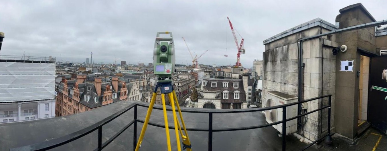
With survey control, set up once and used by every survey. Survey control is a network of fixed points that every measurement is tied to. Spatial Dimensions places control both on and off the site, so construction doesn’t disturb it, and ties it to Ordnance Survey grid and datum unless the client specifies otherwise.
That matters on phased industrial work. If the first phase is surveyed on one grid and the second on another, the drainage, the slab levels and the new building stop lining up. Spatial Dimensions is regularly asked to step in where a survey was delivered on an arbitrary grid or the wrong datum after design work had already started. As our topographical survey guide puts it, “Survey control is invisible when done properly, and painfully obvious when it isn’t.”
How much do the surveys for an industrial site cost?
A topographical survey from Spatial Dimensions starts at £595, and an underground utility survey at £850. Prices for the surveys a warehouse or logistics expansion usually needs:
The ranges are the span across each whole service, not one job. On an industrial site the price depends mainly on the area covered, the detail required, the PAS 128 quality level, the deliverable, and access. A return visit forced by obstructed ground is chargeable, so it helps to agree which areas will be clear on the day. Drain jetting is not standard.
Spatial Dimensions quotes a fixed price against a written specification, with the content, quality level, formats and timescales stated before you commit. A price match guarantee applies to topographical, utility and measured building surveys. We will come back with a written quote within 24 hours. All prices exclude VAT.
What can’t these surveys tell you?
A topographical survey records what can be seen and reached at the surface. A utility survey locates services and estimates their depth, but only exposure confirms them. Neither tells you what the ground is made of. Ground investigation, such as boreholes and soil testing for foundation design, is a separate specialist service and not one Spatial Dimensions provides.
Access limits what can be recorded on a working site, too. Ground under parked trailers, stacked goods or skips can’t be measured or scanned for services. Spatial Dimensions will say before the survey where access will limit what we can record, rather than leaving gaps in the drawing to be found later.
What does this mean for developers, architects and engineers?
It means commissioning the surveys before the layout is fixed, and specifying them for the site rather than taking a standard package. Ask for denser levels around docks and falls, drainage inverts where new hardstanding connects to existing drains, and a DTM if earthworks are involved. Book the utility survey alongside the topographical survey, on the same control, and agree the PAS 128 quality level with the engineer. If the extension joins an existing shed, include a measured building survey of the junction.

“On an industrial site, levels and MEP really matter. Get both measured on the same control before anyone designs the scheme and the design will be one that can be built.”
Claire Fenwick FCInstCES
Managing Director, Spatial Dimensions, and President of the Geospatial Survey Association
Warehouse extension survey FAQs
What surveys do I need before extending a warehouse?
Usually a topographical survey, an underground utility survey and a measured building survey of the existing building the extension joins. On large yards and roofs, a drone mapping survey can speed up the work. Spatial Dimensions can quote for all of them on one set of survey control.
Do I need a utility survey before resurfacing a yard?
If the work goes below the surface, yes. A topographical survey shows covers and gullies at the surface; a PAS 128 utility survey locates the cables and pipes underneath before anyone digs.
Which PAS 128 quality level do I need?
It depends on the risk. Detection (Quality Level B) locates services with electromagnetic location and ground penetrating radar. Verification (Quality Level A) confirms them by trial hole, priced from £350 per trial hole, excluding VAT. Spatial Dimensions states the quality level in writing at quotation.
How much does a topographical survey of an industrial site cost?
Spatial Dimensions topographical surveys start from £595, and most fall between £750 and £2,500, excluding VAT. The price depends mainly on the area, the detail required and access.
How quickly can a surveyor get to site?
Spatial Dimensions’ average time from instruction to site is 5.3 working days. We confirm delivery dates in writing before work starts.
Will the surveys work with our engineer’s drainage design?
Yes. Spatial Dimensions ties every survey to Ordnance Survey grid and datum unless you specify otherwise, and supplies DWG or DXF drawings, a digital terrain model or a Revit model, so the data drops straight into the design.
Spatial Dimensions has surveyed land and buildings for architects, engineers and developers since 2012, with permanent in-house teams of surveyors, utility surveyors, CAD technicians and project managers. We never subcontract our core work. Our offices are in Sevenoaks, London and Nottingham, and we carry £10m of insurance across professional indemnity, public liability and employer’s liability. Our Managing Director, Claire Fenwick FCInstCES, is President of the Geospatial Survey Association. Call us on 01732 458799 or get in touch.
Planning an industrial extension? Download our topographical survey guide.
 DEVELOPER
 CONSULTANT
 ARCHITECT
 ENGINEER
 SURVEYOR
 PLANNER
 CONTRACTOR
 ESTATE AGENT
 LAWYER
 HOMEOWNER