 Skip to content

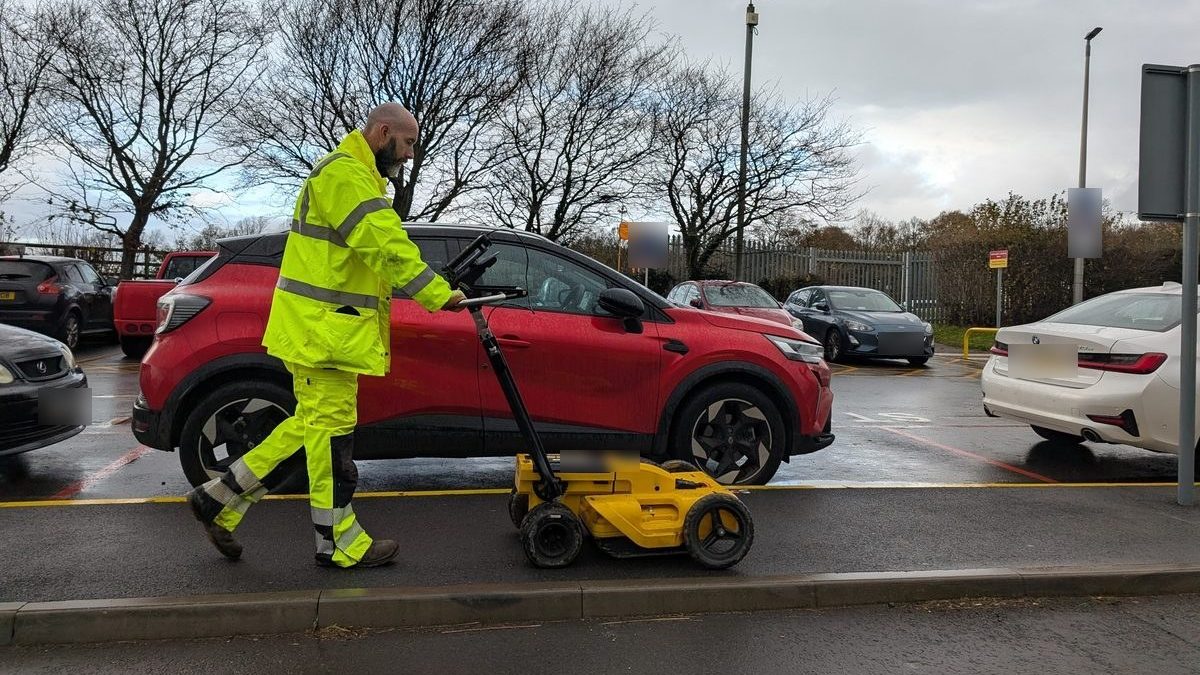
A PAS 128 utility survey locates buried services and grades each result by quality level: QL-D is a desktop search of the statutory records, QL-C is a site reconnaissance, QL-B is detection with electromagnetic location and ground penetrating radar, and QL-A is verification by exposing the service. On most redevelopment sites that means a desktop search first, which Spatial Dimensions recommends on every project, then detection across the area to be developed, then verification wherever a design decision depends on the exact position of a service. Underground utility surveys start from £850, and most fall between £1,200 and £3,500, excluding VAT.
What is a PAS 128 utility survey?
It is a survey of buried services carried out to PAS 128:2022, the British Standards Institution specification for detecting, verifying and locating underground utilities. Its main job is to tell you how far you can trust each line on the drawing. A pipe taken from an old record and a pipe dug down to and measured are both lines on a plan, but they are not worth the same when a foundation is about to go in next to them.
PAS 128 deals with this by giving every result a quality level, which the surveyor assigns after the survey according to what site conditions allowed. The level is stated on the drawing, so the design team and the contractor can see at a glance which services were found on site, which were only taken from the records, and which were exposed and confirmed.
Spatial Dimensions delivers underground utility surveys to PAS 128. It is a specification we work to, not an accreditation. A PAS 128 survey is not a legal requirement either. However, the Health and Safety Executive’s guidance HSG47 expects anyone breaking ground to find out what is below it first, and a PAS 128 survey is the recognised way of showing that it was done properly.
What do the PAS 128 quality levels mean?

There are four, and each one adds certainty to the level before it:
A desktop search, sometimes called a C2 search or a safe dig pack, shows what the utility companies think is there. It is quick and cheap, but the records are often incomplete, and private services on the site itself are rarely on them.
Detection is where the site is actually surveyed. EML picks up metallic services and cables that carry a signal; GPR picks up changes in the ground, which is how plastic pipes and empty ducts are found. Spatial Dimensions marks detected services on the ground with temporary, biodegradable spray paint as standard, so the contractor can see them as well as read them.
Verification is the only level that proves a service is where the drawing says it is. It costs more per point, so it is used where it matters rather than across the whole site. Any level can also be delivered as a 3D Revit model or 3D AutoCAD file on request.
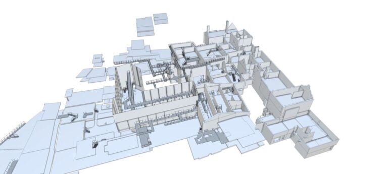 READ NEXTBEFORE THE NEW SHED GOES UP: THE SURVEYS A WAREHOUSE OR LOGISTICS SITE EXPANSION NEEDS FIRST
Which PAS 128 survey does a redevelopment site need?
Usually all four, but not all at once and not everywhere. The right level depends on the stage the project has reached and on what the next decision is.
- Pre-acquisition and technical due diligence. It is less common, but best practice is to commission a desktop search (QL-D) before a site is bought. Services and easements that could limit the scheme are then known before the price is agreed, rather than found after.
- Feasibility and concept. A desktop search (QL-D), ideally with a site reconnaissance (QL-C), shows the main services crossing the site and any easements to plan around. Architects, consultants and lawyers often commission this at feasibility, planning and easement stage.
- Technical and developed design coordination. A detection survey (QL-B) across the area to be developed. This is where clashes with the proposed scheme show up while they are still cheap to resolve. A clash found on paper costs far less than one found in a trench.
- Pre Construction. Verification (QL-A) at the points where the design depends on an exact position or depth: a new foundation beside a main, a drainage connection, or a service that has to be diverted.
Engineers usually commission utility surveys for design coordination, and contractors commission them before excavation. On a redevelopment, the cheapest point to ask is early, when the answer can still change the layout.
The survey also runs in a set order. Spatial Dimensions carries out the topographical survey first, then the desktop search, then detection, then verification and CCTV drainage surveys where they are specified. The statutory records have to be in hand before the survey is complete, because detection is checked against them.
Why does a utility survey need a topographical base?
Because a utility line is only useful if it sits in the right place relative to everything else on the site. Spatial Dimensions draws detected services on a measured topographical survey, not on an Ordnance Survey map. A map base can’t show kerbs, covers, levels and building lines accurately enough to place a service against them, so a utility drawing built on one can’t be relied on for design.
That is why many of our clients commission the topographical and utility surveys together, to reduce risk and avoid redesign later. The same survey control holds both together, so the services, the levels and the boundaries all line up in the architect’s and engineer’s models. Our topographical surveys page sets out what the base survey records, and our infill and redevelopment topographical survey article covers what it needs to show on a tight or complex site.
PLANNING A PROJECT?
Tell us about your site and what you need, and we will come back to you with a quote.
How accurate is a PAS 128 utility survey?
For depth, PAS 128:2022 sets a tolerance of ±15% of the detected depth for the best detection grade (QL-B1) and ±40% for the next (QL-B2). Which grade a service reaches depends on how clear and confident the signal is on site, not simply on how many technologies picked it up. That is why Spatial Dimensions uses both EML and GPR on every detection survey: each finds services the other can miss, and two methods agreeing give much more confidence than one.
A detection survey can locate up to about 95% of buried utilities, and Spatial Dimensions detects gas and water mains down to 63 mm in diameter. For an exact position and depth, verification (QL-A) is the only certain answer, because the service is exposed and measured.
What can’t a PAS 128 survey find?
No detection survey finds everything, and it is better to know the limits before the design relies on the drawing. The usual ones are:
- small-diameter fibre optic cable laid directly in the ground, which neither EML nor GPR can reliably detect
- services within about 25 cm of a surface obstruction, such as a wall or a parked vehicle
- services under reinforced concrete, which limits what GPR can see
- several cables or ducts running together, which can show as a single line on the drawing
The survey also only covers the ground that can be reached on the day. A return visit forced by obstructed ground is chargeable, so it pays to agree access and clearance before the team arrives. Spatial Dimensions will say before the survey where access or ground conditions are likely to limit the result, and where a verification trial hole would settle a doubt.
How much does a PAS 128 survey cost, and how long does it take?
An underground utility survey from Spatial Dimensions starts at £850, and most fall between £1,200 and £3,500. The price depends mainly on the survey type, the size of the site and how congested it is, whether a usable topographical base already exists, traffic management, and access. Prices for the surveys a redevelopment usually needs:
The ranges are the span across each whole service, not one job. The £350 per trial hole excludes backfill and reinstatement, and drain jetting is not standard. Our quotes assume NC1 low-risk chambers. A price match guarantee applies to utility and topographical surveys.
On timing, a desktop search returns an interim report in 3 to 5 working days and the full report within 10. Our average time from instruction to site is 5.3 working days. All prices exclude VAT. We will come back with a written quote within 24 hours.
What does this mean for architects and developers?
It means specifying the survey type and method in writing, and matching them to the decision in front of you. The surveyor then states a quality level for every service on the drawing. A drawing without quality levels can’t tell you which lines were found on site and which were copied from a record.
In practice, three things help on a redevelopment. First, commission the desktop search and the topographical survey early, so the scheme starts from what is known. Second, book a detection survey across the developable area before the layout is fixed. Third, ask for verification only where a decision depends on it, and say which points they are. Spatial Dimensions will set out the survey type, the method and the deliverables on every quotation, so you know exactly what the drawing will and won’t tell you.
PAS 128 quality levels FAQs
What is PAS 128?
PAS 128:2022 is the British Standards Institution specification for detecting, verifying and locating underground utilities. It grades every result by quality level, from QL-D (records) to QL-A (exposed and confirmed). Spatial Dimensions delivers utility surveys to PAS 128.
What is the difference between QL-B and QL-A?
QL-B is detection: services are traced from the surface with electromagnetic location and ground penetrating radar. QL-A is verification: a service is exposed by vacuum excavation or a hand-dug trial hole, and its position and depth are confirmed.
Do I always need a desktop utility search first?
Yes. The desktop search (QL-D) is the starting point for the other levels, and Spatial Dimensions recommends one on every project. The statutory records it collects are also needed to check the detection survey.
Is a PAS 128 survey a legal requirement?
No. However, HSE guidance HSG47 expects buried services to be located before ground is broken, and a PAS 128 survey is the recognised way of showing that it was done properly.
How accurate is the depth of a detected service?
Under PAS 128:2022, depth is within ±15% for a service graded QL-B1 and within ±40% for QL-B2. The grade depends on how confident the signal is on site, and Spatial Dimensions uses both electromagnetic location and ground penetrating radar on every detection survey.
How much does a PAS 128 survey cost?
Spatial Dimensions utility surveys start from £850, and most fall between £1,200 and £3,500, excluding VAT. The price depends mainly on the survey type, the site’s size and congestion, and access.
Spatial Dimensions has surveyed for architects, engineers and developers since 2012, and our underground utilities team has been part of the business since 2023. Our permanent in-house teams of surveyors, CAD technicians and project managers never subcontract our core work. Our offices are in Sevenoaks, London and Nottingham. Our Managing Director, Claire Fenwick FCInstCES, is President of the Geospatial Survey Association. Call us on 01732 458799 or get in touch.
Specifying a utility survey? Download our underground utility survey guide.


 DEVELOPER
 CONSULTANT
 ARCHITECT
 ENGINEER
 SURVEYOR
 PLANNER
 CONTRACTOR
 ESTATE AGENT
 LAWYER
 HOMEOWNER