 Skip to content
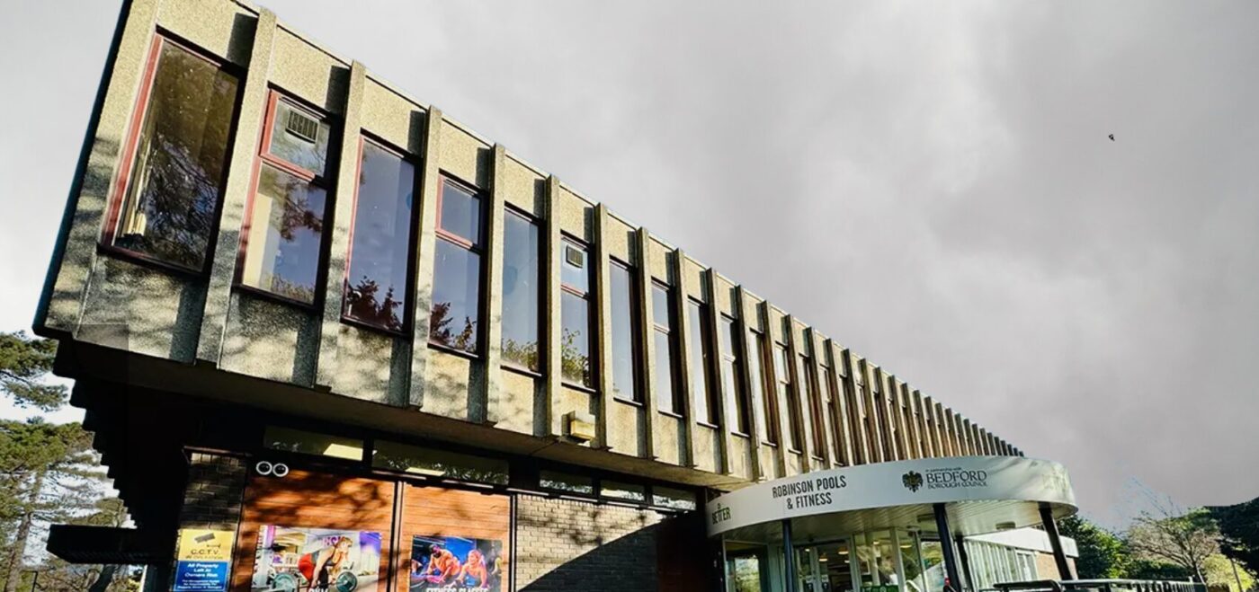
THE BRIEF
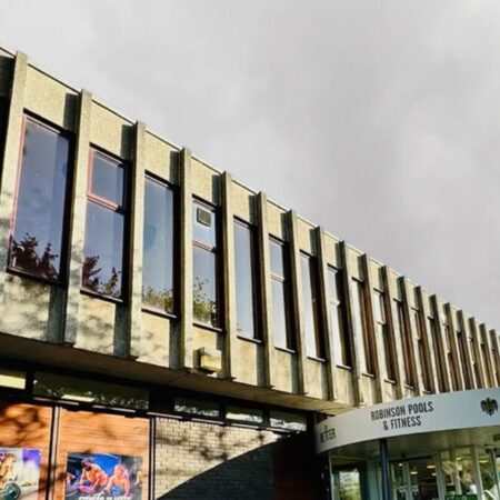
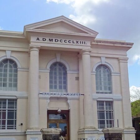
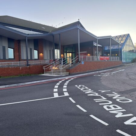
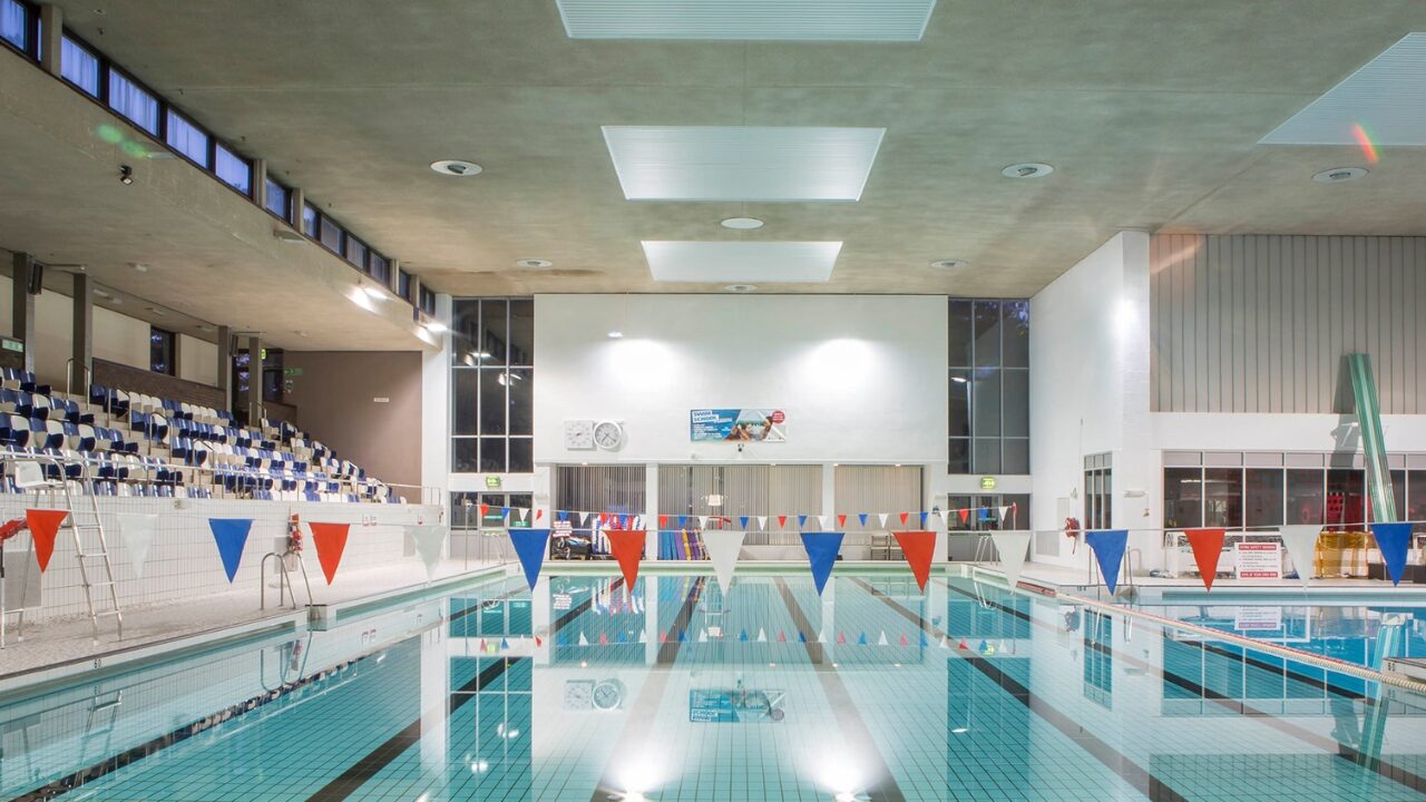
Robinson Pool is a flagship leisure centre in the heart of Bedford. It offers swimming pools, gyms, studios, and leisure spaces to the community and welcomes hundreds of visitors each day. This an example of how leisure centre surveys are becoming increasingly important.
Bedford Borough Council committed to a £1.3 million investment and redevelopment plan for the facility. The improvements included a new gym, cycling studio, and modernised fitness spaces. Upgrades to the pool, changing facilities, and reception were also part of the programme.
To support these plans, the council required accurate survey data of the building and the surrounding site. Spatial Dimensions were appointed to deliver measured building surveys, topographical surveys, and underground utility surveys. This information would provide the design team with a reliable foundation for planning and construction.
OUR WORK
LEISURE CENTRE SURVEY
Robinson Pool stayed open while we worked. That meant we had to be mindful of staff and visitors at all times.
We planned survey activities around peak hours to avoid disruption. Clear communication with centre staff allowed us to maintain public safety. Our team managed equipment carefully in shared spaces. As a result, we delivered all surveys with no impact on the centre’s daily operations.
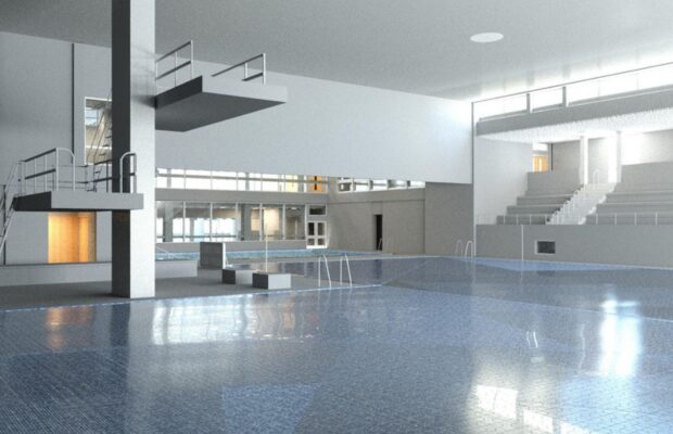
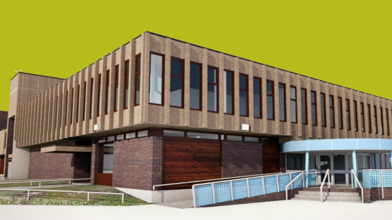
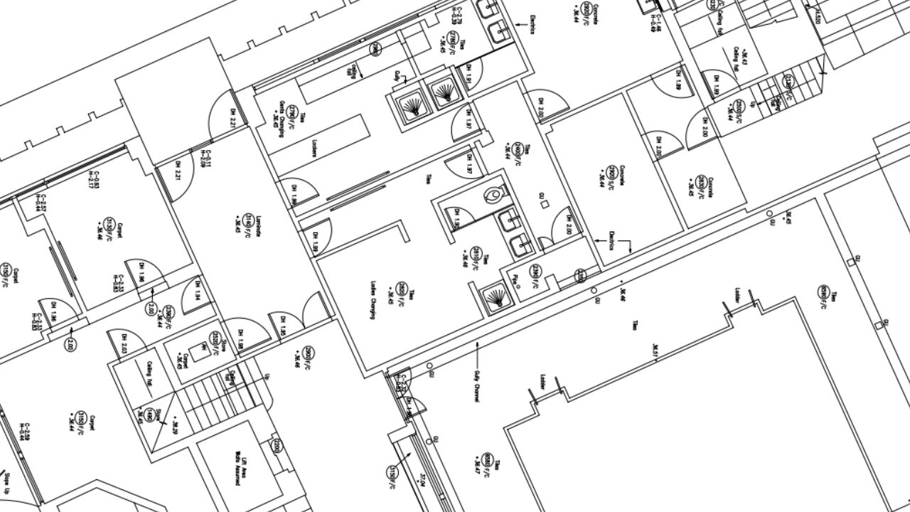
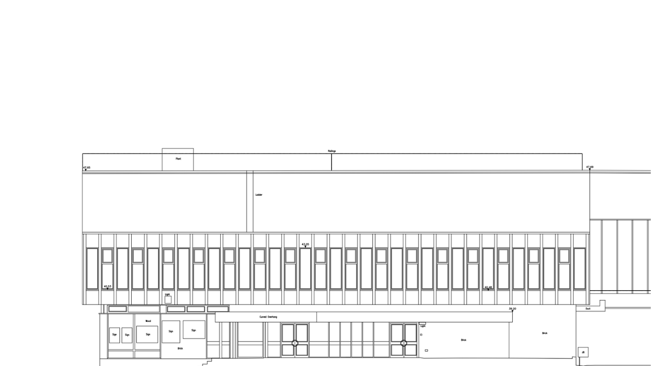
MEASURED BUILDING SURVEY
We conducted a high-resolution laser scan survey covering the external facades, roofs (where safely accessible), and internal areas of designated buildings. The data enabled accurate digital records tied to Ordnance Survey datums.
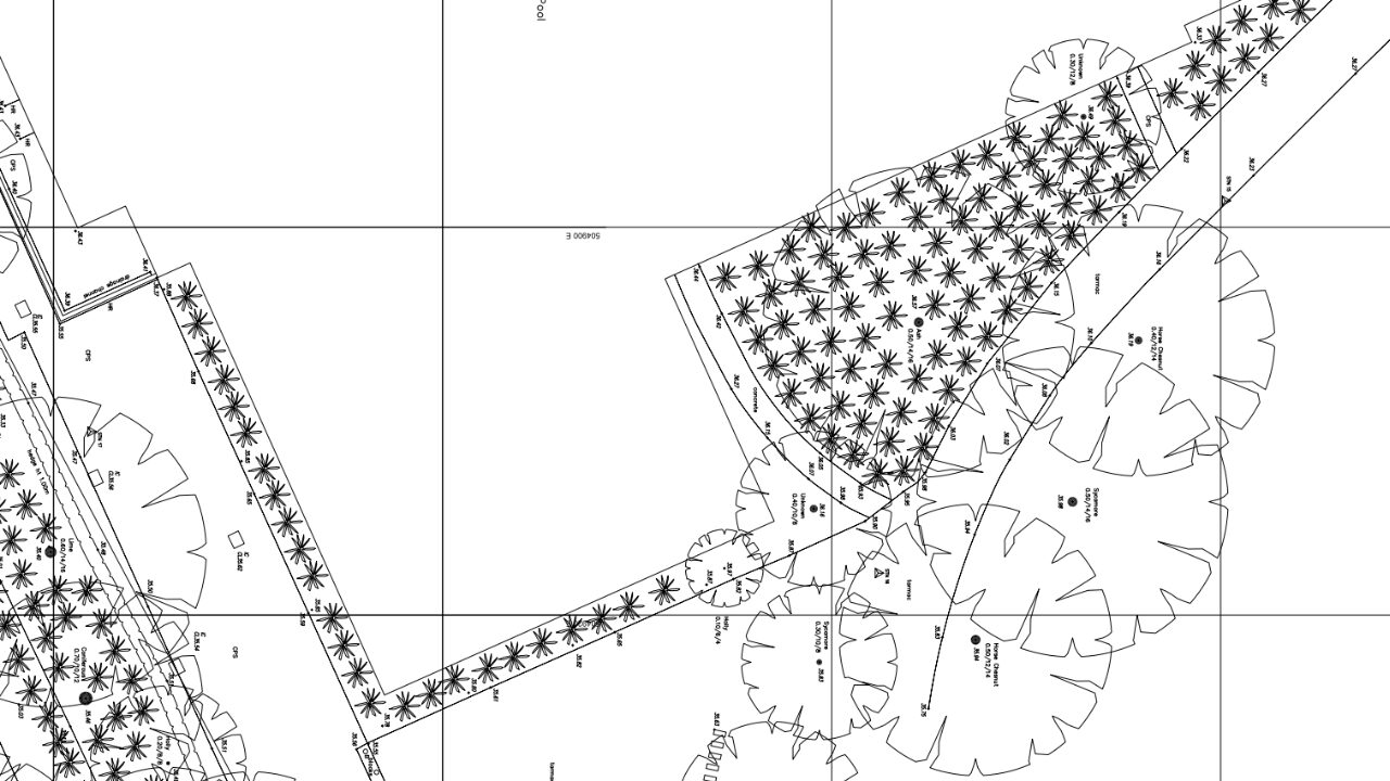
TOPOGRAPHICAL SURVEY
Detailed topographical surveys were undertaken of the surrounding site. Using total stations such as the Leica TS15, we mapped levels, boundaries, hard surfaces, and landscaped areas. This work gave the design team accurate data for access routes, parking, and external site planning.
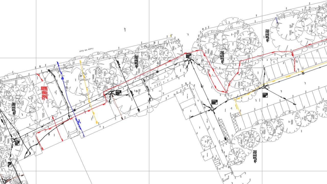
UNDERGROUND UTILITY SURVEY
We completed an underground utility survey to map buried infrastructure. Our approach combined electromagnetic detection with ground-penetrating radar (GPR). We also ran CCTV surveys of drainage systems to confirm routes and conditions.
To give the council a clear picture, we combined this data with statutory records. Our CAD team then produced a single OS-based plan. This resource highlighted service congestion and helped the client avoid costly risks during excavation.
THE OUTCOME
The final deliverables included a Revit model at LOD 3, topographical drawings (1:100), elevations + floor plans (1:50), and utility maps (1:200). Together, they gave Bedford Borough Council a complete digital record of Robinson Pool.
This dataset provided a strong base for the £1.3 million redevelopment programme. The information supported the design of the new gym, cycling studio, and upgraded pool areas. It also reduced risk by identifying underground services early and improved collaboration across the project team.
All outputs were delivered on time. The client praised both the quality of the deliverables and the way we worked within a live leisure environment.
Spatial Dimensions combined technical expertise with careful project management. The result was a clear, accurate, and future-ready dataset that gave the council confidence to move ahead with improvements. The redevelopment will ensure Robinson Pool continues to serve Bedford residents for years to come.
