 Skip to content

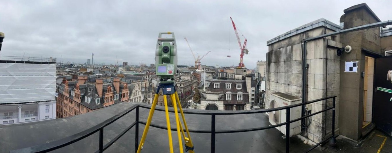
Small infill plots and complex redevelopment sites leave very little room for error. Before you commission an infill topographical survey, or one for a redevelopment, it is worth knowing what these sites need and which questions sort a good survey from a cheap one.
In short: A topographical survey for an infill or redevelopment site records the ground, the boundaries and the neighbouring buildings that a new scheme has to fit between. Spatial Dimensions sets up survey control on and off the site, ties it to Ordnance Survey grid and datum, and records neighbouring buildings with ridge and eaves heights as standard. Topographical surveys start from £595, excluding VAT, and our average time from instruction to site is 5.3 working days.
What makes infill and redevelopment sites hard to survey?
They are tight, busy and surrounded by things the new design must not touch. On an open field, a few centimetres of uncertainty rarely matters. On an infill plot between two houses, it can decide whether a scheme fits at all.
The usual difficulties are the same on most sites:
- Neighbouring buildings. The design has to respect the windows, eaves and ridges next door, for daylight, overlooking and party wall reasons.
- Boundaries. Walls, fences and hedges sit right at the edge of the site, and levels often change across them.
- Restricted access. Small sites can be overgrown, locked or sandwiched behind other properties.
- What is already there. Redevelopment sites often carry buildings to demolish, old slabs, retaining walls and services from earlier uses.
On a large redevelopment, the challenge grows with the site. As a result, the survey has to hold together across a bigger area, often over several visits and phases.
What should an infill topographical survey show?

It should show everything the scheme has to fit around, and not just the plot itself. A Spatial Dimensions topographical survey records, as standard:
- boundary features, with their heights and descriptions
- external building outlines, with ridge and eaves heights
- neighbouring building outlines, with ridge and eaves heights
- overhead canopies, steps, changes of surface and water features
- trees over 200 mm bole diameter, hedges and planting
- inspection covers, manholes, gullies and drainage channels
- rainwater pipes, vent pipes, overhead cables and significant services
Ground levels are taken at 10 m intervals unless the client asks for more. On a small infill plot, that is often worth changing, because one or two levels can decide a floor level or a drainage fall. Drainage invert levels, contours and 3D points are available on request, so it pays to ask for them at the quotation stage rather than afterwards.
Our rooftop and small sites article looks at what London’s new small sites design code asks for.
What changes on a complex redevelopment site?
The survey has to hold together across the whole site and the whole programme. That starts with survey control: a network of fixed points that every measurement is tied to.
Spatial Dimensions places control both on and off the site, so construction does not disturb it, and ties it to Ordnance Survey grid and datum unless the client specifies otherwise. In practice, that means later surveys, setting out and other consultants’ models all line up. Poor control is one of the most expensive survey failures. In fact, we are regularly asked to step in where a survey was delivered on an arbitrary grid or the wrong datum after design work had already started.
Redevelopment sites usually need more than one kind of survey, too:
- Below ground. A PAS 128 underground utility survey locates the services a topographical survey can only show at the surface.
- Existing buildings. A measured building survey records buildings that are staying or being adapted.
- Large or hard-to-reach areas. A drone survey maps roofs and open ground quickly.
The deliverable matters as well. Spatial Dimensions supplies topographical data as 3D points, 3D contours, a 3D mesh (a digital terrain model) or a full Revit BIM model. A digital terrain model is a continuous surface of the ground, so the design team does not have to guess the slope between measured points. That makes it the safer choice for earthworks and drainage design. Our masterplanning surveys page covers the larger end of this work.
How do you choose a topographical survey firm for these sites?
Ask four questions, and compare the written answers rather than the prices alone. These are the questions our own topographical survey guide tells buyers to ask:
- How is survey control established and referenced? Look for control on and off the site, tied to Ordnance Survey grid and datum.
- What accuracy tolerances apply? They should be stated in writing for each deliverable, before work starts.
- How is the data checked before it is issued? Cheaper surveys sometimes rely on GPS-only capture, skip verification or generalise features.
- Will the outputs work with other surveys and models? The topographical survey is the base layer for planning drawings, drainage, highways and earthworks, so it has to line up with everything else.
Spatial Dimensions answers all four in writing on every quotation. Our surveyors use calibrated robotic total stations and multi-frequency GPS, and every survey is checked before it is issued. We use permanent in-house teams and never subcontract our core work. We also carry £10m of insurance across professional indemnity, public liability and employer’s liability.
How accurate is it, and what does it cost?
For a 3D topographical deliverable, Spatial Dimensions works to Level of Detail (LOD) 3, which is RICS Band D: ±20 mm in plan and ±10 mm in height on hard detail. For a 2D topographical drawing, the RICS guidance note Measured surveys of land, buildings and utilities (3rd edition) has the client choose an accuracy band, and topographic surveys usually sit in Band D or Band E. Band E, for example, is ±50 mm in plan at 95% confidence and ±10 mm in height on hard detail. We state the band in writing at quotation for each job. Prices for the surveys an infill or redevelopment site usually needs:
The ranges are the span across each whole service, not one job. A topographical survey’s price depends mainly on the area covered, the detail required, the deliverable and how easy the site is to get into. A price match guarantee applies to topographical and utility surveys. All prices exclude VAT. We will come back with a written quote within 24 hours.
What can’t a topographical survey tell you?
A topographical survey records what can be seen and reached. It shows manhole covers and gullies, but not the pipes and cables beneath them. That is a job for a utility survey.
It also doesn’t settle legal boundaries. The survey records where walls and fences stand, but that is not always where the legal line runs. Dense vegetation can hide ground levels, and a locked neighbouring garden can’t be measured without access. Spatial Dimensions will say before the survey where access or clearance will limit what we can record, rather than leaving gaps in the drawing to be found later.
What does this mean for architects and developers?
It means specifying the survey for the site you have, not a generic one. On an infill plot, ask for neighbouring buildings, denser levels and any drainage inverts at the start. On a redevelopment, agree the control, the datum and the deliverable, and book the utility survey alongside the topographical survey. Many of our clients commission the two together, to reduce risk and avoid redesign later.

“On a tight site, the survey is the thing every later drawing leans on. If the control is wrong or the neighbours’ buildings are missing, the design will need doing twice. A high-quality survey doesn’t cost more; it prevents more.”
Claire Fenwick FCInstCES
Managing Director, Spatial Dimensions, and President of the Geospatial Survey Association
Infill topographical survey FAQs
What does a topographical survey of an infill site include?
It records the site and its surroundings: boundaries with heights, neighbouring buildings with ridge and eaves heights, trees, levels, covers and drainage. Spatial Dimensions includes neighbouring building outlines as standard.
How do I choose a topographical survey firm for a redevelopment site?
Ask how survey control is set up, what tolerances apply, how the data is checked and whether it will line up with other surveys. Compare the written answers, not only the price.
Do I need a utility survey as well?
Usually, yes, on a redevelopment site. A topographical survey shows covers and gullies at the surface; a PAS 128 utility survey locates the services underneath.
How much does a topographical survey cost?
Spatial Dimensions topographical surveys start from £595, and most fall between £750 and £2,500, excluding VAT. The price depends mainly on the area, the detail required and access.
What accuracy does a topographical survey work to?
For a 3D deliverable, Spatial Dimensions works to LOD 3, RICS Band D: ±20 mm in plan and ±10 mm in height on hard detail. The tolerance for each job is stated in writing at quotation.
Can you survey a site we can’t fully access?
Often, yes. We will tell you before the survey what restricted access or vegetation means for the result, and where a return visit after clearance would help.
Spatial Dimensions has carried out topographical surveys for architects, engineers and developers since 2012, with permanent in-house teams of surveyors, CAD technicians and project managers. Our offices are in Sevenoaks, London and Nottingham. Our Managing Director, Claire Fenwick FCInstCES, is President of the Geospatial Survey Association. Call us on 01732 458799 or get in touch.
Specifying a topographical survey? Download our topographical survey guide.