 Skip to content
The Complete Guide to Topographical Surveys for Building Design
A topographical survey is the measured record of what a site is actually like before anyone designs anything on it. If that record is wrong, every drawing built on top of it is wrong too, and nobody finds out until the design is expensive to change.
Written for UK architects, developers and project managers: what the survey captures, how control keeps it accurate, what you receive, what it costs.
In short: A topographical survey is a measured three-dimensional record of a site’s ground surface and everything on it, used as the base drawing for building design and masterplanning. Spatial Dimensions, a UK chartered geospatial surveying consultancy established in 2012, sets a survey control network referenced to the Ordnance Survey grid and datum, georeferences every topographical survey to OSGB36 National Grid and Ordnance Datum, and delivers it as 3D points, contours, a digital terrain model or a full Revit BIM topography, in .DWG, .DXF, .RVT or .IFC, at Level of Detail (LOD) 3 by default. Surveys start at £595. Because the survey sits on the National Grid rather than an arbitrary local grid, it lines up with Ordnance Survey mapping, planning submissions, underground utility surveys and neighbouring site data without anyone guessing at a transformation.
WHAT IS A TOPOGRAPHICAL SURVEY?
A topographical survey is a survey of the land itself. It records the position and height of everything on and around a site, as a drawing or 3D dataset a designer can work over. “Topography” means the shape of the ground, so the defining feature is height: a plan tells you where things sit, a topographical survey also tells you how high or low they are, relative to each other and to a fixed national reference.
Spatial Dimensions carries out both the topographical survey and the measured building survey that records the structure itself, and most projects need both, on one coordinate system.

WHAT DOES A TOPOGRAPHICAL SURVEY ACTUALLY CAPTURE?
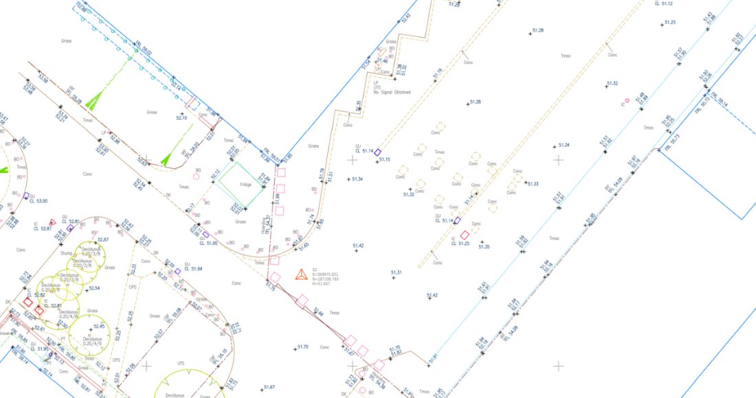
A topographical survey captures the ground surface and the features on it, in three dimensions. Spatial Dimensions works to a standard content schedule, typically drawn at 1:200 scale, and states it in writing before anyone goes to site.
| What is captured as standard | Why building design needs it |
|---|---|
| Ground levels at 10 m intervals unless otherwise requested | Cut and fill, floor levels, thresholds, level access |
| External building outlines with ridge and eave heights | Massing, daylight and overshadowing studies, planning views |
| Neighbouring building outlines with ridge and eave heights | Masterplanning context, boundary interfaces, rights of light |
| Structural building lines, beams and columns above door head level | Setting out, and the interface with any building survey |
| Boundary features with heights and descriptions | Red line drawings, ownership, party wall matters |
| Road channels, tops of kerb, steps, changes of surface and water features | Vehicle tracking, refuse and fire access, highways submissions |
| Overhead canopies and fixed street furniture | Clearances, servicing, public realm design |
| Individual trees over 200 mm bole diameter, hedges, areas of foliage and planting | Tree constraint plans, root protection areas, landscape design |
| Inspection covers, manholes and service valves | Connection points, and the starting point for a utility survey |
| Drainage channels and gullies | Surface water strategy |
| Rainwater pipes, vent pipes, overhead cables and significant services | Services coordination and clearances |
Swipe the table sideways on a phone.
Five more items are available on request, and are worth asking for at specification stage:
- Road markings
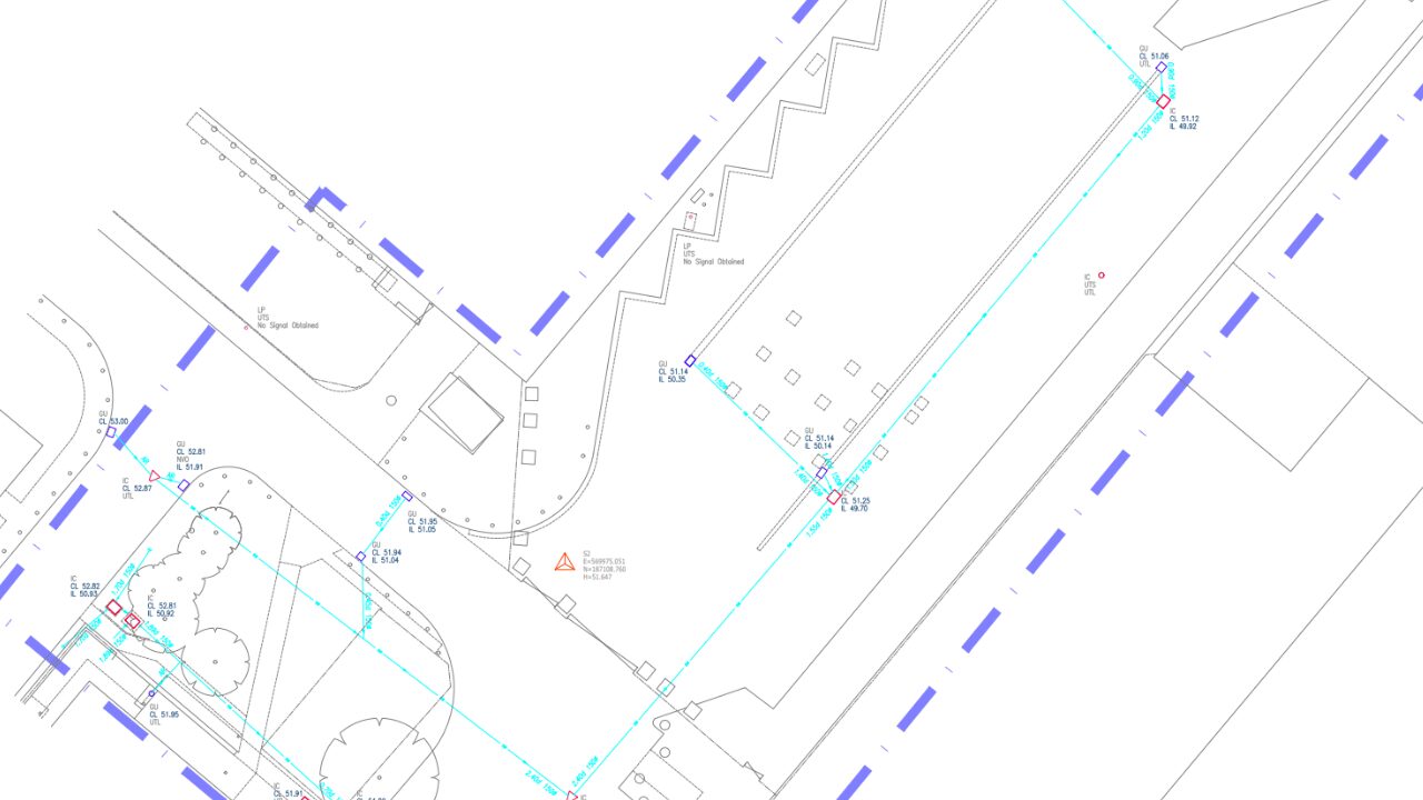
- Drainage invert levels, with runs and pipe diameters
- Contours at a specified interval
- 3D points
- 3D linework

A topographical survey shows surface evidence of buried services, such as manhole and inspection covers, but it does not tell you what is under the ground. Being straight about that matters. If you need to know where the buried services run, you need a separate underground utility survey. Spatial Dimensions grades those to BSI PAS 128:2022, from Quality Level D (desktop records search) up to Quality Level A (verified on site), and detects gas and water mains down to 63 mm diameter.
WHAT DOES 'GEOREFERENCED TO OSGB36' mean and why does it matter?
It means every point in the survey has a real-world coordinate and a real-world height, not a made-up one. Spatial Dimensions georeferences topographical surveys to OSGB36 National Grid and Ordnance Datum, the national position and height references used across Great Britain.
The practical effect is that your survey is in the same language as everything else on the project. Ordnance Survey mapping overlays it, a utility survey done later drops straight on, and flood and highway levels published as Ordnance Datum figures compare directly against your site levels.
The alternative is a local grid, where the surveyor invents a datum and calls a random point zero. That works for one drawing in isolation, and stops working the moment a masterplan grows or a second surveyor is appointed.
HOW IS SURVEY CONTROL ESTABLISHED, AND WHY DOES IT MATTER?
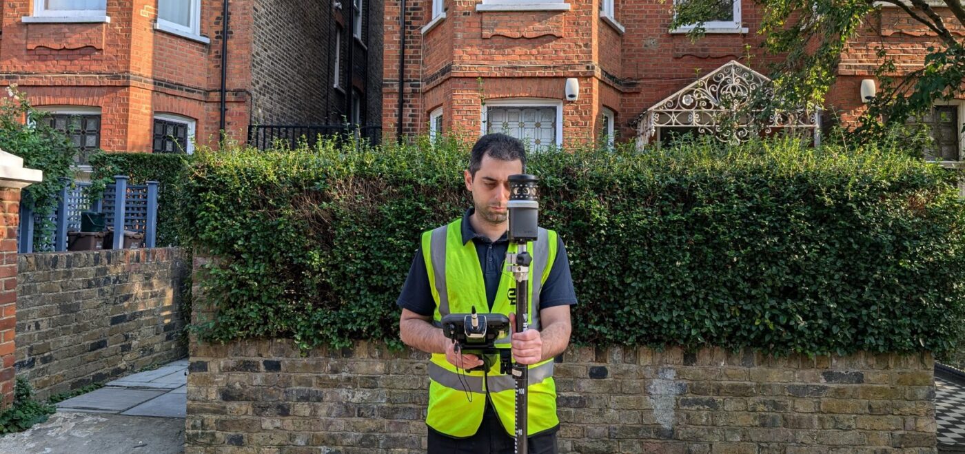
Survey control is the geospatial backbone of any accurate topographical survey, and it is the first thing Spatial Dimensions puts in place on site. Control means a permanent network of fixed points, called stations, each measured to a known position and height. Every measurement in the survey is taken from that network, so if the network is right, the survey is right.
Spatial Dimensions sets stations inside the site and outside it. That second part matters, because control placed only within the boundary is destroyed as soon as ground works start, while stations outside the site survive the construction phase. Unless a project specifies otherwise, the network is related to the Ordnance Survey grid and datum.
“Survey control is invisible when done properly, and painfully obvious when it isn’t.”
Spatial Dimensions guide to specifying a topographical survey
HOW IS SURVEY CONTROL ESTABLISHED, AND WHY DOES IT MATTER?
Survey control is the geospatial backbone of any accurate topographical survey, and it is the first thing Spatial Dimensions puts in place on site. Control means a permanent network of fixed points, called stations, each measured to a known position and height. Every measurement in the survey is taken from that network, so if the network is right, the survey is right.
Spatial Dimensions sets stations inside the site and outside it. That second part matters, because control placed only within the boundary is destroyed as soon as ground works start, while stations outside the site survive the construction phase. Unless a project specifies otherwise, the network is related to the Ordnance Survey grid and datum.
“Survey control is invisible when done properly, and painfully obvious when it isn’t.”
Spatial Dimensions guide to specifying a topographical survey
Poor control is one of the most expensive survey failures there is. Misaligned grids, wrong floor levels, incorrect heights and drifted control networks lead to clashes, redesigns, incompatible models and significant variations. Spatial Dimensions is regularly asked to step in where a survey was delivered on an arbitrary grid or an incorrect datum and design had already progressed on that misaligned control, which means delays, redesign and abortive fees.
Errors in a topographical survey do not stay in the survey. It is the base layer for planning submissions, drainage strategies, highways design and earthworks, so a control problem travels into all four at once.
WHAT EQUIPMENT DOES SPATIAL DIMENSIONS USE, AND HOW IS THE DATA CHECKED?
Spatial Dimensions captures topographical surveys with calibrated robotic total stations and multi-frequency, data-corrected GPS, used together rather than one instead of the other. The total station measures precisely from the control network; the GPS ties that network into the national grid.
All equipment is calibrated, and all data is quality-checked before issue. Surveyors are trained to verify, cross-check and challenge data on site, which catches a bad reading while the crew is still on the ground rather than months later in a coordination meeting.
The honest comparison: cheaper topographical surveys often rely on GPS-only capture, skip verification, or generalise features instead of measuring them individually. The drawing looks much the same on screen, and behaves very differently once a design is set out from it.
How do inaccurate topographical surveys impact early-stage building design?
Inaccurate topographical surveys damage early-stage design because the errors are invisible when they are introduced and expensive when they are found. Everything above the survey inherits its faults silently.
The error is copied into every drawing. A wrong level becomes the finished floor level, which becomes the threshold detail, which becomes the drainage invert, which becomes the external landscape. By the time it is spotted, it exists in a dozen coordinated documents.
Earthworks quantities move. Cut and fill volumes are calculated from the surveyed ground surface, so if that surface is wrong across a site, the muck-away figure in the cost plan is wrong. That is how a small level error becomes a large financial variance.
Drainage stops working by gravity. Foul and surface water drainage depends on falls of a few tens of millimetres over long runs. Get the levels wrong and a gravity system that worked on paper needs pumping, a tank, or a redesign of the external strategy.
Boundaries come out wrong. A badly measured boundary means the developable area is wrong, so the schedule of accommodation and the appraisal are wrong with it.
The pattern is always the same: cheap survey, expensive rework. Spatial Dimensions works to RICS guidance and holds ISO 9001:2015 certified quality management, so the checking happens before data leaves the office rather than after it has been designed over. As Managing Director Claire Fenwick puts it in our Survey Buyers Guide, “A high-quality survey doesn’t cost more, it prevents more.”
Why do architects need detailed topographical surveys before masterplanning a site?
Because masterplanning is the stage where decisions are cheapest to make and most expensive to undo, and every one of them is a decision about the ground. Where buildings sit, which way the site drains, how vehicles get in, how much earth has to move. None of that can be judged from a title plan or an aerial photograph.
A detailed topographical survey lets an architect test options against reality while testing is still free. It shows which parts of the site are naturally flat and which need retaining, where a gravity outfall is possible, and the real constraint of existing trees and neighbouring building heights. Spatial Dimensions delivers it as a digital terrain model or full 3D BIM topography, so one dataset carries early massing studies, later coordination in 3D BIM models and construction setting out. At Hinchingbrooke Hospital, a large-scale NHS development scheme, Spatial Dimensions delivered drone survey, photogrammetry, topographical survey and underground utility survey for BDP, NHS and WSP.
What do you get from a topographical survey?
You get a georeferenced dataset in the format your design team works in. Spatial Dimensions issues topographical surveys as 2D CAD linework, and as 3D data in four tiers.
| Level | Output | Best for | Format |
|---|---|---|---|
| Level 1 | 3D points — individual height nodes (X,Y,Z) for every feature | Basic height checks on specific features such as manholes or kerbs | .DWG / .DXF |
| Level 2 | 3D contours — linework connecting heights at set intervals | Visualising the fall and slope of the land for drainage planning | .DWG / .DXF |
| Level 3 | 3D mesh, a Digital Terrain Model — a continuous survey-grade surface | Accurate earthworks, cut-and-fill calculations and site sections | .DWG / .IFC |
| Level 4 | BIM model — intelligent 3D objects (walls, roads, trees) at LOD 3 | Complex architectural design, BIM coordination, high-detail planning | .RVT |
Swipe the table sideways on a phone.
Spatial Dimensions delivers standard 3D topographical surveys at Level of Detail (LOD) 3 by default. A digital terrain model removes the risk of interpolation, which is guessing what the ground does between measured points. 2D data is flat, so the design team has to assume the slopes between measured levels, and that assumption is where hidden risk sits in complex drainage or foundation design.
A Level 4 Revit model at LOD 3 carries roads, pavements, kerbs, ramps and steps; walls, fences and railings; trees with bole and spread, hedge lines and surface changes; manholes, service covers, gullies and pylons; and building footprints, massing volumes, eave and ridge heights. The target Revit version is fixed at quotation.
On complex or heavily built-up sites Spatial Dimensions uses high-definition terrestrial laser scanning, producing a point cloud in .E57, .RCP, .RCS, .LAS, .PTS or .PTG that can be re-measured later without a second site visit.
What should you ask a surveyor, and how do you specify the survey?
Ask four questions, which the Spatial Dimensions guide to specifying a topographical survey recommends putting to any surveyor before price is discussed.
- How is survey control established and referenced?
- What accuracy tolerances are being applied?
- How is the data verified before issue?
- Will the outputs integrate reliably with other surveys and models?
A surveyor who cannot answer the first one in plain words is not the surveyor to appoint. Then write the specification down, because a survey quoted against a vague brief will be argued about later. State the extent and how far beyond the boundary to go, the coordinate system and datum, any on-request items such as invert levels or contours, the 3D deliverable tier, the formats and software versions, and any access restrictions. Spatial Dimensions answers all four questions in the written specification its fixed price is quoted against, so the number you approve is the number you pay. Our free guide to specifying a topographical survey covers all four questions in more detail, and the rest of our guides are on the guides page, with role-specific pages for architects, planners and contractors, and scope for buildings works the same way, set by Level of Detail.
How much does a topographical survey cost?
A topographical survey from Spatial Dimensions starts at £595. Most topographical surveys fall between £750 and £2,500, depending mainly on the area covered and the detail required.
That span is the range across the whole service, from a small single-plot survey to a large or complex site, rather than the price of one example job.
The price of a topographical survey depends on four things: the area to be covered, the detail required — the standard schedule plus any on-request items such as drainage invert levels or contours — the deliverable tier, from 2D CAD linework up to a full 3D Revit topography, and how accessible the site is.
Spatial Dimensions quotes a fixed price against a written specification, with the content schedule, formats and timescales stated before you commit, and offers a price match guarantee.
For a fixed price on your site, send us the address, the approximate area and what the survey is for. We will come back with a written quote within 24 hours. All prices exclude VAT.
How long does a topographical survey take?
Timescales depend on site access, control requirements and how clear the scope is. Spatial Dimensions mobilises to site in an average of 5.3 working days from instruction and confirms delivery dates upfront, before the work starts rather than after. Rushing a survey increases risk, so Spatial Dimensions prioritises right-first-time delivery over unrealistic promises.
Frequently asked questions
It is the base drawing the design is built on, giving the design team the measured levels, boundaries and features that floor levels, drainage, access, earthworks and massing are set out from. Spatial Dimensions delivers it georeferenced to OSGB36 National Grid and Ordnance Datum so it overlays correctly with everything else on the project.
A topographical survey records the site and its ground levels; a measured building survey records the building itself. Spatial Dimensions provides both, and specifies measured building surveys by Level of Detail: LOD 2 at ±20 mm for 1:100, LOD 3 at ±10 mm for 1:50, LOD 4 at ±5 mm for 1:20. The two share one coordinate system.
No. It shows surface evidence such as manhole covers, but it does not locate buried services. For that you need an underground utility survey. Spatial Dimensions grades those to BSI PAS 128:2022 from Quality Level D to Quality Level A, and achieves depth accuracy of ±15% using dual-technology detection with Electromagnetic Location and Ground Penetrating Radar, against ±40% with a single technology.
Spatial Dimensions establishes a permanent network of fixed stations across the site and outside it, related to the Ordnance Survey grid and datum unless otherwise specified, so control survives the construction phase. Capture is by calibrated robotic total station and multi-frequency, data-corrected GPS, with all data quality-checked before issue. As the Spatial Dimensions guide puts it, “Survey control is invisible when done properly, and painfully obvious when it isn’t.”
CAD drawings in .DWG and .DXF, 3D models in .RVT and .IFC, and point clouds in .E57 and .RCP, with .LAS, .RCS, .PTS and .PTG also available. 3D deliverables come in four tiers: 3D points, 3D contours, a digital terrain model, and a full Revit BIM topography, delivered at Level of Detail (LOD) 3 by default. The target Revit version is fixed at quotation to avoid backward-compatibility problems.
Spatial Dimensions mobilises to site in an average of 5.3 working days from instruction, working nationally from operational hubs in London, Sevenoaks and Nottingham.
A topographical survey from Spatial Dimensions starts at £595, and most fall between £750 and £2,500, depending mainly on the area covered and the detail required. Spatial Dimensions quotes a fixed price against a written specification, with a price match guarantee and a written quote within 24 hours. All prices exclude VAT.
Yes. Spatial Dimensions holds ISO 9001:2015 certified quality management, Constructionline Gold (PAS 91) and Acclaim (SSIP) membership, and is a corporate member of The Survey Association and CICES. Field staff hold CSCS cards and are DBS checked and BPSS security cleared. Insurance is £10,000,000 each for Professional Indemnity, Public Liability and Employers Liability. Managing Director Claire Fenwick is FCICES.
NEXT STEPS
Talk to Spatial Dimensions before you write the specification, not after. Our topographical survey service page covers what is provided and how to brief it, and measured building surveys covers the building itself. See our process and credentials, or get in touch on 01732 458799.
Get the full guide to specifying a topographical survey
Our free guide goes further than this article: the full 2D and 3D feature schedules, the four deliverable tiers, survey control and accuracy, Level of Detail, Spatial Twins, and the questions to ask before you appoint anyone. Written by the Spatial Dimensions survey team for architects, planners and project managers.
Download the free guideFree to download. No cost, no obligation.
