 Skip to content
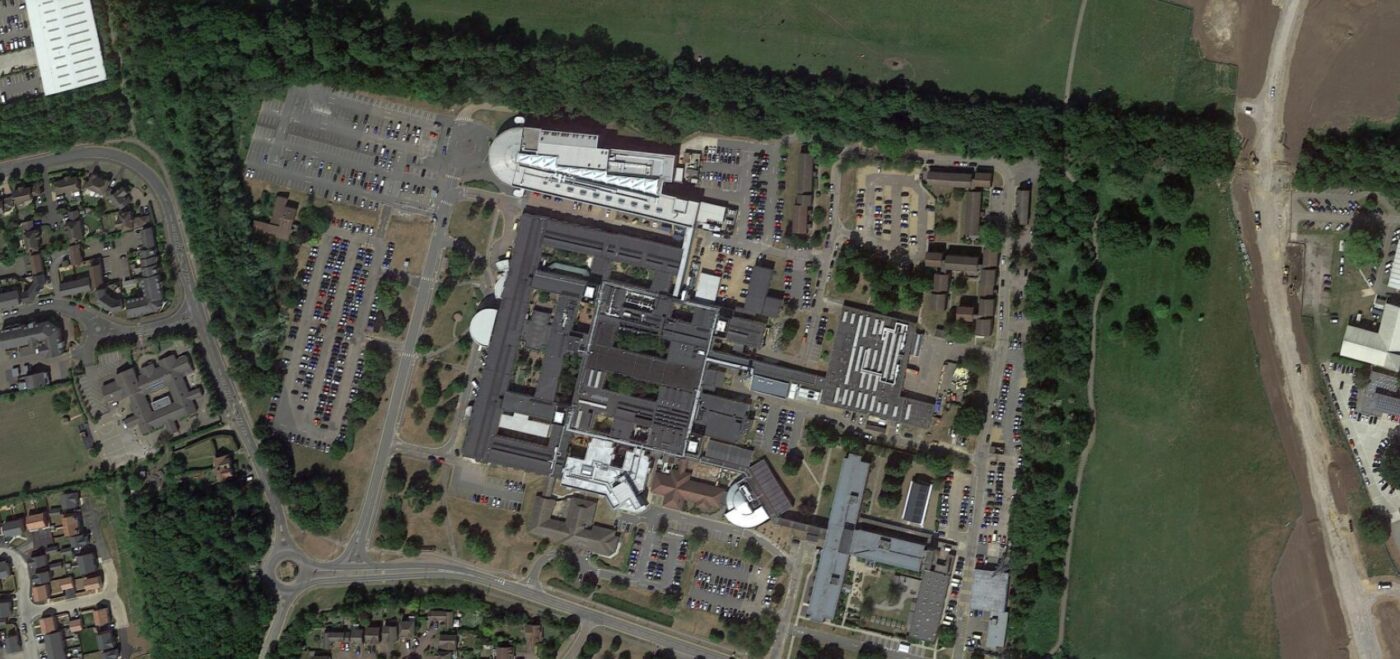
THE BRIEF
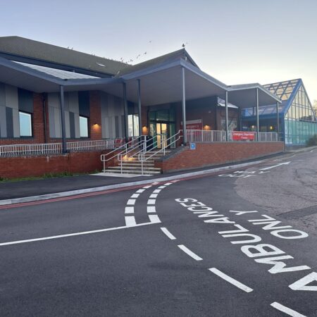
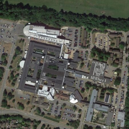
The Hinchingbrook Hospital was opened in 1983 to serve the Huntingdonshire area of Cambridgeshire. The hospital currently has roughly 330 beds and provides a large number of specialist services. These include but are not limited to; an emergency department, general surgery, ophthalmology, gynaecology, vascular services as well as children’s inpatient and outpatient services. The ‘Operational productivity and performance in English NHS acute hospitals’ report 2016, highlighted Hinchingbrooke as the second least efficient hospital in England. This was a number of issues around the time.
In 2023, an announcement was made that the hospital would be rebuilt due to mass amounts of reinforced aerated concrete (RAAC). Before the announcement, Hinchingbrooke was said to have a ‘catastrophic’ level of risk with an incident related to RAAC ‘likely.’ The Hinchingbrooke estate is currently covered by roughly 75% RAAC panels.
The development program called ‘The National Hospital Programme’ is a country-wide program, rebuilding a number of hospitals where there have been significant challenges.
Development plans were announced to keep the newly built hospital on the current site. This is a significant benefit for the local community and something Spatial Dimensions were excited to be a part of! Hannah Coffey, the Chief Executive Officer, highlighted the redevelopment as a ‘once in a generation opportunity.’
OUR WORK
In February 2024, Spatial Dimensions were instructed by the NHS to carry out essential survey works. The overall aim of the surveys was to inform and then help instruct whole site development.
Hinchingbrooke was, and still is, an active hospital with extremely busy wards and specialist departments. Before attending on-site, our survey teams were briefed about the site and the specifics of the job to ensure patient access wasn’t compromised. Our project management team were in constant touch with WSP, BDP and the NHS to ensure deliveries were on time. We were also conscious of going at quieter times and days to minimise disruption.
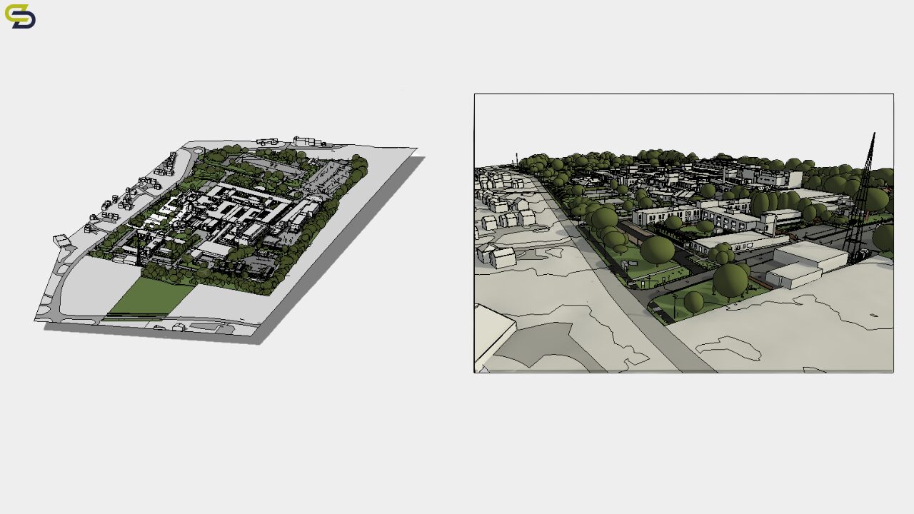
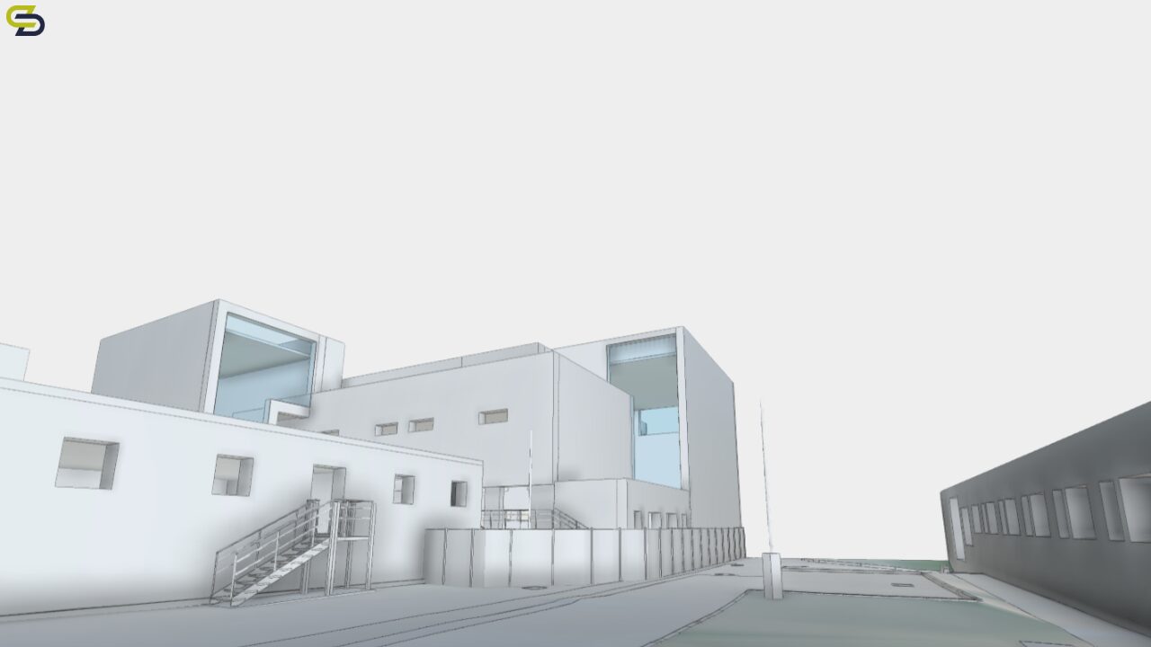
TOPOGRAPHICAL SURVEYS
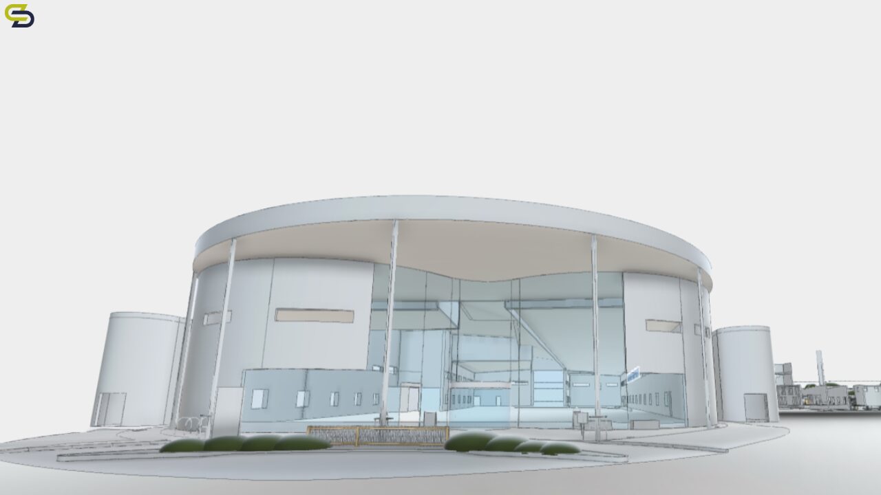
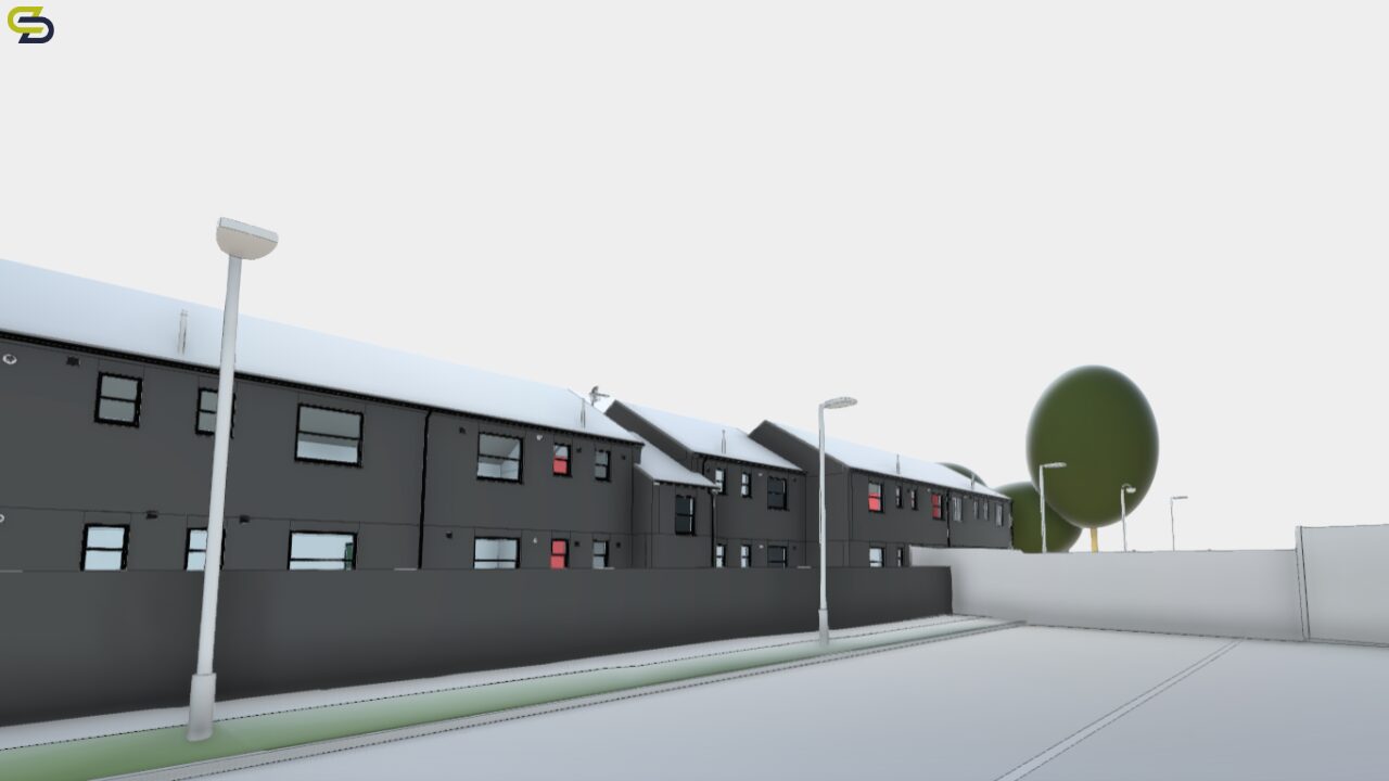
Topographical surveys were carried out of the full existing site to record the existing footprint of buildings, structures, land and features. From this information our BIM team created an exact Revit model in level of detail (LOD) 3, to match our client’s specifications. The same information was used to create a 2D topographical CAD plan, to support the full needs of the project team.
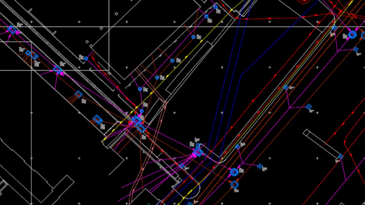
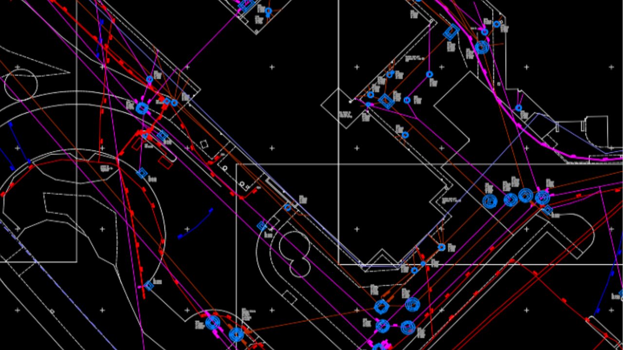
UNDERGROUND UTILITY SURVEYS
Our underground utility team conducted a PAS 128 survey using Ground Penetrating Radars (GPR). PAS 128 ensures infrastructure planning and designs are aware of existing structures. This will help prevent potential damage to the existing underground structures during construction, saving our clients potential time and money. PAS 128 is a required standard for work within the NHS. In this instance, the PAS 128 data was delivered at QL-B, as per the client’s specifications.
DRONE SURVEYS
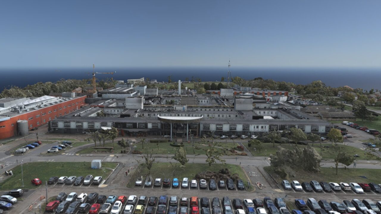
Drone surveys conducted by Spatial Dimensions have played an integral role in the planning stages of Hinchingbrooke Hospital. By utilising drone technology, our team were able to capture full site information rapidly. This ensures our clients have reliable data quickly and can make informed decisions, speeding up the planning process. Photogrammetry from drone data was made easily accessible through our drone work, too. By planning this into our existing survey control, our clients were able to understand the situation of the full site and existing structures.
The above external work was complemented by the internal laser scanning of the current hospital. The laser scanning data gives exact positional accuracy of the surveyed internal areas, down to a few mm. Laser scanning data created highly details point clouds that give increased accessibility to our clients and lay the foundation for potential future assets.
THE OUTCOME
At the time of writing, the redesign of the project is underway and on track. The hospital is due for completion by 2030.
All data and information provided by Spatial Dimensions was delivered on time and to the required specifications. This included 3D models, drone photogrammetry, 2D CAD plans, PAS 128 survey and point cloud data.


