Skip to content
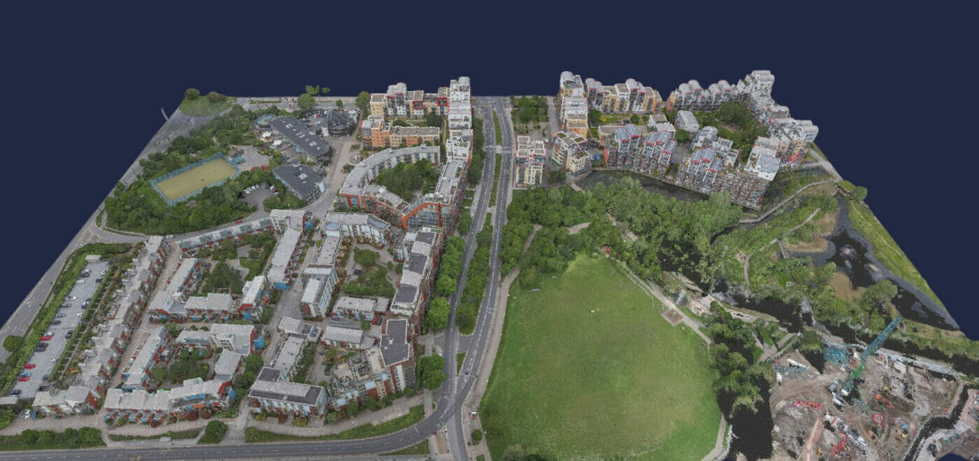
INTRODUCTION
At Spatial Dimensions, we are passionate about helping our clients and helping them get their projects off to the best start possible!
As surveying professionals, we understand the importance of accuracy, efficiency, and collaboration in the design, construction, and maintenance of the built environment. That’s why we have fully embraced the power of 3D models in surveying, which offers numerous benefits that empower us to deliver the highest quality services to our clients across the UK.
In this article, we will explore how we leverage 3D models in our surveying projects using and how it helps us achieve our mission of measuring, mapping, and modelling to help our clients create spaces everyone loves.

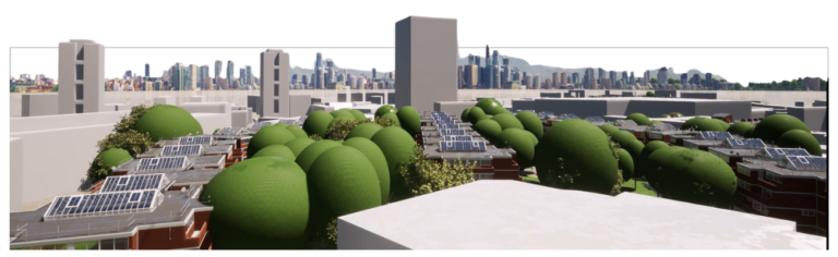
ENHANCED VISUALISATION
We believe that visualization is key to understanding the environment being surveyed. 3D models provide an outstanding visual representation of the surveyed area, allowing us and our clients to fully immerse ourselves in the space. This enhanced visualisation helps to identify potential challenges, conceptualize design options, and make informed decisions. By visualising the environment from various angles and perspectives, our clients gain valuable insights into the scale, proportions, and spatial relationships of the site, resulting in more accurate and well-informed planning and design processes. This can also help make informed decisions for Rights of Light (ROL).
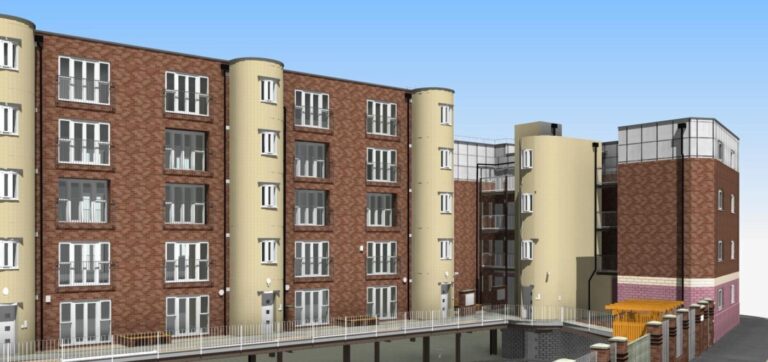
IMPROVED ACCURACY
At Spatial Dimensions, we know that accuracy is paramount in surveying. Our 3D models generated from measured survey data offer a significantly higher level of accuracy compared to traditional surveying methods. With our advanced surveying technologies like laser scanning, we capture precise measurements and detailed information about the terrain, structures, and objects within the surveyed area. This level of accuracy not only reduces the risk of error in design and construction, but also ensures that projects are executed to the desired specifications, minimising costly rework and optimising resource allocation.
STREAMLINED DATA PROCESSING
We understand the value of time and effort. That’s why we leverage 3D models to optimize data capture and processing, saving valuable time and effort for our clients. Our modern surveying technologies can rapidly capture vast amounts of data with high precision, while our computer algorithms and software efficiently process and convert this data into comprehensive 3D models. By streamlining data processing, architects, project managers and developers can focus more on analysis, problem-solving, and delivering value-added services. The speed and efficiency of our 3D models allow for more rapid project turnaround times and increased productivity, benefiting everyone involved!

ENHANCED COLLABORATION
Effective collaboration is essential in the design and construction industry. Our 3D models serve as a common visual language, facilitating better collaboration between architects, engineers, contractors, and clients. By sharing a digital representation of the environment, everyone involved in a project can easily understand and contribute to the design process. This collaborative approach promotes inclusivity, reduces communication errors, and fosters a more inclusive decision-making process. Our 3D models align all parties around a shared vision, promoting trust, consensus, and a sense of ownership. This results in projects that better reflect the client’s needs and aspirations.
COST AND TIME SAVINGS
At Spatial Dimensions, we recognize that cost and time effectiveness are crucial to our clients. Our 3D models help significantly reduce both cost and time. The accuracy and comprehensiveness of our 3D models reduce the need for costly and time-consuming site revisits, as stakeholders can virtually explore and analyse the environment from their own locations. By minimising the occurrence of errors, rework, and disputes, our approach to 3D models ensures that projects are executed more efficiently, saving valuable time and resources. With our smart utilisation of resources, our clients ultimately enjoy cost savings and improved profitability.
CONCLUSION
Embracing the power of 3D models in surveying is at the heart of Spatial Dimensions’ mission to create spaces that everyone loves. Our approach is characterised by our friendly and passionate team who are always on hand to help during this process.
At Spatial Dimensions, we use 3D models to enhance visualisation, improve accuracy, streamline data processing, enhance collaboration, and save cost and time for our clients. By leveraging the benefits of 3D models in surveying, we offer exceptional value to our clients, empowering them to achieve their vision for the built environment and ensuring they can create amazing spaces that everybody love!