Skip to content
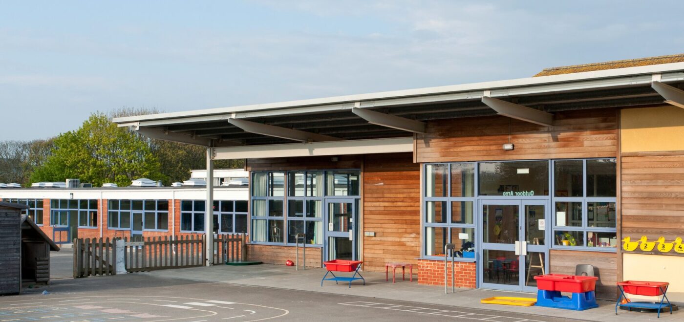
In an era where data drives decisions, measured surveys have become an indispensable tool across various sectors, and the education industry is no exception. Surveys provide the critical spatial data needed to inform effective decision-making. As educational institutions face increasing pressure to optimise their facilities, budgets, and student outcomes, the role of accurate, detailed surveys becomes ever more vital.
WHAT IS A MEASURED SURVEY?
A measured survey is a precise, detailed record of a physical space, capturing dimensions, structural elements, and spatial relationships through tools such as laser scanning, total stations, and photogrammetry. The deliverables are normally 2D CAD plans or 3D models. This data assists architects, contractors, planners and developers to make informed decisions about a site.
ENHANCING CAMPUS PLANNING & DEVELOPMENT
Direct benefits of measured surveys in education are found in campus planning and development. Whether an institution is expanding with new buildings, renovating existing spaces, or repurposing older facilities, having an accurate, up-to-date survey is essential.
Measured surveys such as topographical surveys, measured building surveys, underground utility surveys and drone surveys eliminate guesswork. This allows clients to base their designs on real-world dimensions and conditions. This helps prevent costly errors or delays during construction and ensures compliance with building regulations. For instance, designing a new science wing or a sports complex becomes far more streamlined and accurate when built upon a precise understanding of site constraints and existing infrastructure.
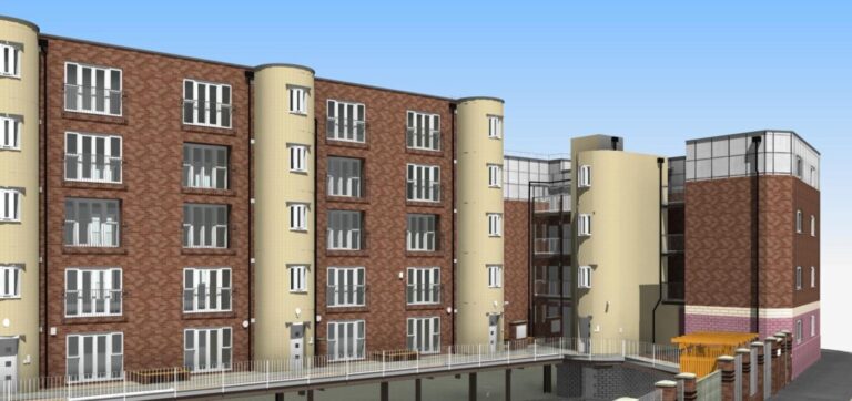
SUPPORTING DIGITAL TRANSFORMATION WITH 3D MODELS
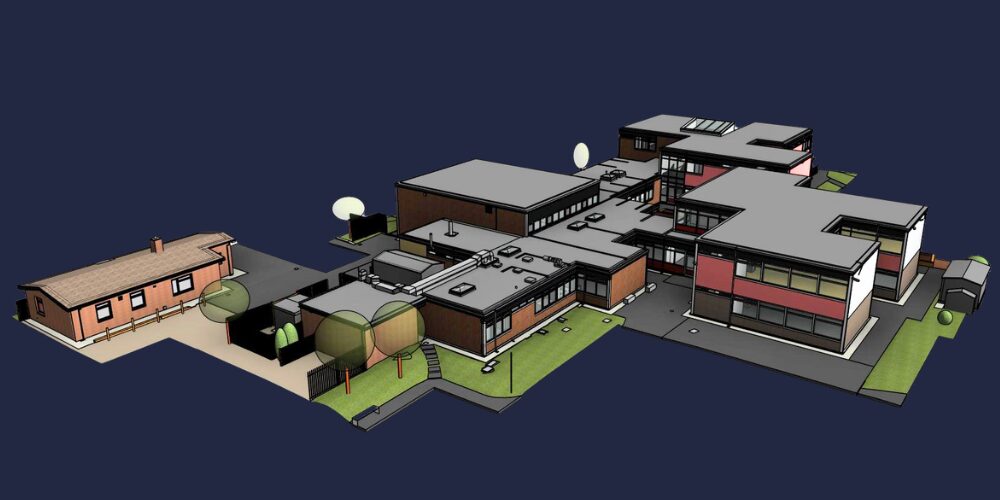
Whilst on site, surveyors use high-tech laser scanning equipment. This data is turned into a point cloud (millions of points of data) and then into BIM models. BIM stands for ‘Building Information Model’ and offers a dynamic, interactive way to manage buildings over their entire lifecycle. These digital models are not only valuable during construction or refurbishment, but also in long-term maintenance and future upgrades.
Having access to a detailed digital twin of a building allows for proactive management of space, improved energy efficiency, and easier compliance with health and safety standards. It also enables better resource allocation, from heating and lighting systems to room usage scheduling. Digital models ensure architects can work visually without attending site, saving time throughout the project process.
THE VALUE OF 2D CAD IN EDUCATIONAL PLANNING
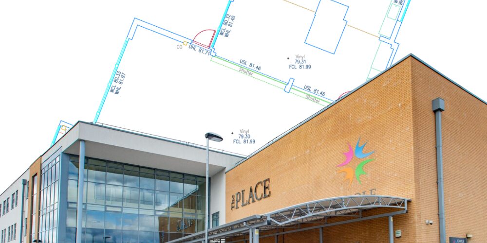
While 3D models are growing in popularity, 2D CAD (Computer-Aided Design) remains a crucial deliverable for educational institutions. Many schools, colleges, and universities still rely heavily on 2D CAD drawings for a wide range of applications. These include site layouts, floor plans, elevations and sections.
2D CAD drawings generated from measured surveys are easy to read, modify, and share across departments. They serve as a clear visual reference for clients.
Moreover, educational institutions often have legacy documentation stored in 2D formats. Integrating updated CAD plans from modern surveys ensures continuity and consistency. This bridges the gap between old records and current needs. These drawings are also invaluable for a range of submissions. These include funding proposals, space planning, safety & compliance, planning applications and project tenders, making them an essential part of the education estates teams toolkit!
PRESERVING HISTORIC EDUCATIONAL BUILDINGS
Many schools, colleges, and universities operate in historic or heritage-listed buildings in the UK. Renovating or adapting these structures requires a delicate balance between modern functionality and preservation of architectural integrity.
Measured surveys provide the detailed documentation needed to navigate this challenge. Measured building surveys capture intricate building details through laser scanning technology. By the time this data reaches architects, contractors, planners or developers, they are assured of its accuracy. Exact representations of a building through point cloud data, CAD and 3D models ensure renovations are accurate to the existing structure!
ENSURING ACCESSIBILITY AND COMPLIANCE
Educational institutions have a responsibility to provide safe, sustainable, inclusive environments for all students, staff, and visitors. Measured surveys support this goal by identifying barriers to accessibility and ensuring compliance with regulations.
By mapping out floor levels, staircases, door widths, and restroom layouts, measured surveys make it easier to plan for ramps, elevators, signage, and other accessible features. Educational places can use this data to prioritise upgrades that improve inclusivity and ensure legal compliance. This is especially critical when applying for funding or undergoing inspections.
IMPROVING LEARNING ENVIRONMENTS
Good educational outcomes depend not just on curriculum and teaching quality, but also on the physical environment. Measured surveys allow schools and universities to assess how their buildings support effective learning. It also allows future planning on how this can be improved.
For example, understanding acoustics, lighting, and space utilisation can inform classroom layouts or redesigns. Optimising these elements leads to improved concentration, comfort, and overall student engagement. Especially in the wake of the COVID-19 pandemic, institutions have become more conscious of space planning for ventilation and social distancing, both of which are aided by accurate spatial data.

ENABLING STRATEGIC DECISION-MAKING
At an administrative level, measured surveys offer long-term strategic benefits. Facilities managers can make informed decisions about maintenance cycles, renovations, and space allocation. Finance officers gain a clearer understanding of property assets and associated costs. Environmental sustainability officers can use survey data to plan carbon reduction strategies.
In short, these surveys provide a shared source of truth that aligns stakeholders across departments, reduces risk, and promotes efficiency.
CONCLUSION
Measured surveys are having a huge impact on education spaces. The need for new education spaces, and more efficient and sustainable existing spaces, is of paramount importance. Services including topographical surveys, measured building surveys, underground utility surveys and drone surveys are driving results through data.
Companies like Spatial Dimensions are investing heavily in the latest laser scanners, total stations and processing equipment to ensure data is turned around quickly and accurately. 2D CAD plans remain a significant tool in visualising spaces, alongside 3D models, which increase collaboration across stakeholders. Do you need help with surveying your next school, college or university? As specialists in the education sector, we are here to help! You can read more about our services here, our education projects here or contact us here for more information!